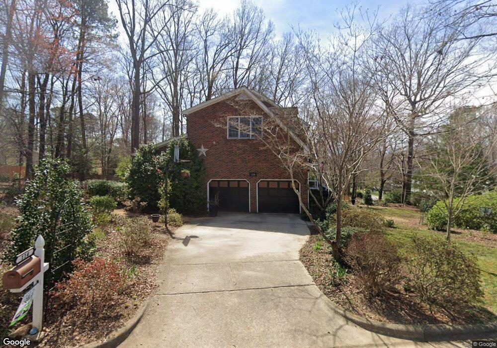
114 Kings Fork Rd Cary, NC 27511
South Cary NeighborhoodEstimated Value: $555,000 - $664,000
4
Beds
3
Baths
2,782
Sq Ft
$220/Sq Ft
Est. Value
About This Home
This home is located at 114 Kings Fork Rd, Cary, NC 27511 and is currently estimated at $610,960, approximately $219 per square foot. 114 Kings Fork Rd is a home located in Wake County with nearby schools including Farmington Woods Elementary, East Cary Middle School, and Cary High School.
Ownership History
Date
Name
Owned For
Owner Type
Purchase Details
Closed on
Aug 29, 2012
Sold by
Nader Joseph A and Nader Ann Marie
Bought by
Donaghy James
Current Estimated Value
Home Financials for this Owner
Home Financials are based on the most recent Mortgage that was taken out on this home.
Original Mortgage
$169,000
Outstanding Balance
$26,928
Interest Rate
2.86%
Mortgage Type
New Conventional
Estimated Equity
$584,032
Create a Home Valuation Report for This Property
The Home Valuation Report is an in-depth analysis detailing your home's value as well as a comparison with similar homes in the area
Home Values in the Area
Average Home Value in this Area
Purchase History
| Date | Buyer | Sale Price | Title Company |
|---|---|---|---|
| Donaghy James | $294,000 | None Available |
Source: Public Records
Mortgage History
| Date | Status | Borrower | Loan Amount |
|---|---|---|---|
| Open | Donaghy James | $169,000 |
Source: Public Records
Tax History
| Year | Tax Paid | Tax Assessment Tax Assessment Total Assessment is a certain percentage of the fair market value that is determined by local assessors to be the total taxable value of land and additions on the property. | Land | Improvement |
|---|---|---|---|---|
| 2025 | $4,683 | $544,033 | $220,000 | $324,033 |
| 2024 | $4,582 | $544,033 | $220,000 | $324,033 |
| 2023 | $3,677 | $364,958 | $115,000 | $249,958 |
| 2022 | $3,540 | $364,958 | $115,000 | $249,958 |
| 2021 | $3,469 | $364,958 | $115,000 | $249,958 |
| 2020 | $3,487 | $364,958 | $115,000 | $249,958 |
| 2019 | $3,240 | $300,692 | $86,000 | $214,692 |
| 2018 | $3,040 | $300,692 | $86,000 | $214,692 |
| 2017 | $2,922 | $300,692 | $86,000 | $214,692 |
| 2016 | $2,878 | $300,692 | $86,000 | $214,692 |
| 2015 | $2,961 | $298,701 | $86,000 | $212,701 |
| 2014 | $2,792 | $298,701 | $86,000 | $212,701 |
Source: Public Records
Map
Nearby Homes
- 1205 Seabrook Ave
- 1224 Collington Dr
- 208 Lawrence Rd
- 1414 Debra Dr
- 1722 Seabrook Ave
- 1641 Kildonan Place
- 1331 Kingston Ridge Rd
- 807 Ellynn Dr
- 1216 Walnut St
- 312 Heidinger Dr
- 3413 Wellington Ridge Loop
- 3612 Wellington Ridge Loop
- 1227 Kingston Ridge Rd
- 1200 Fairlane Rd
- 3012 Leith Meadow Ct
- 908 Tanglewood Dr
- 2210 Stephens Rd
- 1103 Warren Ave
- 1201 Deerfield Dr
- 2434 Stephens Rd
- 103 Dorchester Pines Ct
- 638 Kings Fork Rd
- 103 Tolliver Ct
- 107 Kings Fork Rd
- 109 Kings Fork Rd
- 100 Dorchester Pines Ct
- 640 Kings Fork Rd
- 105 Dorchester Pines Ct
- 639 Kings Fork Rd
- 1404 Coral Ct
- 102 Dorchester Pines Ct
- 1406 Coral Ct
- 641 Kings Fork Rd
- 105 Tolliver Ct
- 100 Lively Ct E
- 104 Dorchester Pines Ct
- 102 Lively Ct E
- 1400 Seabrook Ave
- 110 Kings Fork Rd
- 1402 Seabrook Ave