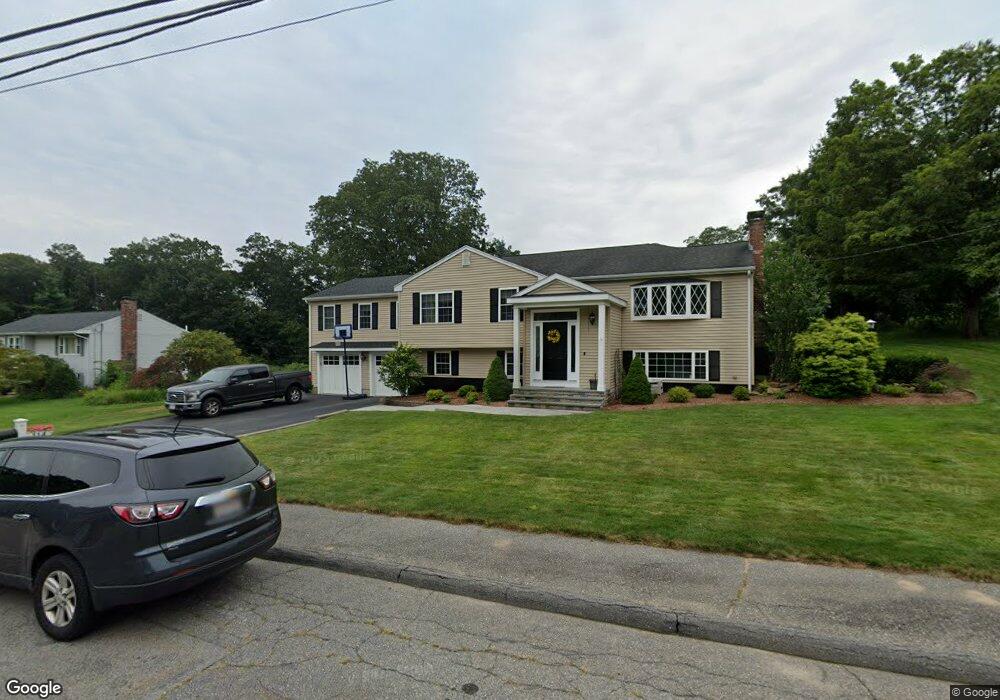
114 Kosmas St Marlborough, MA 01752
Estimated Value: $615,000 - $1,258,000
3
Beds
2
Baths
1,400
Sq Ft
$650/Sq Ft
Est. Value
About This Home
This home is located at 114 Kosmas St, Marlborough, MA 01752 and is currently estimated at $909,379, approximately $649 per square foot. 114 Kosmas St is a home located in Middlesex County with nearby schools including Marlborough High School, New Covenant Christian School, and Glenhaven Academy - JRI School.
Ownership History
Date
Name
Owned For
Owner Type
Purchase Details
Closed on
Jun 12, 2024
Sold by
King Christopher and King Roberta
Bought by
Christopher J King Ft and King
Current Estimated Value
Purchase Details
Closed on
Oct 26, 2004
Sold by
Rammer George J and Rammer Linda J
Bought by
King Christopher and King Roberta
Home Financials for this Owner
Home Financials are based on the most recent Mortgage that was taken out on this home.
Original Mortgage
$304,000
Interest Rate
5.85%
Mortgage Type
Purchase Money Mortgage
Create a Home Valuation Report for This Property
The Home Valuation Report is an in-depth analysis detailing your home's value as well as a comparison with similar homes in the area
Home Values in the Area
Average Home Value in this Area
Purchase History
| Date | Buyer | Sale Price | Title Company |
|---|---|---|---|
| Christopher J King Ft | -- | None Available | |
| Christopher J King Ft | -- | None Available | |
| King Christopher | $380,000 | -- | |
| King Christopher | $380,000 | -- |
Source: Public Records
Mortgage History
| Date | Status | Borrower | Loan Amount |
|---|---|---|---|
| Previous Owner | King Christopher | $319,300 | |
| Previous Owner | King Christopher | $304,000 |
Source: Public Records
Tax History Compared to Growth
Tax History
| Year | Tax Paid | Tax Assessment Tax Assessment Total Assessment is a certain percentage of the fair market value that is determined by local assessors to be the total taxable value of land and additions on the property. | Land | Improvement |
|---|---|---|---|---|
| 2025 | $8,607 | $872,900 | $230,700 | $642,200 |
| 2024 | $8,224 | $803,100 | $209,800 | $593,300 |
| 2023 | $8,019 | $694,900 | $181,200 | $513,700 |
| 2022 | $7,221 | $550,400 | $172,500 | $377,900 |
| 2021 | $7,056 | $511,300 | $143,900 | $367,400 |
| 2020 | $6,928 | $488,600 | $137,000 | $351,600 |
| 2019 | $6,268 | $445,500 | $134,300 | $311,200 |
| 2018 | $5,924 | $404,900 | $117,400 | $287,500 |
| 2017 | $6,140 | $400,800 | $116,700 | $284,100 |
| 2016 | $6,113 | $398,500 | $116,700 | $281,800 |
| 2015 | $5,462 | $346,600 | $119,600 | $227,000 |
Source: Public Records
Map
Nearby Homes
- 38 Airport Blvd
- 45 Raffaele Rd
- 323 Robert Rd
- 256 Robert Rd
- 114 Lodi Rd
- 274 Naugler Ave
- 37 Hosmer St Unit 10
- 37 Hosmer St Unit 20
- 137 Naugler Ave
- 57 Paquin Dr
- 24 Clinton St
- 492 Stow Rd
- 16 Clinton St
- 110 Boston Post Rd E Unit 104
- 38 Collins Dr
- 97 Cook Ln
- 96 Cook Ln
- 211 Stevens St
- 41 Kane Dr
- 25 Walnut St
- 124 Kosmas St
- 104 Kosmas St
- 106 Spoonhill Ave
- 107 Kosmas St
- 134 Kosmas St
- 100 Spoonhill Ave
- 94 Kosmas St
- 118 Spoonhill Ave
- 117 Kosmas St
- 38 Airport Blvd
- 71 Airport Blvd Unit 15-A
- 98 Airport Blvd Unit 8
- 28 Airport Blvd Unit 2
- 49 Airport Blvd
- 37 Airport Blvd
- 17 Airport Blvd Unit 20
- 71 Airport Blvd
- 97 Kosmas St
- 133 Kosmas St
- 86 Spoonhill Ave