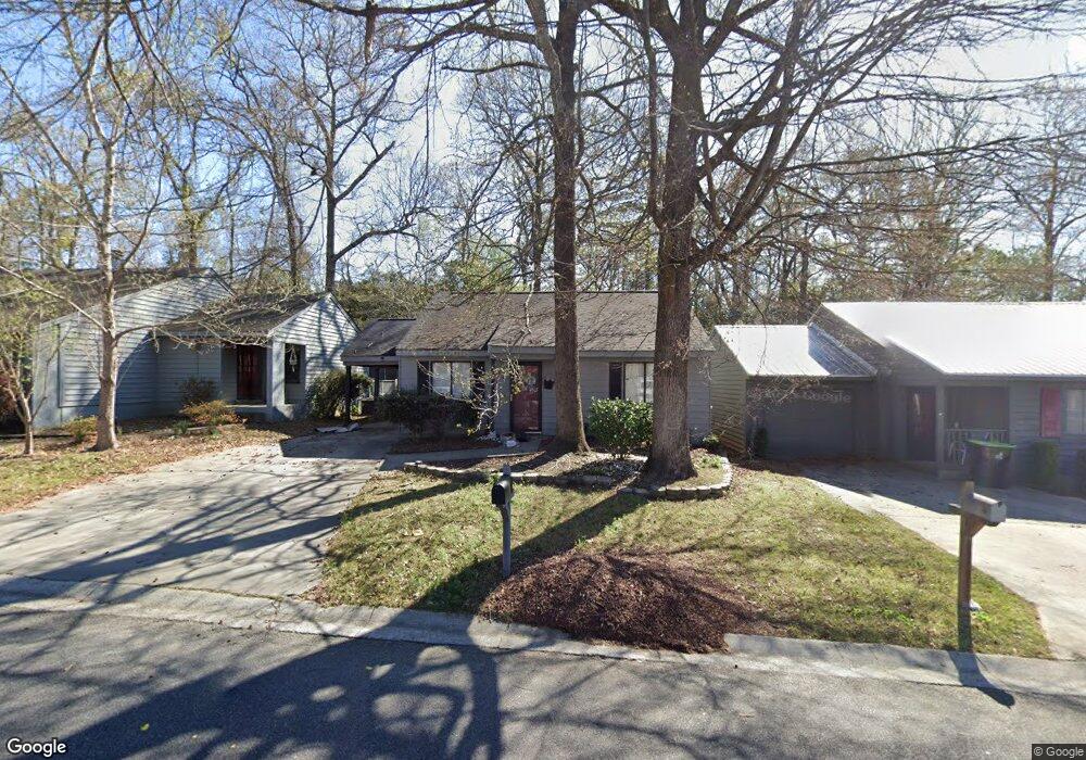
114 Lake Pointe Dr Warner Robins, GA 31088
Estimated Value: $138,000 - $154,000
2
Beds
1
Bath
1,140
Sq Ft
$127/Sq Ft
Est. Value
About This Home
This home is located at 114 Lake Pointe Dr, Warner Robins, GA 31088 and is currently estimated at $145,244, approximately $127 per square foot. 114 Lake Pointe Dr is a home located in Houston County with nearby schools including Russell Elementary School, Huntington Middle School, and Warner Robins High School.
Ownership History
Date
Name
Owned For
Owner Type
Purchase Details
Closed on
Jul 8, 2004
Sold by
Molencamp Quin Lowell
Bought by
Selph Raymond T
Current Estimated Value
Purchase Details
Closed on
Aug 30, 1996
Sold by
Vermillion Scot S
Bought by
Molencamp Quin Lowell
Purchase Details
Closed on
Oct 26, 1995
Sold by
Antebellum Builders Inc
Bought by
Vermillion Scot S
Purchase Details
Closed on
Apr 18, 1995
Sold by
Antebellum South Inc
Bought by
Antebellum Builders Inc
Purchase Details
Closed on
Aug 4, 1992
Sold by
First Denver Investment Corp
Bought by
Antebellum South Inc
Create a Home Valuation Report for This Property
The Home Valuation Report is an in-depth analysis detailing your home's value as well as a comparison with similar homes in the area
Home Values in the Area
Average Home Value in this Area
Purchase History
| Date | Buyer | Sale Price | Title Company |
|---|---|---|---|
| Selph Raymond T | $76,000 | -- | |
| Molencamp Quin Lowell | $63,000 | -- | |
| Vermillion Scot S | $62,100 | -- | |
| Antebellum Builders Inc | -- | -- | |
| Antebellum South Inc | -- | -- |
Source: Public Records
Tax History Compared to Growth
Tax History
| Year | Tax Paid | Tax Assessment Tax Assessment Total Assessment is a certain percentage of the fair market value that is determined by local assessors to be the total taxable value of land and additions on the property. | Land | Improvement |
|---|---|---|---|---|
| 2024 | $1,459 | $44,600 | $4,400 | $40,200 |
| 2023 | $1,224 | $37,120 | $4,400 | $32,720 |
| 2022 | $787 | $34,240 | $4,400 | $29,840 |
| 2021 | $688 | $29,760 | $4,400 | $25,360 |
| 2020 | $689 | $29,640 | $4,400 | $25,240 |
| 2019 | $689 | $29,640 | $4,400 | $25,240 |
| 2018 | $689 | $29,640 | $4,400 | $25,240 |
| 2017 | $689 | $29,640 | $4,400 | $25,240 |
| 2016 | $697 | $29,920 | $4,400 | $25,520 |
| 2015 | -- | $29,920 | $4,400 | $25,520 |
| 2014 | -- | $29,920 | $4,400 | $25,520 |
| 2013 | -- | $29,920 | $4,400 | $25,520 |
Source: Public Records
Map
Nearby Homes
- 105 Ridge Pointe Ct
- 254 Southland Station Dr
- 266 Southland Station Dr
- 230 Tallulah Trail
- 102 Tallulah Trail
- 122 Tallulah Trail
- 236 Tallulah Trail
- 303 Leisure Lake Dr
- 104 Breeze Point Trail
- 101 Leisure Lake Ct
- 104 Crossing Place
- 103 Leisure Lake Ct
- 105 Leisure Lake Ct
- 202 Lake Front Dr
- 108 Pheasant Cove
- 112 Lake Pointe Dr
- 118 Lake Pointe Dr
- 110 Lake Pointe Dr
- 0 Lake Pointe Dr Unit 7278350
- 0 Lake Pointe Dr Unit 3265269
- 0 Lake Pointe Dr Unit 7311195
- 0 Lake Pointe Dr Unit 8273945
- 0 Lake Pointe Dr
- 108 Lake Pointe Dr
- 113 Lake Pointe Dr
- 111 Lake Pointe Dr
- 115 Lake Pointe Dr
- 109 Lake Pointe Dr
- 122 Lake Pointe Dr
- 106 Lake Pointe Dr
- 121 Lake Pointe Dr
- 104 Lake Pointe Dr
- 105 Lake Pointe Dr
- 131 Lake Pointe Dr
- 124 Lake Pointe Dr