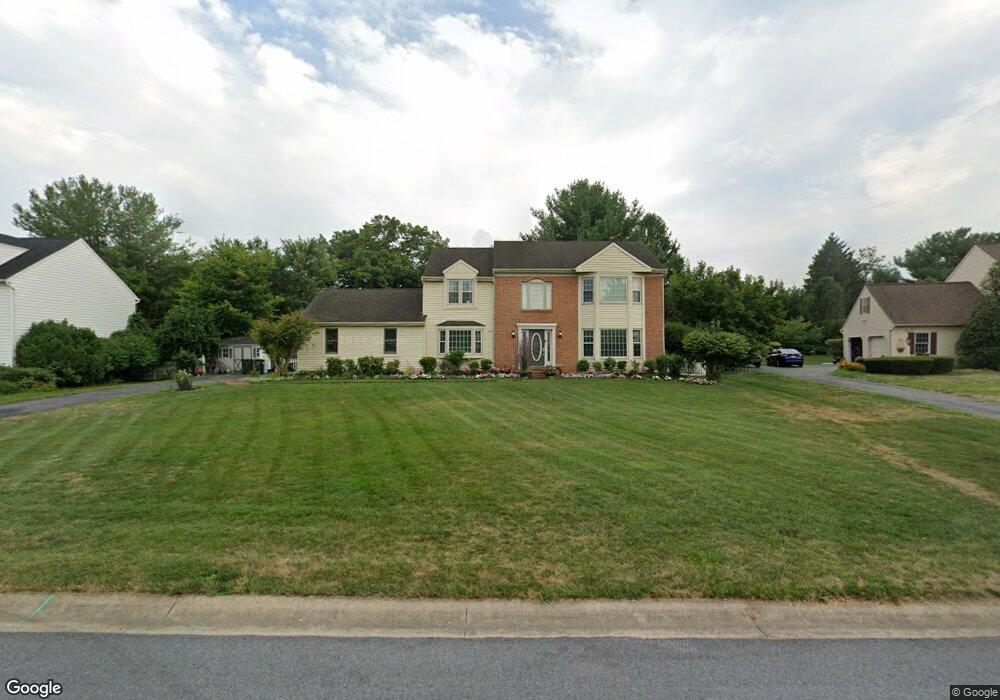
114 Langford Cir Lancaster, PA 17601
Eden NeighborhoodEstimated Value: $602,059 - $641,000
4
Beds
3
Baths
2,546
Sq Ft
$247/Sq Ft
Est. Value
About This Home
This home is located at 114 Langford Cir, Lancaster, PA 17601 and is currently estimated at $629,515, approximately $247 per square foot. 114 Langford Cir is a home located in Lancaster County with nearby schools including Nitrauer School, Landis Run Intermediate School, and Manheim Township Middle School.
Ownership History
Date
Name
Owned For
Owner Type
Purchase Details
Closed on
Sep 25, 1998
Sold by
Luu Thu D and Luu Huyen T
Bought by
Luu Thu D and Luu Huyen T
Current Estimated Value
Home Financials for this Owner
Home Financials are based on the most recent Mortgage that was taken out on this home.
Original Mortgage
$130,000
Interest Rate
6.89%
Create a Home Valuation Report for This Property
The Home Valuation Report is an in-depth analysis detailing your home's value as well as a comparison with similar homes in the area
Home Values in the Area
Average Home Value in this Area
Purchase History
| Date | Buyer | Sale Price | Title Company |
|---|---|---|---|
| Luu Thu D | -- | First American Title Ins Co |
Source: Public Records
Mortgage History
| Date | Status | Borrower | Loan Amount |
|---|---|---|---|
| Closed | Luu Thu D | $130,000 |
Source: Public Records
Tax History Compared to Growth
Tax History
| Year | Tax Paid | Tax Assessment Tax Assessment Total Assessment is a certain percentage of the fair market value that is determined by local assessors to be the total taxable value of land and additions on the property. | Land | Improvement |
|---|---|---|---|---|
| 2025 | $6,783 | $313,500 | $73,400 | $240,100 |
| 2024 | $6,783 | $313,500 | $73,400 | $240,100 |
| 2023 | $6,606 | $313,500 | $73,400 | $240,100 |
| 2022 | $6,495 | $313,500 | $73,400 | $240,100 |
| 2021 | $6,350 | $313,500 | $73,400 | $240,100 |
| 2020 | $6,350 | $313,500 | $73,400 | $240,100 |
| 2019 | $6,289 | $313,500 | $73,400 | $240,100 |
| 2018 | $4,630 | $313,500 | $73,400 | $240,100 |
| 2017 | $6,214 | $244,200 | $69,900 | $174,300 |
| 2016 | $6,214 | $244,200 | $69,900 | $174,300 |
| 2015 | $1,562 | $244,200 | $69,900 | $174,300 |
| 2014 | $4,444 | $244,200 | $69,900 | $174,300 |
Source: Public Records
Map
Nearby Homes
- 1935 New Holland Pike
- 1919 Pickering Trail
- 1923 Pickering Trail
- 1915 Pickering Trail
- 1981 Landis Valley Rd
- 1922 Pickering Trail
- 1914 Pickering Trail
- 2111 Landis Valley Rd
- 2010 Landis Valley Rd
- 2007 Meadow Ridge Dr
- 1550 Euclid Dr
- 2043 Stonecrest Dr
- 0 Butter Rd
- 0 Butter Rd
- 2098 Mallard Dr
- 212 Greenview Dr Unit T2212
- 1150 Groff Ln
- 1326 Stillwater Rd
- 672 Stockdale Dr
- 1339 Beaconfield Ln
- 118 Langford Cir
- 110 Langford Cir
- 1967 New Holland Pike
- 138 Langford Cir
- 122 Langford Cir
- 1961 New Holland Pike
- 106 Langford Cir
- 134 Langford Cir
- 146 Langford Cir
- 1953 New Holland Pike
- 1989 Copperfield Dr
- 130 Langford Cir
- 2018 Wynfield Dr
- 2022 Wynfield Dr
- 126 Langford Cir
- 1984 New Holland Pike
- 2014 Wynfield Dr
- 1947 New Holland Pike
- 1937 Glendower Dr
- 1988 New Holland Pike