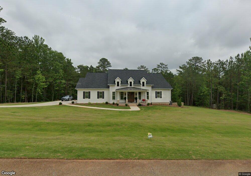
114 Laurel Ridge Forsyth, GA 31029
Estimated Value: $531,000 - $599,000
4
Beds
4
Baths
3,406
Sq Ft
$165/Sq Ft
Est. Value
About This Home
This home is located at 114 Laurel Ridge, Forsyth, GA 31029 and is currently estimated at $560,353, approximately $164 per square foot. 114 Laurel Ridge is a home located in Monroe County with nearby schools including T.G. Scott Elementary School, Mary Persons High School, and Lighthouse Academy.
Ownership History
Date
Name
Owned For
Owner Type
Purchase Details
Closed on
May 18, 2021
Sold by
Walthall Malcolm F
Bought by
Walthall Elizabeth J
Current Estimated Value
Home Financials for this Owner
Home Financials are based on the most recent Mortgage that was taken out on this home.
Original Mortgage
$348,750
Interest Rate
2.9%
Mortgage Type
New Conventional
Purchase Details
Closed on
Dec 7, 2020
Sold by
Ford Michael B
Bought by
Walthall Malcolm F
Purchase Details
Closed on
Jan 17, 2019
Sold by
Craine Richard T
Bought by
Ford Michael B and Ford Susanne C
Purchase Details
Closed on
Feb 27, 2012
Bought by
Craine Richard T
Purchase Details
Closed on
Apr 15, 2011
Sold by
Firstbank Financial Services
Bought by
Overlook At Arkwright Llc
Purchase Details
Closed on
Dec 2, 2008
Sold by
Not Provided
Bought by
Firstbank Financial Services
Purchase Details
Closed on
Aug 15, 2005
Sold by
Ray Hughes Homes Of Georgia Inc
Bought by
Sparrow Development Co Llc
Create a Home Valuation Report for This Property
The Home Valuation Report is an in-depth analysis detailing your home's value as well as a comparison with similar homes in the area
Purchase History
| Date | Buyer | Sale Price | Title Company |
|---|---|---|---|
| Walthall Elizabeth J | -- | -- | |
| Walthall Malcolm F | $35,000 | -- | |
| Ford Michael B | $31,550 | -- | |
| Craine Richard T | $25,000 | -- | |
| Overlook At Arkwright Llc | $145,000 | -- | |
| Firstbank Financial Services | $1,455,000 | -- | |
| Firstbank Financial Services | $1,455,000 | -- | |
| Sparrow Development Co Llc | -- | -- |
Source: Public Records
Mortgage History
| Date | Status | Borrower | Loan Amount |
|---|---|---|---|
| Closed | Walthall Elizabeth J | $348,750 |
Source: Public Records
Tax History
| Year | Tax Paid | Tax Assessment Tax Assessment Total Assessment is a certain percentage of the fair market value that is determined by local assessors to be the total taxable value of land and additions on the property. | Land | Improvement |
|---|---|---|---|---|
| 2025 | $4,832 | $171,640 | $13,480 | $158,160 |
| 2024 | $4,832 | $171,640 | $13,480 | $158,160 |
| 2023 | $4,637 | $171,640 | $13,480 | $158,160 |
| 2022 | $365 | $13,480 | $13,480 | $0 |
| 2021 | $378 | $13,480 | $13,480 | $0 |
| 2020 | $363 | $13,480 | $13,480 | $0 |
| 2019 | $342 | $13,480 | $13,480 | $0 |
| 2018 | $343 | $11,800 | $11,800 | $0 |
| 2017 | $343 | $11,800 | $11,800 | $0 |
| 2016 | $326 | $11,800 | $11,800 | $0 |
| 2015 | $309 | $11,800 | $11,800 | $0 |
| 2014 | $298 | $11,800 | $11,800 | $0 |
Source: Public Records
Map
Nearby Homes
- 34 Kyndall Ln
- 311 Clover Pass
- 98 Adam Dr
- 88 Adam Dr
- 131 Hawthorne Ln
- 125 Hawthorne Ln
- 155 Hawthorne Ln
- 243 Copper Crossing
- 1550 Charlie Benson Rd
- 153 Jackson Dr
- 149 Presidents Way
- 556 Constitution Dr
- 656 Dolly Dr
- TRACTS 1 & 5 Old Rumble Rd
- TRACTS 2-4 Old Rumble Rd
- 2022 Highway 41 N
- 0 Highway 42 S Unit 26159012
- 485 Mitchell Rd
- 0 Benson Ham Rd Unit OUTPARCEL 1 10551782
- 0 Benson Ham Rd Unit OUTPARCEL 2 10558340
- 114 Laurel Ridge Unit 12
- 110 Laurel Ridge
- 115 Laurel Ridge
- 117 Laurel Ridge
- 116 Laurel Ridge
- 0 Rabon Dr Unit 157838
- 0 Rabon Dr
- 113 Laurel Ridge Unit 24
- 119 Laurel Ridge
- 111 Laurel Ridge
- 101 Laurel Ridge
- 118 Laurel Ridge
- 100 Laurel Ridge
- 34 Rabon Dr
- 33 Rabon Dr
- 333 Chriswood Dr
- 337 Chriswood Dr
- 121 Laurel Ridge
- Rabon Rabon Dr
- 91 Laurel Ridge
Your Personal Tour Guide
Ask me questions while you tour the home.