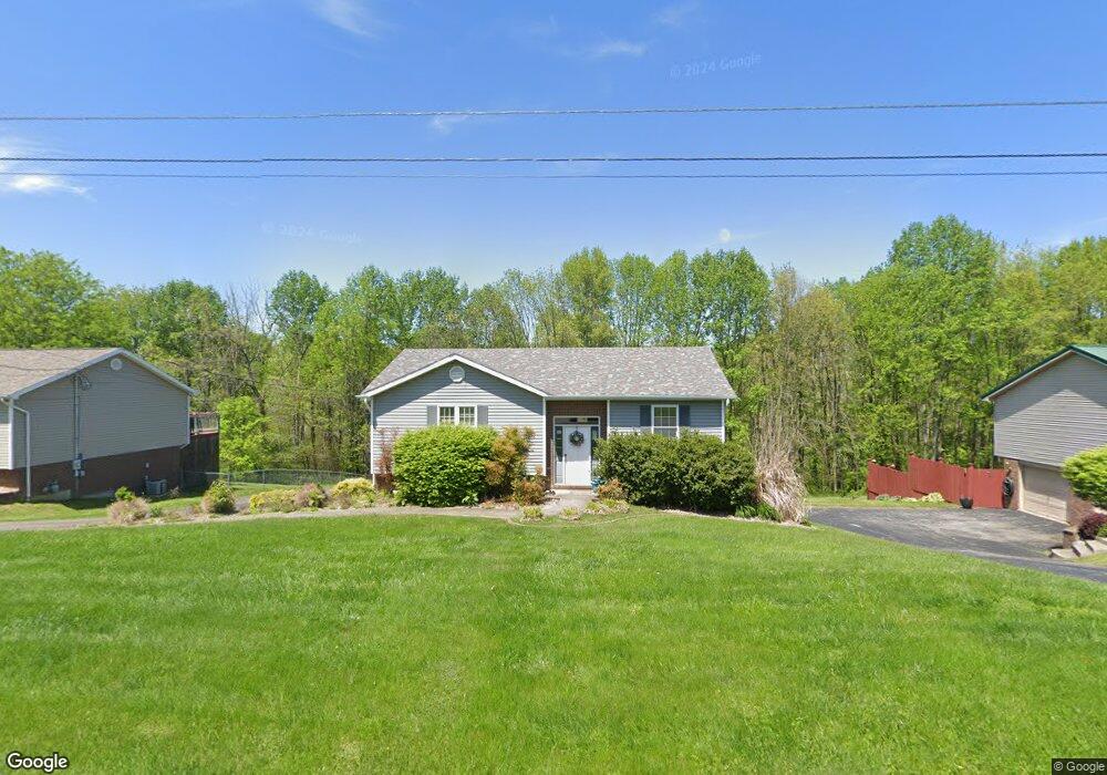
114 Mayfield Dr Campbellsville, KY 42718
Estimated Value: $206,000 - $256,000
3
Beds
3
Baths
1,326
Sq Ft
$175/Sq Ft
Est. Value
About This Home
This home is located at 114 Mayfield Dr, Campbellsville, KY 42718 and is currently estimated at $232,359, approximately $175 per square foot. 114 Mayfield Dr is a home located in Taylor County with nearby schools including Campbellsville Elementary School, Campbellsville Middle School, and Campbellsville High School.
Ownership History
Date
Name
Owned For
Owner Type
Purchase Details
Closed on
Aug 25, 2009
Sold by
Hord Shaun and Hord Jillian
Bought by
Caven Edwin K
Current Estimated Value
Home Financials for this Owner
Home Financials are based on the most recent Mortgage that was taken out on this home.
Original Mortgage
$113,417
Outstanding Balance
$73,684
Interest Rate
5.22%
Mortgage Type
New Conventional
Estimated Equity
$158,675
Create a Home Valuation Report for This Property
The Home Valuation Report is an in-depth analysis detailing your home's value as well as a comparison with similar homes in the area
Home Values in the Area
Average Home Value in this Area
Purchase History
| Date | Buyer | Sale Price | Title Company |
|---|---|---|---|
| Caven Edwin K | $112,500 | 1St Hamburg Title |
Source: Public Records
Mortgage History
| Date | Status | Borrower | Loan Amount |
|---|---|---|---|
| Open | Caven Edwin K | $113,417 |
Source: Public Records
Tax History Compared to Growth
Tax History
| Year | Tax Paid | Tax Assessment Tax Assessment Total Assessment is a certain percentage of the fair market value that is determined by local assessors to be the total taxable value of land and additions on the property. | Land | Improvement |
|---|---|---|---|---|
| 2025 | $1,259 | $130,000 | $0 | $0 |
| 2024 | $1,276 | $130,000 | $0 | $0 |
| 2023 | $1,321 | $130,000 | $0 | $0 |
| 2022 | $1,342 | $130,000 | $0 | $0 |
| 2021 | $1,096 | $106,600 | $0 | $0 |
| 2020 | $1,121 | $106,600 | $0 | $0 |
| 2019 | $1,123 | $106,600 | $0 | $0 |
| 2018 | $1,103 | $106,600 | $0 | $0 |
| 2017 | $1,079 | $106,600 | $0 | $0 |
| 2016 | $1,053 | $106,600 | $0 | $0 |
| 2015 | $1,048 | $106,600 | $0 | $0 |
| 2014 | $1,026 | $106,600 | $0 | $0 |
| 2012 | -- | $106,600 | $0 | $0 |
Source: Public Records
Map
Nearby Homes
- 116 Mayfield Dr
- 904 Maplewood St
- 0 Trace Fork Rd Unit HK24003110
- 321 Beechwood Dr
- 112 Mcclelland Ct
- 208 Skyline Dr
- 105 Druin St
- Lot 82 Hampton Ct Unit Lot 82
- 102 Floyd St
- 107 Druin St
- 106 Floyd St
- 113 Yorkshire Place
- 39 Woodland Heights Pkwy
- 112 Floyd St
- 1805 Hodgenville Rd
- 105 Tammie Trail
- 116 Coakley St
- 623 N Central Ave
- 721 Lebanon Ave
- 1511 Longview Dr
- 112 Mayfield Dr
- 118 Mayfield Dr
- 113 Mayfield Dr
- 117 Mayfield Dr
- 111 Mayfield Dr
- 108 Mayfield Dr
- 218 Twin Creek Dr
- 109 Mayfield Dr
- 214 Twin Creek Dr
- 106 Mayfield Dr
- 212 Twin Creek Dr
- 120 Mayfield Dr
- 107 Mayfield Dr
- 210 Twin Creek Dr
- 104 Mayfield Dr
- 105 Mayfield Dr
- 102 Mayfield Dr
- 260 Cambridge Way
- 229 Twin Creek Dr
- 208 Twin Creek Dr
