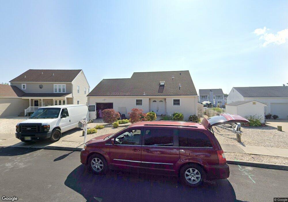
114 Moorage Ave Bayville, NJ 08721
Estimated Value: $730,429 - $833,000
3
Beds
2
Baths
1,506
Sq Ft
$505/Sq Ft
Est. Value
About This Home
This home is located at 114 Moorage Ave, Bayville, NJ 08721 and is currently estimated at $760,607, approximately $505 per square foot. 114 Moorage Ave is a home located in Ocean County with nearby schools including Central Regional Middle School, Central Regional High School, and Ocean Academy.
Ownership History
Date
Name
Owned For
Owner Type
Purchase Details
Closed on
Jan 7, 2015
Sold by
Kardos Dennis P and Kardos Nancy J
Bought by
Kardos Living Trust and Kardos Nancy J
Current Estimated Value
Purchase Details
Closed on
Aug 31, 2010
Sold by
Suppa Ann
Bought by
Kardos Dennis P and Kardos Nancy J
Home Financials for this Owner
Home Financials are based on the most recent Mortgage that was taken out on this home.
Original Mortgage
$335,200
Outstanding Balance
$222,576
Interest Rate
4.55%
Mortgage Type
Stand Alone First
Estimated Equity
$538,031
Create a Home Valuation Report for This Property
The Home Valuation Report is an in-depth analysis detailing your home's value as well as a comparison with similar homes in the area
Home Values in the Area
Average Home Value in this Area
Purchase History
| Date | Buyer | Sale Price | Title Company |
|---|---|---|---|
| Kardos Living Trust | -- | None Available | |
| Kardos Dennis P | $419,000 | Fidelity Natl Title Ins Co |
Source: Public Records
Mortgage History
| Date | Status | Borrower | Loan Amount |
|---|---|---|---|
| Open | Kardos Dennis P | $335,200 |
Source: Public Records
Tax History Compared to Growth
Tax History
| Year | Tax Paid | Tax Assessment Tax Assessment Total Assessment is a certain percentage of the fair market value that is determined by local assessors to be the total taxable value of land and additions on the property. | Land | Improvement |
|---|---|---|---|---|
| 2025 | $9,487 | $393,500 | $265,200 | $128,300 |
| 2024 | $9,129 | $393,500 | $265,200 | $128,300 |
| 2023 | $8,960 | $393,500 | $265,200 | $128,300 |
| 2022 | $8,960 | $393,500 | $265,200 | $128,300 |
| 2021 | $8,771 | $393,500 | $265,200 | $128,300 |
| 2020 | $8,771 | $393,500 | $265,200 | $128,300 |
| 2019 | $8,527 | $393,500 | $265,200 | $128,300 |
| 2018 | $8,500 | $393,500 | $265,200 | $128,300 |
| 2017 | $8,185 | $393,500 | $265,200 | $128,300 |
| 2016 | $8,142 | $393,500 | $265,200 | $128,300 |
| 2015 | $7,917 | $393,500 | $265,200 | $128,300 |
| 2014 | $7,693 | $393,500 | $265,200 | $128,300 |
Source: Public Records
Map
Nearby Homes
- 38 Belmont Ave
- Elm&Cherry Cherry St
- 40 Dockage Rd
- 0 Red Bank Ave
- 33 Anchorage Blvd
- 13 Skimmer Ln Unit 48
- 58 Ronald Ave S
- 79 Sloop Creek Rd
- 5 Melinda Ct
- 87 Puffin Glade Unit 87
- 257 Ocean Gate Turnpike
- 32 Toppinglift Dr
- 803 Ocean Gate Dr
- 36 W Point Pleasant Ave
- 7 Travelers Way
- 21 Buckley Ln
- 11 Drake Dr
- 32 E Long Branch Ave
- 46 Amherst Dr
- 553 Ocean Gate Dr
- 112 Moorage Ave
- 116 Moorage Ave
- 110 Moorage Ave
- 66 Veeder Ln
- 66 Veeder Ln Unit A
- 66A Veeder Ln
- 108 Moorage Ave
- 62 Ocean Gate Ave
- 60 Ocean Gate Ave
- 64 Ocean Gate Ave
- 58 Ocean Gate Ave
- 66 Ocean Gate Ave
- 68 Veeder Ln
- 106 Moorage Ave
- 68 Ocean Gate Ave
- 56 Ocean Gate Ave
- 104 Moorage Ave
- 70 Veeder Ln
- 70 Ocean Gate Ave
- 63 Ocean Gate Ave