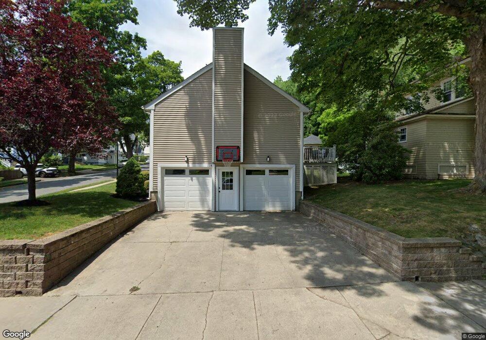
114 Morningside Rd Worcester, MA 01602
Newton Square NeighborhoodEstimated Value: $587,000 - $633,000
4
Beds
3
Baths
2,600
Sq Ft
$234/Sq Ft
Est. Value
About This Home
This home is located at 114 Morningside Rd, Worcester, MA 01602 and is currently estimated at $609,136, approximately $234 per square foot. 114 Morningside Rd is a home located in Worcester County with nearby schools including Chandler Magnet, Jacob Hiatt Magnet School, and May Street Elementary School.
Ownership History
Date
Name
Owned For
Owner Type
Purchase Details
Closed on
May 2, 2005
Sold by
Hilltop Rt and Mccarthy Dorothy A
Bought by
Lito Irgena and Lito Zhani
Current Estimated Value
Home Financials for this Owner
Home Financials are based on the most recent Mortgage that was taken out on this home.
Original Mortgage
$292,000
Outstanding Balance
$153,325
Interest Rate
5.95%
Mortgage Type
Purchase Money Mortgage
Estimated Equity
$455,811
Create a Home Valuation Report for This Property
The Home Valuation Report is an in-depth analysis detailing your home's value as well as a comparison with similar homes in the area
Home Values in the Area
Average Home Value in this Area
Purchase History
| Date | Buyer | Sale Price | Title Company |
|---|---|---|---|
| Lito Irgena | $365,000 | -- |
Source: Public Records
Mortgage History
| Date | Status | Borrower | Loan Amount |
|---|---|---|---|
| Open | Lito Irgena | $292,000 |
Source: Public Records
Tax History Compared to Growth
Tax History
| Year | Tax Paid | Tax Assessment Tax Assessment Total Assessment is a certain percentage of the fair market value that is determined by local assessors to be the total taxable value of land and additions on the property. | Land | Improvement |
|---|---|---|---|---|
| 2025 | $7,352 | $557,400 | $117,500 | $439,900 |
| 2024 | $7,224 | $525,400 | $117,500 | $407,900 |
| 2023 | $6,982 | $486,900 | $102,200 | $384,700 |
| 2022 | $6,557 | $431,100 | $81,800 | $349,300 |
| 2021 | $6,781 | $416,500 | $65,400 | $351,100 |
| 2020 | $6,586 | $387,400 | $65,400 | $322,000 |
| 2019 | $6,349 | $352,700 | $58,800 | $293,900 |
| 2018 | $6,259 | $331,000 | $58,800 | $272,200 |
| 2017 | $6,064 | $315,500 | $58,800 | $256,700 |
| 2016 | $6,158 | $298,800 | $42,700 | $256,100 |
| 2015 | $5,997 | $298,800 | $42,700 | $256,100 |
| 2014 | $5,831 | $298,400 | $42,700 | $255,700 |
Source: Public Records
Map
Nearby Homes
- 24 Hadwen Rd
- 53 Howland Terrace
- 40 Howland Terrace
- 34 Monroe Ave
- 96 June St Unit 3
- 2 Carlisle St
- 16 Sherwood Rd
- 250 May St
- 371 Chandler St Unit 2
- 346 Lovell St
- 336 Lovell St
- 6 Newton Ave
- 9 Field Way
- 5 Coombs Rd
- 19 Kenilworth Rd
- 3 Suburban Rd
- 574 Pleasant St
- 7 Longworth Rd
- 31 Lenox St
- 41 Walnut Hill Dr
- 112 Morningside Rd
- 8 Rob Roy Rd
- 122 Morningside Rd
- 12 Rob Roy Rd
- 108 Morningside Rd
- 113 Morningside Rd
- 7 Rob Roy Rd
- 117 Morningside Rd
- 117 Morningside Rd Unit Left
- 117 Morningside Rd Unit Right
- 126 Morningside Rd
- 16 Rob Roy Rd
- 109 Morningside Rd
- 123 Morningside Rd
- 102 Morningside Rd
- 11 Rob Roy Rd
- 105 Morningside Rd
- 127 Morningside Rd
- 22 Rob Roy Rd
- 42 Hadwen Rd