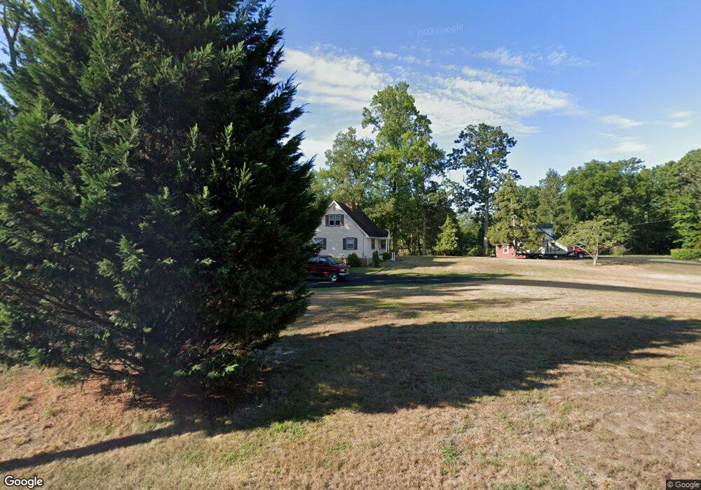
114 Mount Misery Rd Browns Mills, NJ 08015
Estimated Value: $261,000 - $415,000
--
Bed
--
Bath
1,881
Sq Ft
$190/Sq Ft
Est. Value
About This Home
This home is located at 114 Mount Misery Rd, Browns Mills, NJ 08015 and is currently estimated at $357,063, approximately $189 per square foot. 114 Mount Misery Rd is a home located in Burlington County.
Ownership History
Date
Name
Owned For
Owner Type
Purchase Details
Closed on
Nov 20, 2009
Sold by
Grady Richard E and Grady Sandra A
Bought by
Sullivan Charles H and Sullivan Kamela J
Current Estimated Value
Home Financials for this Owner
Home Financials are based on the most recent Mortgage that was taken out on this home.
Original Mortgage
$223,200
Outstanding Balance
$145,890
Interest Rate
5.02%
Mortgage Type
New Conventional
Estimated Equity
$211,173
Purchase Details
Closed on
Feb 18, 1994
Sold by
Earley Margaret L
Bought by
Grady Richard E and Grady Sandra
Home Financials for this Owner
Home Financials are based on the most recent Mortgage that was taken out on this home.
Original Mortgage
$142,000
Interest Rate
7.18%
Mortgage Type
VA
Create a Home Valuation Report for This Property
The Home Valuation Report is an in-depth analysis detailing your home's value as well as a comparison with similar homes in the area
Home Values in the Area
Average Home Value in this Area
Purchase History
| Date | Buyer | Sale Price | Title Company |
|---|---|---|---|
| Sullivan Charles H | $279,000 | Weichert Title Agency | |
| Grady Richard E | $137,000 | -- |
Source: Public Records
Mortgage History
| Date | Status | Borrower | Loan Amount |
|---|---|---|---|
| Open | Sullivan Charles H | $223,200 | |
| Previous Owner | Grady Richard E | $114,700 | |
| Previous Owner | Grady Richard E | $18,000 | |
| Previous Owner | Grady Richard E | $142,000 |
Source: Public Records
Tax History Compared to Growth
Tax History
| Year | Tax Paid | Tax Assessment Tax Assessment Total Assessment is a certain percentage of the fair market value that is determined by local assessors to be the total taxable value of land and additions on the property. | Land | Improvement |
|---|---|---|---|---|
| 2025 | $6,498 | $212,000 | $44,600 | $167,400 |
| 2024 | $6,097 | $212,000 | $44,600 | $167,400 |
| 2023 | $6,097 | $212,000 | $44,600 | $167,400 |
| 2022 | $5,643 | $212,000 | $44,600 | $167,400 |
| 2021 | $5,412 | $212,000 | $44,600 | $167,400 |
| 2020 | $5,209 | $212,000 | $44,600 | $167,400 |
| 2019 | $4,988 | $212,000 | $44,600 | $167,400 |
| 2018 | $4,819 | $212,000 | $44,600 | $167,400 |
| 2017 | $4,719 | $212,000 | $44,600 | $167,400 |
| 2016 | $5,076 | $135,800 | $25,000 | $110,800 |
| 2015 | $5,035 | $135,800 | $25,000 | $110,800 |
| 2014 | $4,814 | $135,800 | $25,000 | $110,800 |
Source: Public Records
Map
Nearby Homes
- 0 Pembrown Rd Unit NJBL2061932
- 3561 Weymouth Rd
- 3698 A Nashua St
- 3594 Nashua St
- 3620 Weymouth Rd
- 3610 Weymouth Rd
- 3394 Liberty St
- 3399 Liberty St
- 20 Coville Dr
- 204 Scammell Dr
- 20 Carp Ln
- 601 Concord Dr
- 215 Coville Dr
- 217 Coville Dr
- 28 Scammell Dr
- 511 Laurel Blvd
- 219 Kinsley Rd
- 227 Kinsley Rd
- 25 Railroad St
- 216 Kinsley Rd
- 114 Mount Misery Rd
- 112 Mount Misery Rd
- 118 Mount Misery Rd
- 103 Mount Misery Rd
- 120 Mount Misery Rd
- 115 Four Mile Rd
- 111 Mount Misery Rd
- 122 Mount Misery Rd
- 150 Mount Misery Rd
- 122 Mount Misery Rd
- 119 Four Mile Rd
- 20 S Woods Rd
- 20 Woods Rd
- 77 Four Mile Rd
- 29 Four Mile Rd
- 25 Four Mile Rd
- 110 Four Mile Rd
- 104 Four Mile Rd
- 112 Four Mile Rd
- 106 Four Mile Rd