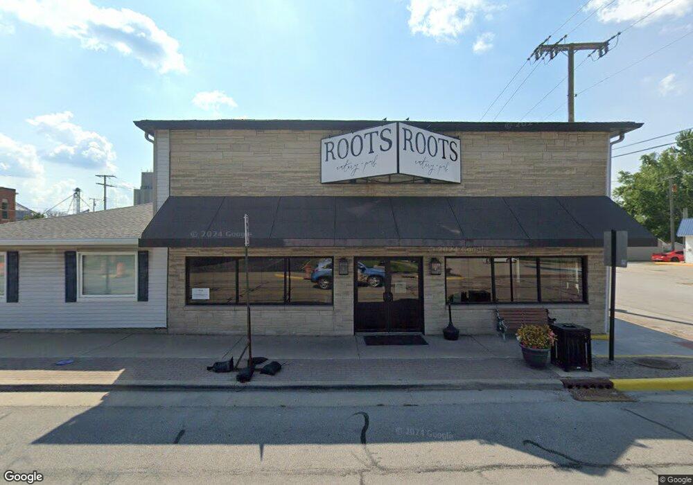
114 N Range St Wolcott, IN 47995
Estimated Value: $250,350
--
Bed
--
Bath
4,510
Sq Ft
$56/Sq Ft
Est. Value
About This Home
This home is located at 114 N Range St, Wolcott, IN 47995 and is currently estimated at $250,350, approximately $55 per square foot. 114 N Range St is a home located in White County with nearby schools including Tri-County Primary School, Tri-County Intermediate School, and Tri-County Jr.-Sr. High School.
Ownership History
Date
Name
Owned For
Owner Type
Purchase Details
Closed on
Sep 8, 2017
Sold by
Connelly & Associates Inc
Bought by
Bl Furrer Land Holdings Llc
Current Estimated Value
Purchase Details
Closed on
Sep 29, 2016
Sold by
Prairie Land Properties Llc
Bought by
Connelly & Associates Inc
Purchase Details
Closed on
Mar 10, 2010
Sold by
Bank Of Wolcott
Bought by
Prairie Land Properties Llc
Create a Home Valuation Report for This Property
The Home Valuation Report is an in-depth analysis detailing your home's value as well as a comparison with similar homes in the area
Home Values in the Area
Average Home Value in this Area
Purchase History
| Date | Buyer | Sale Price | Title Company |
|---|---|---|---|
| Bl Furrer Land Holdings Llc | -- | White Cnty Title Co | |
| Connelly & Associates Inc | $110,000 | White County Abstract & Title | |
| Prairie Land Properties Llc | $110,000 | Bank Of Wolcott |
Source: Public Records
Tax History Compared to Growth
Tax History
| Year | Tax Paid | Tax Assessment Tax Assessment Total Assessment is a certain percentage of the fair market value that is determined by local assessors to be the total taxable value of land and additions on the property. | Land | Improvement |
|---|---|---|---|---|
| 2024 | $2,245 | $97,000 | $10,500 | $86,500 |
| 2023 | $2,244 | $97,900 | $10,500 | $87,400 |
| 2022 | $2,187 | $96,000 | $10,500 | $85,500 |
| 2021 | $2,182 | $88,700 | $10,500 | $78,200 |
| 2020 | $2,414 | $88,700 | $10,500 | $78,200 |
| 2019 | $2,341 | $88,700 | $10,500 | $78,200 |
| 2018 | $2,280 | $88,700 | $10,500 | $78,200 |
| 2017 | $2,051 | $82,200 | $10,500 | $71,700 |
| 2016 | $1,880 | $77,500 | $10,500 | $67,000 |
| 2014 | $569 | $24,700 | $9,700 | $15,000 |
Source: Public Records
Map
Nearby Homes
- 125 E Johnson St
- 302 W Johnson St
- 408 N Range St
- 406 W Anderson St
- 415 W Us Highway 24
- S County Road 280 W
- 4729 W 100 N
- 1 S Kentucky St
- 305 N Illinois St
- 114 E North St
- 310 N Indiana St
- 4 W North St
- 21 W Bruel St
- 5824 W 1800 S
- 688 W County Rd 1100 S
- 1910 E 1050 S
- 0 60 Rd E
- 9954 S 210 E
- 107 W 4th St
- 514 N Kenton St
- 112 N Range St
- 107 W Johnson St
- 110 N Range St
- 107 N 2nd St
- 128 W Market St
- 203 N 2nd St
- 101 N Range St
- 203 N Range St
- 127 W Market St
- 106 S Range St
- 101 E Market St
- 205 N 2nd St
- 205 N Range St
- 122 E Johnson St
- 125 W North St
- 112 S Range St
- 124 E Market St
- 101 E North St
- 0 Us Hwy 24 Unit 201804287
- 126 E Johnson St
