Estimated Value: $912,000 - $1,193,000
4
Beds
3
Baths
2,504
Sq Ft
$403/Sq Ft
Est. Value
About This Home
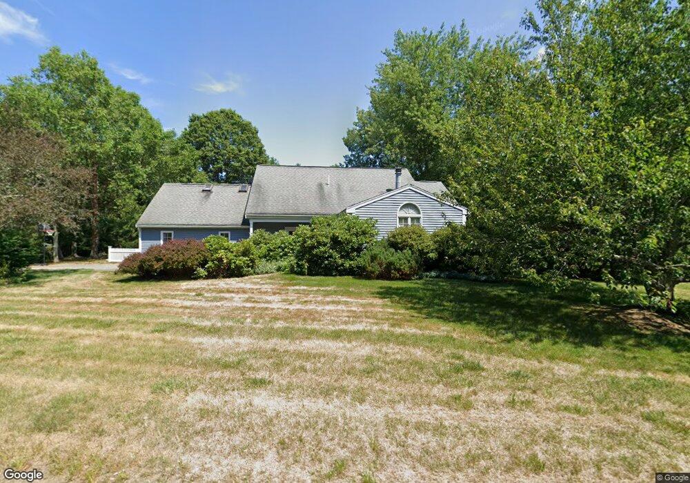
This home is located at 114 Nonset Path, Acton, MA 01720 and is currently estimated at $1,007,960, approximately $402 per square foot. 114 Nonset Path is a home located in Middlesex County with nearby schools including Acton-Boxborough Regional High School and Oak Meadow Montessori School.
Ownership History
Date
Name
Owned For
Owner Type
Purchase Details
Closed on
Dec 12, 2016
Sold by
Tarnowski Gary J and Sibley Sheila M
Bought by
Tarnowskisibley Lt
Current Estimated Value
Purchase Details
Closed on
Jun 26, 2009
Sold by
Panicali Dennis L and Panicali Sandra L
Bought by
Tarnowski Gary J and Sibley Sheila M
Home Financials for this Owner
Home Financials are based on the most recent Mortgage that was taken out on this home.
Original Mortgage
$350,000
Interest Rate
4.92%
Mortgage Type
Purchase Money Mortgage
Create a Home Valuation Report for This Property
The Home Valuation Report is an in-depth analysis detailing your home's value as well as a comparison with similar homes in the area
Home Values in the Area
Average Home Value in this Area
Purchase History
| Date | Buyer | Sale Price | Title Company |
|---|---|---|---|
| Tarnowskisibley Lt | -- | -- | |
| Tarnowski Gary J | $545,000 | -- |
Source: Public Records
Mortgage History
| Date | Status | Borrower | Loan Amount |
|---|---|---|---|
| Previous Owner | Tarnowski Gary J | $350,000 |
Source: Public Records
Tax History
| Year | Tax Paid | Tax Assessment Tax Assessment Total Assessment is a certain percentage of the fair market value that is determined by local assessors to be the total taxable value of land and additions on the property. | Land | Improvement |
|---|---|---|---|---|
| 2025 | $13,492 | $786,700 | $349,500 | $437,200 |
| 2024 | $13,373 | $802,200 | $349,500 | $452,700 |
| 2023 | $12,791 | $728,400 | $318,100 | $410,300 |
| 2022 | $11,763 | $604,800 | $276,100 | $328,700 |
| 2021 | $11,687 | $577,700 | $255,800 | $321,900 |
| 2020 | $11,115 | $577,700 | $255,800 | $321,900 |
| 2019 | $11,188 | $577,600 | $255,800 | $321,800 |
| 2018 | $10,192 | $525,900 | $255,800 | $270,100 |
| 2017 | $9,934 | $521,200 | $255,800 | $265,400 |
| 2016 | $9,392 | $488,400 | $255,800 | $232,600 |
| 2015 | $9,344 | $490,500 | $255,800 | $234,700 |
| 2014 | $9,204 | $473,200 | $255,800 | $217,400 |
Source: Public Records
Map
Nearby Homes
- 405 Great Elm Way
- 262 Brown Bear Crossing Unit 262
- 237 Brown Bear Crossing Unit 237
- 238 Brown Bear Crossing Unit 238
- 5 Samantha Way Unit 5
- 11 Walnut St
- 420 Great Rd Unit B3
- 390 Great Rd Unit B16
- 388 Great Rd Unit A9
- 388 Great Rd Unit B14
- 386 Great Rd Unit A8
- 18 Mcintosh Ln
- 159 Skyline Dr Unit 159
- 380A Great Rd Unit 301
- 380 Great Rd Unit B301
- 927 Main St
- 11 Davis Rd Unit A5
- 11 Davis Rd Unit B8
- 15 Davis Rd Unit B-8
- 87 Canterbury Hill Rd
- 112 Nonset Path
- 116 Nonset Path
- 115 Nonset Path
- 115 Nonset Path Unit 115
- 113 Nonset Path
- 117 Nonset Path
- 118 Nonset Path
- 110 Nonset Path
- 119 Nonset Path
- 21 Henley Rd
- 19 Henley Rd
- 111 Nonset Path
- 25 Henley Rd
- 121 Nonset Path
- 122 Nonset Path
- 109 Nonset Path
- 17 Henley Rd
- 20 Henley Rd
- 107 Nonset Path
- 24 Henley Rd
Your Personal Tour Guide
Ask me questions while you tour the home.