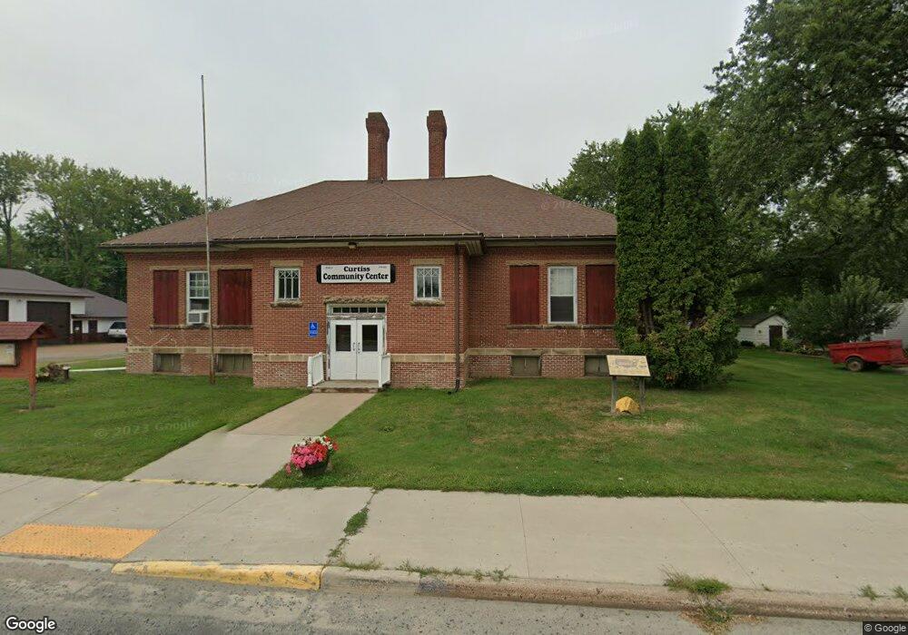
114 Po Box Curtiss, WI 54422
Estimated Value: $116,000 - $435,000
--
Bed
--
Bath
--
Sq Ft
10,019
Sq Ft Lot
About This Home
This home is located at 114 Po Box, Curtiss, WI 54422 and is currently estimated at $251,899. 114 Po Box is a home located in Clark County with nearby schools including Owen-Withee Elementary School, Owen-Withee Junior High School, and Owen-Withee High School.
Ownership History
Date
Name
Owned For
Owner Type
Purchase Details
Closed on
Jan 30, 2025
Sold by
Hassemer Neil
Bought by
Bonilla Ma Luisa Aguile
Current Estimated Value
Purchase Details
Closed on
Jul 6, 2023
Sold by
Aguilera Raman and Agulera Maria E
Bought by
Aguiler Raman and Aguiler Naeli
Purchase Details
Closed on
Jun 16, 2008
Sold by
Harris Sylvester and Harris Elizabeth L
Bought by
Aguilera Ramon and Aguilera Maria E
Home Financials for this Owner
Home Financials are based on the most recent Mortgage that was taken out on this home.
Original Mortgage
$47,502
Interest Rate
6.05%
Mortgage Type
Future Advance Clause Open End Mortgage
Create a Home Valuation Report for This Property
The Home Valuation Report is an in-depth analysis detailing your home's value as well as a comparison with similar homes in the area
Home Values in the Area
Average Home Value in this Area
Purchase History
| Date | Buyer | Sale Price | Title Company |
|---|---|---|---|
| Bonilla Ma Luisa Aguile | $58,500 | None Listed On Document | |
| Aguiler Raman | -- | None Listed On Document | |
| Aguilera Ramon | -- | -- |
Source: Public Records
Mortgage History
| Date | Status | Borrower | Loan Amount |
|---|---|---|---|
| Previous Owner | Aguilera Ramon | $47,502 |
Source: Public Records
Tax History Compared to Growth
Tax History
| Year | Tax Paid | Tax Assessment Tax Assessment Total Assessment is a certain percentage of the fair market value that is determined by local assessors to be the total taxable value of land and additions on the property. | Land | Improvement |
|---|---|---|---|---|
| 2024 | $1,864 | $107,500 | $3,800 | $103,700 |
| 2023 | $1,926 | $107,500 | $3,800 | $103,700 |
| 2022 | $1,733 | $71,200 | $2,100 | $69,100 |
| 2021 | $1,682 | $71,200 | $2,100 | $69,100 |
| 2020 | $1,730 | $71,200 | $2,100 | $69,100 |
| 2019 | $1,642 | $71,200 | $2,100 | $69,100 |
| 2018 | $1,625 | $71,200 | $2,100 | $69,100 |
| 2017 | $48 | $71,200 | $2,100 | $69,100 |
| 2016 | $1,358 | $71,200 | $2,100 | $69,100 |
| 2015 | -- | $71,200 | $2,100 | $69,100 |
| 2014 | -- | $71,200 | $2,100 | $69,100 |
| 2013 | -- | $71,200 | $2,100 | $69,100 |
| 2011 | -- | $71,200 | $2,100 | $69,100 |
Source: Public Records
Map
Nearby Homes
- W2087 Willow Rd
- 642 E 6th St
- 629 E 7th St
- 211 N 5th Ave
- 407 E 5th St
- N14303 County Highway D
- 246 S 4th St
- 301 W Butternut St
- 205 W Hickory St
- 151 N 4th St
- 106 S Harding St Unit 1-8
- 405 N 3rd St
- 312 Other
- 312 N 3rd St
- 112 N 2nd St
- 500 N Front St
- 519 W Bjornstad St
- 619 W 3rd St
- 00 Oak Dr
- N896 County Rd E
