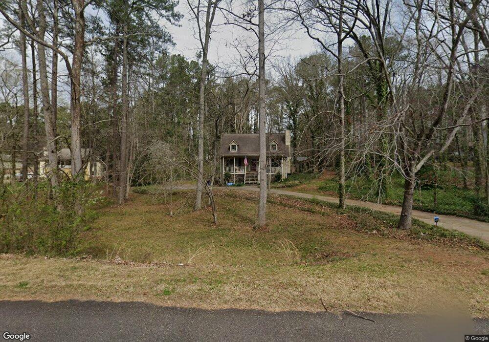
114 Port Victoria Way Unit 1 Woodstock, GA 30189
Sutallee NeighborhoodEstimated Value: $397,000 - $422,000
3
Beds
2
Baths
2,176
Sq Ft
$187/Sq Ft
Est. Value
About This Home
This home is located at 114 Port Victoria Way Unit 1, Woodstock, GA 30189 and is currently estimated at $407,272, approximately $187 per square foot. 114 Port Victoria Way Unit 1 is a home located in Cherokee County with nearby schools including Boston Elementary School, E. T. Booth Middle School, and Etowah High School.
Ownership History
Date
Name
Owned For
Owner Type
Purchase Details
Closed on
Jun 19, 2018
Sold by
Barclay David
Bought by
Powell Katherine Ann
Current Estimated Value
Purchase Details
Closed on
Mar 22, 2006
Sold by
King Stephen R and King Heather A
Bought by
Barclay David
Purchase Details
Closed on
Apr 10, 2000
Sold by
Delli William E and Delli Charlotte A
Bought by
King Heather A and King Stephen R
Home Financials for this Owner
Home Financials are based on the most recent Mortgage that was taken out on this home.
Original Mortgage
$120,000
Interest Rate
8.29%
Mortgage Type
New Conventional
Create a Home Valuation Report for This Property
The Home Valuation Report is an in-depth analysis detailing your home's value as well as a comparison with similar homes in the area
Home Values in the Area
Average Home Value in this Area
Purchase History
| Date | Buyer | Sale Price | Title Company |
|---|---|---|---|
| Powell Katherine Ann | -- | -- | |
| Barclay David | $168,000 | -- | |
| King Heather A | $141,000 | -- |
Source: Public Records
Mortgage History
| Date | Status | Borrower | Loan Amount |
|---|---|---|---|
| Previous Owner | King Heather A | $120,000 |
Source: Public Records
Tax History Compared to Growth
Tax History
| Year | Tax Paid | Tax Assessment Tax Assessment Total Assessment is a certain percentage of the fair market value that is determined by local assessors to be the total taxable value of land and additions on the property. | Land | Improvement |
|---|---|---|---|---|
| 2025 | $3,223 | $139,908 | $34,000 | $105,908 |
| 2024 | $3,007 | $129,308 | $29,200 | $100,108 |
| 2023 | $2,630 | $132,068 | $29,200 | $102,868 |
| 2022 | $2,512 | $104,388 | $26,000 | $78,388 |
| 2021 | $2,425 | $91,668 | $19,480 | $72,188 |
| 2020 | $2,227 | $83,028 | $17,400 | $65,628 |
| 2019 | $563 | $69,640 | $15,000 | $54,640 |
| 2018 | $560 | $66,080 | $13,600 | $52,480 |
| 2017 | $578 | $165,600 | $13,600 | $52,640 |
| 2016 | $578 | $157,000 | $11,760 | $51,040 |
| 2015 | $530 | $141,000 | $11,760 | $44,640 |
| 2014 | $481 | $128,700 | $11,760 | $39,720 |
Source: Public Records
Map
Nearby Homes
- 315 Pinewood Dr
- 617 Driftwood Dr
- 442 Colonial Walk
- 313 Maltibe Dr
- 373 N Victoria Rd
- 146 Sunset Ln
- 627 Apache Trail
- 7119 Big Woods Dr
- 507 Huntgate Rd
- 386 N Victoria Rd
- 522 Huntgate Rd Unit 4
- 1413 Reed Ln
- 1508 Towne Harbor Ln
- 1028 Deer Hollow Dr
- 1511 Harbor Watch Ct
- 1364 Towne Harbor Trail
- 1029 Chatsworth Ln
- 745 Cedar Creek Way Unit 1
- 819 Victoria Place
- 1001 Deer Hollow Dr
- 116 Port Victoria Way Unit 1
- 112 Port Victoria Way
- 111 Port Victoria Way Unit I
- 201 Shelter Cove
- 405 Harbor Way
- 407 Harbor Way
- 403 Harbor Way
- 118 Port Victoria Way
- 301 Mariner Cir
- 409 Harbor Way
- 203 Shelter Cove Unit 1
- 304 Mariner Cir
- 113 Port Victoria Way Unit 1
- 120 Port Victoria Way
- 202 Shelter Cove
- 411 Harbor Way
- 105 Port Victoria Way Unit 1
- 404 Harbor Way
- 122 Port Victoria Way Unit 1
- 406 Harbor Way