
Seller's Agent in 2023
Kimberly Norman
Norman & Norman Realtors
(404) 759-1328
129 Total Sales
Estimated Value: $59,000 - $113,000
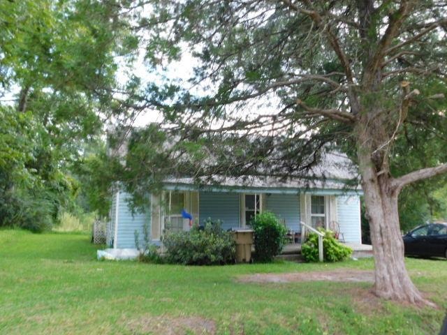
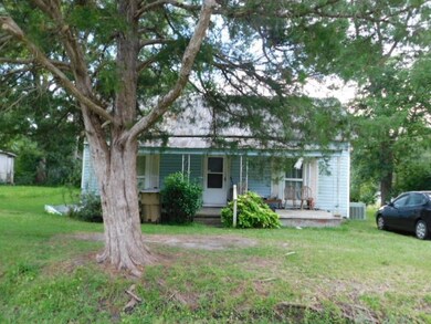
Home has two bedrooms, possibly three, and one full bathroom, and will be auctioned soon. Property viewings will only after closing of the home. Contact a Realtor for more information.
Last Agent to Sell the Property
Norman & Norman Realtors Brokerage Email: 2294352787, Knorman@nnrealtors.com License #179056 Listed on: 11/17/2023
Last Buyer's Agent
Norman & Norman Realtors Brokerage Email: 2294352787, Knorman@nnrealtors.com License #179056 Listed on: 11/17/2023
| Date | Buyer | Sale Price | Title Company |
|---|---|---|---|
| Tompkins Nicole | $35,500 | -- | |
| Calvert Bobbie D | $30,000 | -- |
| Date | Status | Borrower | Loan Amount |
|---|---|---|---|
| Open | Tompkins Nicole | $34,435 |
| Date | Event | Price | List to Sale | Price per Sq Ft |
|---|---|---|---|---|
| 12/07/2023 12/07/23 | Sold | $5,000 | -- | $5 / Sq Ft |
| 11/17/2023 11/17/23 | Pending | -- | -- | -- |
| Year | Tax Paid | Tax Assessment Tax Assessment Total Assessment is a certain percentage of the fair market value that is determined by local assessors to be the total taxable value of land and additions on the property. | Land | Improvement |
|---|---|---|---|---|
| 2024 | $352 | $11,992 | $1,056 | $10,936 |
| 2023 | $352 | $11,992 | $1,056 | $10,936 |
| 2022 | $409 | $11,992 | $1,056 | $10,936 |
| 2021 | $409 | $11,992 | $1,056 | $10,936 |
| 2020 | $409 | $11,992 | $1,056 | $10,936 |
| 2019 | $149 | $11,992 | $1,056 | $10,936 |
| 2018 | $409 | $11,992 | $1,056 | $10,936 |
| 2017 | $409 | $11,992 | $1,056 | $10,936 |
| 2016 | $149 | $11,992 | $1,056 | $10,936 |
| 2015 | $104 | $11,992 | $1,056 | $10,936 |
| 2014 | $104 | $11,992 | $1,056 | $10,936 |
| 2013 | -- | $11,992 | $1,056 | $10,936 |
| 2012 | -- | $11,992 | $1,056 | $10,936 |
Seller's Agent in 2023
Kimberly Norman
Norman & Norman Realtors
(404) 759-1328
129 Total Sales
Source: Albany Board of REALTORS®
MLS Number: 158394
APN: PL020-038-000