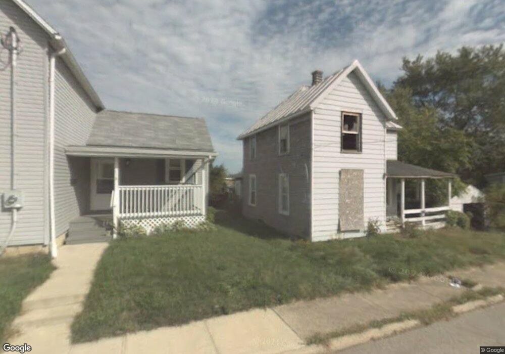
114 Raymond Ave Mansfield, OH 44903
Estimated Value: $87,000 - $286,000
--
Bed
1
Bath
--
Sq Ft
5,489
Sq Ft Lot
About This Home
This home is located at 114 Raymond Ave, Mansfield, OH 44903 and is currently estimated at $152,723. 114 Raymond Ave is a home located in Richland County with nearby schools including Goal Digital Academy, St. Peter's Elementary/Montessori School, and St. Peter's High School/Junior High.
Ownership History
Date
Name
Owned For
Owner Type
Purchase Details
Closed on
Feb 11, 2015
Sold by
Town & Country Co Op Inc
Bought by
Town & Country Co Op Inc
Current Estimated Value
Purchase Details
Closed on
Nov 6, 1996
Sold by
Schaffer Robert M
Bought by
Gisewite Robert A
Home Financials for this Owner
Home Financials are based on the most recent Mortgage that was taken out on this home.
Original Mortgage
$28,800
Interest Rate
10.35%
Mortgage Type
New Conventional
Purchase Details
Closed on
Sep 15, 1993
Sold by
Schaffer Robert Michael
Bought by
Schaffer Robert Michael
Create a Home Valuation Report for This Property
The Home Valuation Report is an in-depth analysis detailing your home's value as well as a comparison with similar homes in the area
Home Values in the Area
Average Home Value in this Area
Purchase History
| Date | Buyer | Sale Price | Title Company |
|---|---|---|---|
| Town & Country Co Op Inc | -- | Chicago Title | |
| Gisewite Robert A | $36,000 | -- | |
| Schaffer Robert Michael | -- | -- |
Source: Public Records
Mortgage History
| Date | Status | Borrower | Loan Amount |
|---|---|---|---|
| Previous Owner | Gisewite Robert A | $28,800 |
Source: Public Records
Tax History Compared to Growth
Tax History
| Year | Tax Paid | Tax Assessment Tax Assessment Total Assessment is a certain percentage of the fair market value that is determined by local assessors to be the total taxable value of land and additions on the property. | Land | Improvement |
|---|---|---|---|---|
| 2024 | $51 | $1,060 | $1,060 | $0 |
| 2023 | $51 | $1,060 | $1,060 | $0 |
| 2022 | $55 | $970 | $970 | $0 |
| 2021 | $56 | $970 | $970 | $0 |
| 2020 | $57 | $970 | $970 | $0 |
| 2019 | $63 | $970 | $970 | $0 |
| 2018 | $62 | $970 | $970 | $0 |
| 2017 | $92 | $970 | $970 | $0 |
| 2016 | $123 | $1,910 | $1,910 | $0 |
| 2015 | $118 | $1,910 | $1,910 | $0 |
| 2014 | $114 | $1,910 | $1,910 | $0 |
| 2012 | $82 | $3,620 | $2,020 | $1,600 |
Source: Public Records
Map
Nearby Homes
- 526 Bowman St
- 452 Daisy St
- 156 Buckingham Ave Unit 158
- 283 Bulkley Ave
- 743 Bowman St
- 371 Bell St
- 0 Voegele Ave Unit Lot 6048, 6049, 6
- 426 Mcpherson St
- 458 Wayne St
- 0 Highway 30
- 346 Newman St
- 512 Burns St
- 362-364 W 6th St
- 169 W 5th St
- 219 W 5th St
- 282 W 5th St
- 311 Auburn St
- 411 Grace St
- 395 Auburn St
- 118 Raymond Ave
- 102 Raymond Ave
- 584 N Mulberry St
- 571 Daisy St
- 575 Daisy St
- 580 N Mulberry St
- 565 Daisy St
- 570 N Mulberry St
- 561 Daisy St
- 576 Daisy St
- 581 N Mulberry St
- 86 Raymond Ave
- 112 Chester Ave
- 110 Chester Ave
- 572 Daisy St
- 577 N Mulberry St
- 564 N Mulberry St
- 553 Daisy St
- 564 Daisy St
- 560 Daisy St