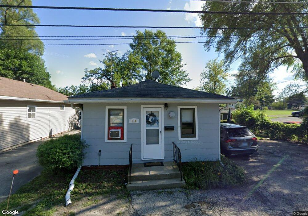
114 Roosevelt Rd Wauconda, IL 60084
Estimated Value: $174,000 - $226,000
--
Bed
2
Baths
1,340
Sq Ft
$155/Sq Ft
Est. Value
About This Home
This home is located at 114 Roosevelt Rd, Wauconda, IL 60084 and is currently estimated at $207,935, approximately $155 per square foot. 114 Roosevelt Rd is a home located in Lake County with nearby schools including Wauconda Grade School, Wauconda Middle School, and Wauconda High School.
Ownership History
Date
Name
Owned For
Owner Type
Purchase Details
Closed on
Jul 25, 2024
Sold by
Albert Mark
Bought by
Flagship Development Llc
Current Estimated Value
Purchase Details
Closed on
Jan 10, 2022
Sold by
Mayfield Family Trust
Bought by
Albert Mark
Purchase Details
Closed on
Mar 12, 2020
Sold by
Mayfield Forrest and Mayfield Barbara
Bought by
Mayfield Amon Forrest and Mayfield Barbara C
Purchase Details
Closed on
Oct 20, 2006
Sold by
Keilman Harold M
Bought by
Mayfield Forrest
Home Financials for this Owner
Home Financials are based on the most recent Mortgage that was taken out on this home.
Original Mortgage
$130,400
Interest Rate
6.33%
Mortgage Type
Purchase Money Mortgage
Purchase Details
Closed on
Mar 19, 1996
Sold by
Keilman Harold and Keilman Blanche
Bought by
Keilman Harold M
Home Financials for this Owner
Home Financials are based on the most recent Mortgage that was taken out on this home.
Original Mortgage
$72,000
Interest Rate
7%
Create a Home Valuation Report for This Property
The Home Valuation Report is an in-depth analysis detailing your home's value as well as a comparison with similar homes in the area
Home Values in the Area
Average Home Value in this Area
Purchase History
| Date | Buyer | Sale Price | Title Company |
|---|---|---|---|
| Flagship Development Llc | -- | None Listed On Document | |
| Albert Mark | $135,000 | Kaiser Shepherd & Nakon Pc | |
| Mayfield Amon Forrest | -- | Attorney | |
| Mayfield Forrest | $163,000 | Heritage Title Co | |
| Keilman Harold M | $80,000 | Chicago Title Insurance Co |
Source: Public Records
Mortgage History
| Date | Status | Borrower | Loan Amount |
|---|---|---|---|
| Previous Owner | Mayfield Forrest | $130,400 | |
| Previous Owner | Keilman Harold M | $72,000 |
Source: Public Records
Tax History Compared to Growth
Tax History
| Year | Tax Paid | Tax Assessment Tax Assessment Total Assessment is a certain percentage of the fair market value that is determined by local assessors to be the total taxable value of land and additions on the property. | Land | Improvement |
|---|---|---|---|---|
| 2024 | $5,275 | $58,732 | $12,741 | $45,991 |
| 2023 | $4,791 | $53,685 | $11,646 | $42,039 |
| 2022 | $4,791 | $43,908 | $7,892 | $36,016 |
| 2021 | $4,592 | $41,489 | $7,457 | $34,032 |
| 2020 | $4,305 | $39,543 | $7,107 | $32,436 |
| 2019 | $3,977 | $37,372 | $6,717 | $30,655 |
| 2018 | $4,557 | $39,615 | $7,808 | $31,807 |
| 2017 | $4,555 | $39,157 | $7,718 | $31,439 |
| 2016 | $4,298 | $37,081 | $7,309 | $29,772 |
| 2015 | $4,071 | $34,041 | $6,710 | $27,331 |
| 2014 | $3,430 | $29,398 | $7,857 | $21,541 |
| 2012 | $3,319 | $29,380 | $7,517 | $21,863 |
Source: Public Records
Map
Nearby Homes
- 450 N Main St Unit S307A
- 450 N Main St Unit S208A
- 136 Hubbard Ct
- 125 E Mill St Unit D103
- 311 Brown St
- 131 E Mill St Unit B104
- 146 E Mill St
- 240 Regency Ct
- 136 Parkview Dr Unit 5136
- 225 Regency Ct Unit A
- 235 Regency Ct Unit B
- 28177 N Garland Rd
- 26049 N Il Route 59
- 318 E Liberty St
- 300 Barrington Rd
- 107 Hammond Ave
- 453 Willow Rd
- 26241 W Bonner Rd
- 325 Sundown Ct Unit B
- 25721 W Lakeview Ave
- 114 Roosevelt Ave
- 116 Roosevelt Rd
- 120 Roosevelt Rd
- 113 Roosevelt Ave
- 113 Roosevelt Rd
- 117 Roosevelt Rd
- 108 Roosevelt Ave
- 121 Roosevelt Ave
- 108 Roosevelt Ave
- 124 Roosevelt Rd
- 121 Roosevelt Rd
- 125 Roosevelt Rd
- 424 N Main St
- 406 N Main St
- 418 Morning Star Ln
- 404 N Main St
- 404 N Main St
- 404B N Main St
- 404A N Main St
- 416 Morning Star Ln