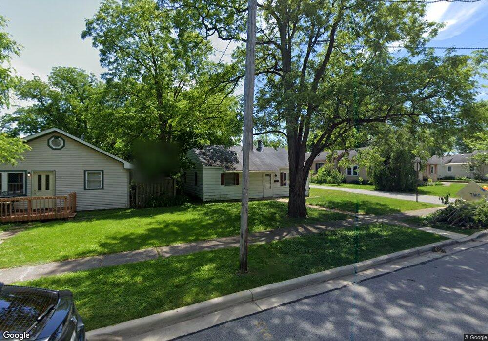
114 S Union St Crown Point, IN 46307
Estimated Value: $144,000 - $200,000
2
Beds
1
Bath
825
Sq Ft
$205/Sq Ft
Est. Value
About This Home
This home is located at 114 S Union St, Crown Point, IN 46307 and is currently estimated at $169,123, approximately $204 per square foot. 114 S Union St is a home located in Lake County with nearby schools including Timothy Ball Elementary School, Robert Taft Middle School, and Crown Point High School.
Ownership History
Date
Name
Owned For
Owner Type
Purchase Details
Closed on
Sep 9, 2022
Sold by
Shelly Brown
Bought by
Brown Ronald L
Current Estimated Value
Purchase Details
Closed on
Jun 1, 2022
Sold by
Shelly Brown
Bought by
Brown Ronald L
Purchase Details
Closed on
Jan 10, 2014
Sold by
Brown Ronald L and Brown Ronald
Bought by
Brown Bradley Allen
Purchase Details
Closed on
Nov 16, 2011
Sold by
Hsbc Bank Usa N A
Bought by
Brown Ronald
Purchase Details
Closed on
Sep 2, 2011
Sold by
Belcher William A
Bought by
Hsbc Bank Usa N A
Create a Home Valuation Report for This Property
The Home Valuation Report is an in-depth analysis detailing your home's value as well as a comparison with similar homes in the area
Home Values in the Area
Average Home Value in this Area
Purchase History
| Date | Buyer | Sale Price | Title Company |
|---|---|---|---|
| Brown Ronald L | -- | -- | |
| Brown Ronald L | -- | None Listed On Document | |
| Brown Bradley Allen | -- | None Available | |
| Brown Bradley Allen | -- | None Available | |
| Brown Ronald | -- | Premium Title Services | |
| Hsbc Bank Usa N A | $92,000 | None Available |
Source: Public Records
Tax History Compared to Growth
Tax History
| Year | Tax Paid | Tax Assessment Tax Assessment Total Assessment is a certain percentage of the fair market value that is determined by local assessors to be the total taxable value of land and additions on the property. | Land | Improvement |
|---|---|---|---|---|
| 2024 | $2,292 | $94,400 | $30,400 | $64,000 |
| 2023 | $1,772 | $83,400 | $26,400 | $57,000 |
| 2022 | $1,772 | $80,100 | $26,400 | $53,700 |
| 2021 | $1,641 | $74,200 | $22,000 | $52,200 |
| 2020 | $1,628 | $73,600 | $22,000 | $51,600 |
| 2019 | $1,629 | $71,600 | $22,000 | $49,600 |
| 2018 | $1,811 | $69,300 | $22,000 | $47,300 |
| 2017 | $1,820 | $68,800 | $22,000 | $46,800 |
| 2016 | $1,836 | $68,200 | $22,000 | $46,200 |
| 2014 | $1,670 | $67,200 | $22,000 | $45,200 |
| 2013 | $1,642 | $65,300 | $22,000 | $43,300 |
Source: Public Records
Map
Nearby Homes
- 531 E Joliet St
- 150 N Ridge St
- 138 N Grant St
- 266 Maxwell St
- 310 N Indiana Ave
- 269 Maxwell St
- 360 N Indiana Ave
- 380 N Indiana Ave
- 407 Prairie St
- 411 Prairie St
- 123 Henderlong Pkwy
- 901 Iroquois Dr
- 0 W Joliet St
- 221 N West St
- 306 Holton Ridge
- 316 W South St
- 936 Seneca Dr
- 1639 Fir Ave
- 511 N West St
- 622 E Brookside Dr
- 110 S Union St
- 106 S Union St
- 126 S Union St
- 701 E Clark St
- 130 S Union St
- 107 S Union St
- 620 Catherine St
- 709 E Clark St
- 129 S John St
- 109 S Union St
- 722 Catherine St
- 715 E Clark St
- 133 S Union St
- 133 S John St
- 113 S John St
- 103 S Union St
- 131 S Union St
- 719 E Clark St
- 134 S Union St
- 101 S Union St