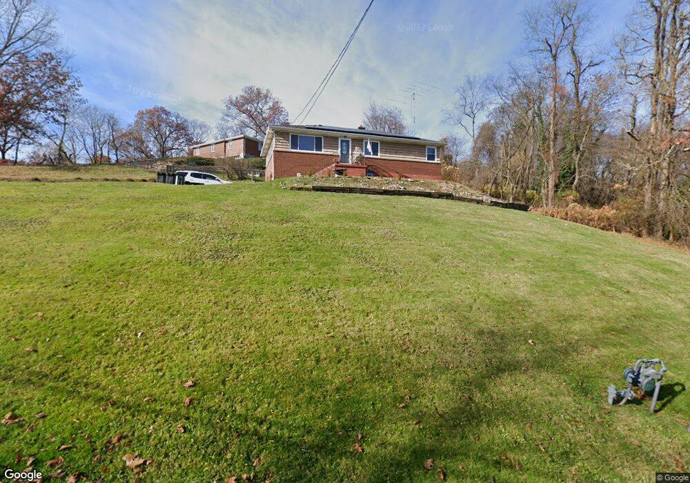
114 Sharp Rd White Oak, PA 15131
White Oak NeighborhoodEstimated Value: $205,000 - $311,000
3
Beds
2
Baths
1,188
Sq Ft
$209/Sq Ft
Est. Value
About This Home
This home is located at 114 Sharp Rd, White Oak, PA 15131 and is currently estimated at $247,902, approximately $208 per square foot. 114 Sharp Rd is a home located in Allegheny County with nearby schools including Mckeesport Area Senior High School, Young Scholars of Greater Allegheny Charter School, and Propel Schools - McKeesport.
Ownership History
Date
Name
Owned For
Owner Type
Purchase Details
Closed on
Jul 7, 2009
Sold by
Wood Christina M
Bought by
Maldonado Chad R
Current Estimated Value
Home Financials for this Owner
Home Financials are based on the most recent Mortgage that was taken out on this home.
Original Mortgage
$144,400
Outstanding Balance
$92,408
Interest Rate
4.93%
Mortgage Type
New Conventional
Estimated Equity
$155,494
Purchase Details
Closed on
Nov 21, 2007
Sold by
Perrotta Philip A
Bought by
Wood Christina M
Home Financials for this Owner
Home Financials are based on the most recent Mortgage that was taken out on this home.
Original Mortgage
$66,400
Interest Rate
6.37%
Mortgage Type
New Conventional
Create a Home Valuation Report for This Property
The Home Valuation Report is an in-depth analysis detailing your home's value as well as a comparison with similar homes in the area
Home Values in the Area
Average Home Value in this Area
Purchase History
| Date | Buyer | Sale Price | Title Company |
|---|---|---|---|
| Maldonado Chad R | $152,000 | -- | |
| Wood Christina M | $69,900 | -- |
Source: Public Records
Mortgage History
| Date | Status | Borrower | Loan Amount |
|---|---|---|---|
| Open | Maldonado Chad R | $144,400 | |
| Previous Owner | Wood Christina M | $66,400 |
Source: Public Records
Tax History
| Year | Tax Paid | Tax Assessment Tax Assessment Total Assessment is a certain percentage of the fair market value that is determined by local assessors to be the total taxable value of land and additions on the property. | Land | Improvement |
|---|---|---|---|---|
| 2025 | $4,048 | $116,700 | $29,200 | $87,500 |
| 2024 | $4,048 | $116,700 | $29,200 | $87,500 |
| 2023 | $3,932 | $116,700 | $29,200 | $87,500 |
| 2022 | $3,932 | $116,700 | $29,200 | $87,500 |
| 2021 | $552 | $116,700 | $29,200 | $87,500 |
| 2020 | $3,653 | $116,700 | $29,200 | $87,500 |
| 2019 | $3,573 | $116,700 | $29,200 | $87,500 |
| 2017 | $3,283 | $116,700 | $29,200 | $87,500 |
Source: Public Records
Map
Nearby Homes
- 300 Oliver Dr
- 203 Oliver Dr
- 1936 Lincoln Way
- 2001 Cypress Dr
- 114 Oliver Dr
- 1674 Lincoln Way
- 2400 Poinsettia Dr
- 1710 California Ave
- 1715 California Ave
- 1410 Monongahela Blvd
- 2503 Poinsettia Dr
- 1608 Kansas Ave
- 1628 Vermont Ave
- 1602 Kansas Ave
- 1601 Lincoln Way
- 1414 Lincoln Way Unit 1
- 1526 Vermont Ave
- 2112 Dalton St
- 1121 Monongahela Blvd
- 1207 Ohio Ave
Your Personal Tour Guide
Ask me questions while you tour the home.