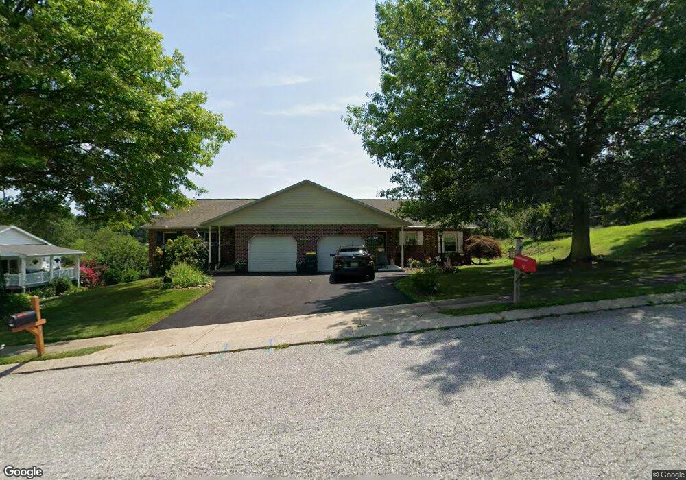
114 Shawnee Dr Stewartstown, PA 17363
Estimated Value: $229,000 - $333,000
3
Beds
2
Baths
1,232
Sq Ft
$221/Sq Ft
Est. Value
About This Home
This home is located at 114 Shawnee Dr, Stewartstown, PA 17363 and is currently estimated at $271,843, approximately $220 per square foot. 114 Shawnee Dr is a home located in York County with nearby schools including South Eastern Intermediate School, South Eastern Middle School, and Kennard-Dale High School.
Ownership History
Date
Name
Owned For
Owner Type
Purchase Details
Closed on
Oct 29, 2004
Sold by
Flanagan Patrick S and Flanagan Leslie
Bought by
Frieman Mark
Current Estimated Value
Home Financials for this Owner
Home Financials are based on the most recent Mortgage that was taken out on this home.
Original Mortgage
$121,600
Outstanding Balance
$59,018
Interest Rate
5.37%
Mortgage Type
Purchase Money Mortgage
Estimated Equity
$212,825
Purchase Details
Closed on
May 14, 2001
Sold by
Simms Wendy L and Simms Michael
Bought by
Flanagan Patrick S and Flanagan Leslie
Home Financials for this Owner
Home Financials are based on the most recent Mortgage that was taken out on this home.
Original Mortgage
$76,000
Interest Rate
7.03%
Purchase Details
Closed on
Aug 25, 1998
Sold by
Stern Wendy L and Simms Wendy L
Bought by
Simms Wendy L
Create a Home Valuation Report for This Property
The Home Valuation Report is an in-depth analysis detailing your home's value as well as a comparison with similar homes in the area
Home Values in the Area
Average Home Value in this Area
Purchase History
| Date | Buyer | Sale Price | Title Company |
|---|---|---|---|
| Frieman Mark | $152,000 | -- | |
| Flanagan Patrick S | $98,900 | -- | |
| Simms Wendy L | -- | -- |
Source: Public Records
Mortgage History
| Date | Status | Borrower | Loan Amount |
|---|---|---|---|
| Open | Frieman Mark | $121,600 | |
| Previous Owner | Flanagan Patrick S | $76,000 | |
| Closed | Frieman Mark | $30,400 |
Source: Public Records
Tax History Compared to Growth
Tax History
| Year | Tax Paid | Tax Assessment Tax Assessment Total Assessment is a certain percentage of the fair market value that is determined by local assessors to be the total taxable value of land and additions on the property. | Land | Improvement |
|---|---|---|---|---|
| 2025 | $3,567 | $111,480 | $30,000 | $81,480 |
| 2024 | $3,567 | $111,480 | $30,000 | $81,480 |
| 2023 | $3,567 | $111,480 | $30,000 | $81,480 |
| 2022 | $3,567 | $111,480 | $30,000 | $81,480 |
| 2021 | $3,456 | $111,480 | $30,000 | $81,480 |
| 2020 | $3,456 | $111,480 | $30,000 | $81,480 |
| 2019 | $3,445 | $111,480 | $30,000 | $81,480 |
| 2018 | $3,445 | $111,480 | $30,000 | $81,480 |
| 2017 | $3,445 | $111,480 | $30,000 | $81,480 |
| 2016 | $0 | $111,480 | $30,000 | $81,480 |
| 2015 | -- | $111,480 | $30,000 | $81,480 |
| 2014 | -- | $111,480 | $30,000 | $81,480 |
Source: Public Records
Map
Nearby Homes
- 9 W Pennsylvania Ave
- 2 S Main St
- 13 Baneberry St
- 94 Piston Ct
- 82 Piston Ct
- 4341 Forbes Dr
- 231 Cool Spring Ln
- 4303 Forbes Dr
- 103 Hershey Cir
- 17 Charles Ave
- 10 Black Oak Ct
- 150 Patterson Dr Unit 47
- 160 Patterson Dr Unit 48
- 180 Patterson Dr Unit 50
- 18007 Dave Anne Cir
- 18010 Dave Anne Cir
- 18183 Piedmont Rd
- 0 Bridgeview Rd Unit PAYK2080146
- 2 Dutton Rd
- 2430 Harris Mill Rd
- 112 Shawnee Dr
- 116 Shawnee Dr
- 110 Shawnee Dr
- 118 Shawnee Dr
- 115 Shawnee Dr
- 108 Shawnee Dr
- 113 Shawnee Dr
- 120 Shawnee Dr
- 111 Shawnee Dr
- 109 Shawnee Dr
- 106 Shawnee Dr
- 117 Shawnee Dr
- 119 Shawnee Dr
- 104 Shawnee Dr
- 107 Shawnee Dr
- 102 Shawnee Dr
- 105 Shawnee Dr
- 46 W Pennsylvania Ave
- 42 W Pennsylvania Ave
- 103 Shawnee Dr