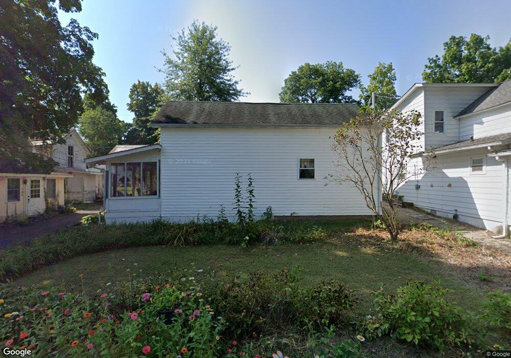
114 W 6th Ave Lancaster, OH 43130
Estimated Value: $80,000 - $85,000
2
Beds
2
Baths
582
Sq Ft
$142/Sq Ft
Est. Value
About This Home
This home is located at 114 W 6th Ave, Lancaster, OH 43130 and is currently estimated at $82,930, approximately $142 per square foot. 114 W 6th Ave is a home located in Fairfield County with nearby schools including General Sherman Junior High School, Lancaster High School, and St Mary Elementary School.
Ownership History
Date
Name
Owned For
Owner Type
Purchase Details
Closed on
Sep 8, 2020
Sold by
Meeting Lancaster Camp and Assemb Church
Bought by
Board Of Trustees Of The Lanca
Current Estimated Value
Home Financials for this Owner
Home Financials are based on the most recent Mortgage that was taken out on this home.
Interest Rate
2.88%
Purchase Details
Closed on
Aug 12, 2020
Sold by
Acton Thomas N
Bought by
Lyle Davis
Home Financials for this Owner
Home Financials are based on the most recent Mortgage that was taken out on this home.
Interest Rate
2.88%
Purchase Details
Closed on
Oct 24, 2014
Sold by
Chapman Betty
Bought by
Acton Thomas N
Purchase Details
Closed on
Jun 23, 2010
Sold by
Lavere Charlotte Jane
Bought by
Chapman Chester and Chapman Betty
Create a Home Valuation Report for This Property
The Home Valuation Report is an in-depth analysis detailing your home's value as well as a comparison with similar homes in the area
Home Values in the Area
Average Home Value in this Area
Purchase History
| Date | Buyer | Sale Price | Title Company |
|---|---|---|---|
| Board Of Trustees Of The Lanca | -- | -- | |
| Lyle Davis | $1,000 | -- | |
| Acton Thomas N | $8,000 | Attorney | |
| Chapman Chester | $1,500 | None Available |
Source: Public Records
Mortgage History
| Date | Status | Borrower | Loan Amount |
|---|---|---|---|
| Closed | Lyle Davis | -- |
Source: Public Records
Tax History Compared to Growth
Tax History
| Year | Tax Paid | Tax Assessment Tax Assessment Total Assessment is a certain percentage of the fair market value that is determined by local assessors to be the total taxable value of land and additions on the property. | Land | Improvement |
|---|---|---|---|---|
| 2024 | $736 | $8,190 | -- | $8,190 |
| 2023 | $105 | $2,810 | -- | $2,810 |
| 2022 | $105 | $2,810 | $0 | $2,810 |
| 2021 | $90 | $2,250 | $0 | $2,250 |
| 2020 | $84 | $2,250 | $0 | $2,250 |
| 2019 | $80 | $2,250 | $0 | $2,250 |
| 2018 | $68 | $1,820 | $0 | $1,820 |
| 2017 | $68 | $1,820 | $0 | $1,820 |
| 2016 | $66 | $1,820 | $0 | $1,820 |
| 2015 | $65 | $1,740 | $0 | $1,740 |
| 2014 | $64 | $1,740 | $0 | $1,740 |
| 2013 | $64 | $1,740 | $0 | $1,740 |
Source: Public Records
Map
Nearby Homes
- 331 16th St
- 255 9th St
- 282 14th St
- 3 1st St
- 367 12th St
- 371 12th St
- 185 9th St
- 204 Western St
- 599 Front St
- 957 Governor's Cir
- 958 Thorn Hill Place
- 842 Lambton Cir W
- 2412 W Fair Ave
- 1707 River Valley N Cir
- 1935 Smith Ave
- 0 W Fair Ave
- 2610 Misty Meadows Ave
- 1628 W Fair Ave
- 461 N Shoshone Dr
- 539 N Ohio Ave