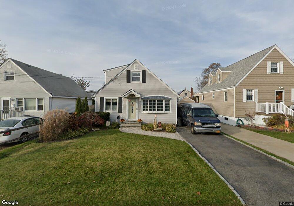
114 W Hampton Rd Lindenhurst, NY 11757
Estimated Value: $552,660 - $658,000
Studio
--
Bath
1,859
Sq Ft
$331/Sq Ft
Est. Value
About This Home
This home is located at 114 W Hampton Rd, Lindenhurst, NY 11757 and is currently estimated at $614,915, approximately $330 per square foot. 114 W Hampton Rd is a home located in Suffolk County with nearby schools including Copiague Middle School, Walter G O Connell Copiague High School, and Copiague Christian Academy.
Ownership History
Date
Name
Owned For
Owner Type
Purchase Details
Closed on
Apr 16, 2010
Sold by
Ruppert Mary Alice and Ruppert James H
Bought by
Marocchi Steven G and Marocchi Lauren J
Current Estimated Value
Home Financials for this Owner
Home Financials are based on the most recent Mortgage that was taken out on this home.
Original Mortgage
$28,987
Outstanding Balance
$19,297
Interest Rate
4.99%
Mortgage Type
FHA
Estimated Equity
$595,618
Purchase Details
Closed on
Sep 29, 2009
Sold by
Deutsche Bank National Trust Company
Bought by
Ruppert Mary Alice and Ruppert James H
Purchase Details
Closed on
Oct 13, 1999
Sold by
Boehm Ronald W and Boehm Patricia A
Bought by
Simonson Michael and Simonson Kari
Home Financials for this Owner
Home Financials are based on the most recent Mortgage that was taken out on this home.
Original Mortgage
$153,900
Interest Rate
7.78%
Mortgage Type
FHA
Create a Home Valuation Report for This Property
The Home Valuation Report is an in-depth analysis detailing your home's value as well as a comparison with similar homes in the area
Home Values in the Area
Average Home Value in this Area
Purchase History
| Date | Buyer | Sale Price | Title Company |
|---|---|---|---|
| Marocchi Steven G | $305,000 | -- | |
| Ruppert Mary Alice | $170,000 | -- | |
| Simonson Michael | $154,000 | -- |
Source: Public Records
Mortgage History
| Date | Status | Borrower | Loan Amount |
|---|---|---|---|
| Open | Marocchi Steven G | $28,987 | |
| Previous Owner | Simonson Michael | $153,900 |
Source: Public Records
Tax History
| Year | Tax Paid | Tax Assessment Tax Assessment Total Assessment is a certain percentage of the fair market value that is determined by local assessors to be the total taxable value of land and additions on the property. | Land | Improvement |
|---|---|---|---|---|
| 2022 | $8,776 | $3,195 | $150 | $3,045 |
| 2021 | $8,776 | $3,195 | $150 | $3,045 |
| 2020 | $9,302 | $3,195 | $150 | $3,045 |
| 2019 | $9,302 | $0 | $0 | $0 |
Source: Public Records
Map
Nearby Homes
- 46 W Clearwater Rd
- 207 E Santa Barbara Rd
- 72 W Marine Ave
- 260 Cedar Ct
- 16 Beach Ave
- 166 Cedar Ct
- 76 E Hollywood Ave
- 52 Halycon Rd
- 315 Cedar Ct
- 131 E Alhambra Ave
- 185 East Dr
- 25 Harbor Ct
- 305 S Strong Ave
- 6 E Kissimee Rd
- 100 Austin Place
- 15 E Clearwater Rd
- 4 Gail-Grace Ct
- 441 Mariners Way
- 219 Mariners Way
- 19 Shore Dr W
- 110 W Hampton Rd
- 120 W Hampton Rd
- 124 W Hampton Rd
- 109 W Granada Ave
- 84 Miramar Blvd
- 86 Miramar Blvd
- 123 W Granada Ave
- 80 Miramar Blvd
- 117 W Hampton Rd
- 127 W Granada Ave
- 105 W Hampton Rd
- 74 Miramar Blvd
- 130 W Hampton Rd
- 121 W Hampton Rd
- 94 Miramar Blvd
- 91 Miramar Blvd
- 135 W Granada Ave
- 125 W Hampton Rd
- 100 Miramar Blvd
- 143 W Hampton Rd
Your Personal Tour Guide
Ask me questions while you tour the home.