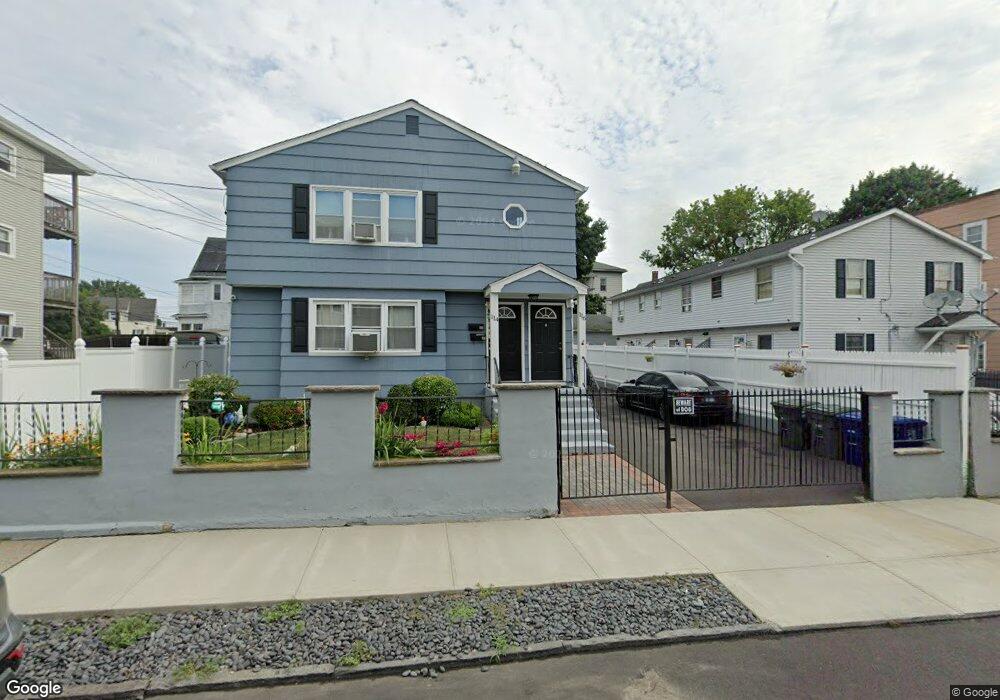
114 Waldorf Ave Unit 2 Bridgeport, CT 06605
Black Rock NeighborhoodEstimated Value: $480,641 - $614,000
3
Beds
1
Bath
1,300
Sq Ft
$436/Sq Ft
Est. Value
About This Home
This home is located at 114 Waldorf Ave Unit 2, Bridgeport, CT 06605 and is currently estimated at $566,410, approximately $435 per square foot. 114 Waldorf Ave Unit 2 is a home located in Fairfield County with nearby schools including Bassick High School, Park City Prep Charter School, and Great Oaks Charter School Bridgeport.
Ownership History
Date
Name
Owned For
Owner Type
Purchase Details
Closed on
Oct 27, 1992
Sold by
Shawmut Mtg Co
Bought by
G E Capital Asset Mtg
Current Estimated Value
Purchase Details
Closed on
Oct 26, 1992
Sold by
Shawmut Mtg Co
Bought by
G E Cpaital Asset Mgmn
Purchase Details
Closed on
Aug 4, 1987
Sold by
Spillane Patrick
Bought by
Rummo Leonard
Create a Home Valuation Report for This Property
The Home Valuation Report is an in-depth analysis detailing your home's value as well as a comparison with similar homes in the area
Home Values in the Area
Average Home Value in this Area
Purchase History
| Date | Buyer | Sale Price | Title Company |
|---|---|---|---|
| G E Capital Asset Mtg | $74,360 | -- | |
| G E Capital Asset Mtg | $74,360 | -- | |
| G E Cpaital Asset Mgmn | $74,360 | -- | |
| G E Cpaital Asset Mgmn | $74,360 | -- | |
| Rummo Leonard | $183,300 | -- |
Source: Public Records
Mortgage History
| Date | Status | Borrower | Loan Amount |
|---|---|---|---|
| Closed | Rummo Leonard | $205,750 | |
| Closed | Rummo Leonard | $197,800 | |
| Closed | Rummo Leonard | $176,000 |
Source: Public Records
Tax History Compared to Growth
Tax History
| Year | Tax Paid | Tax Assessment Tax Assessment Total Assessment is a certain percentage of the fair market value that is determined by local assessors to be the total taxable value of land and additions on the property. | Land | Improvement |
|---|---|---|---|---|
| 2025 | $9,075 | $208,870 | $77,910 | $130,960 |
| 2024 | $9,075 | $208,870 | $77,910 | $130,960 |
| 2023 | $9,075 | $208,870 | $77,910 | $130,960 |
| 2022 | $9,075 | $208,870 | $77,910 | $130,960 |
| 2021 | $9,075 | $208,870 | $77,910 | $130,960 |
| 2020 | $7,657 | $141,830 | $33,440 | $108,390 |
| 2019 | $7,657 | $141,830 | $33,440 | $108,390 |
| 2018 | $7,711 | $141,830 | $33,440 | $108,390 |
| 2017 | $7,711 | $141,830 | $33,440 | $108,390 |
| 2016 | $7,711 | $141,830 | $33,440 | $108,390 |
| 2015 | $7,785 | $184,470 | $21,420 | $163,050 |
| 2014 | $7,785 | $184,470 | $21,420 | $163,050 |
Source: Public Records
Map
Nearby Homes
- 82 Waldorf Ave
- 135 Whittier St
- 144 Whittier St
- 31 Whittier St
- 25 Whittier St
- 167 Scofield Ave
- 105 Scofield Ave
- 166 Alfred St
- 51 Princeton St
- 2773 Fairfield Ave Unit 3
- 37 Rowsley St Unit 6
- 855 Brewster St Unit 857
- 26 Rowsley St Unit 3
- 20 Haddon St Unit 5
- 222 Ellsworth St
- 118 Berwick Ave
- 130 Brentwood Ave
- 554 Brewster St Unit 4
- 145 Brentwood Ave
- 95 Bedford Ave
- 114 Waldorf Ave
- 694 Ellsworth St Unit 696
- 134 Waldorf Ave
- 134 Waldorf Ave Unit 3
- 108 Waldorf Ave
- 102 Waldorf Ave
- 102 Waldorf Ave Unit 2nd Fl
- 102 Waldorf ( Garage) Ave
- 94 Waldorf Ave
- 730 Ellsworth St Unit 3
- 730 Ellsworth St Unit 2
- 730 Ellsworth St Unit 1N
- 730 Ellsworth St Unit 1S
- 139 Hansen Ave Unit 143
- 693 Ellsworth St Unit 695
- 713 Ellsworth St Unit 715
- 103 Waldorf Ave
- 40-42 Waldorf Ave
- 133 Hansen Ave Unit 135
- 88 Waldorf Ave