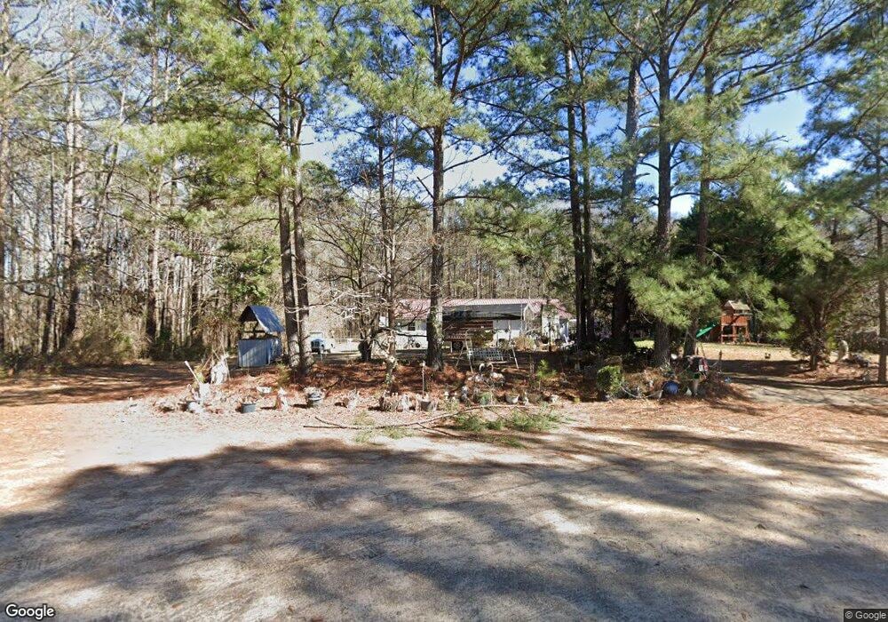
114 Watts Cir Griffin, GA 30223
Spalding County NeighborhoodEstimated Value: $132,000 - $215,000
3
Beds
1
Bath
1,272
Sq Ft
$131/Sq Ft
Est. Value
About This Home
This home is located at 114 Watts Cir, Griffin, GA 30223 and is currently estimated at $167,215, approximately $131 per square foot. 114 Watts Cir is a home located in Spalding County with nearby schools including Jackson Road Elementary School, Kennedy Road Middle School, and Spalding High School.
Ownership History
Date
Name
Owned For
Owner Type
Purchase Details
Closed on
Nov 8, 1979
Sold by
Dukes Plez
Bought by
Scott Paul P and Scott Margaret W
Current Estimated Value
Purchase Details
Closed on
Jun 15, 1979
Sold by
Hartle Charles E
Bought by
Dukes Plez
Purchase Details
Closed on
Dec 4, 1972
Sold by
Clifford Paul W
Bought by
Hartle Charles E
Create a Home Valuation Report for This Property
The Home Valuation Report is an in-depth analysis detailing your home's value as well as a comparison with similar homes in the area
Home Values in the Area
Average Home Value in this Area
Purchase History
| Date | Buyer | Sale Price | Title Company |
|---|---|---|---|
| Scott Paul P | -- | -- | |
| Dukes Plez | $1,400 | -- | |
| Hartle Charles E | $1,400 | -- |
Source: Public Records
Tax History Compared to Growth
Tax History
| Year | Tax Paid | Tax Assessment Tax Assessment Total Assessment is a certain percentage of the fair market value that is determined by local assessors to be the total taxable value of land and additions on the property. | Land | Improvement |
|---|---|---|---|---|
| 2024 | -- | $27,023 | $7,200 | $19,823 |
| 2023 | $0 | $27,023 | $7,200 | $19,823 |
| 2022 | $940 | $25,844 | $6,000 | $19,844 |
| 2021 | $957 | $24,056 | $6,000 | $18,056 |
| 2020 | $957 | $24,056 | $6,000 | $18,056 |
| 2019 | $957 | $24,056 | $6,000 | $18,056 |
| 2018 | $0 | $22,417 | $6,000 | $16,417 |
| 2017 | $892 | $22,417 | $6,000 | $16,417 |
| 2016 | $0 | $22,417 | $6,000 | $16,417 |
| 2015 | -- | $22,417 | $6,000 | $16,417 |
| 2014 | -- | $22,417 | $6,000 | $16,417 |
Source: Public Records
Map
Nearby Homes
- 140 Morris Mill Rd
- 1015 N Walkers Mill Rd
- 1015 Dutchman Rd
- 727 Musgrove Rd
- 501 Musgrove Rd
- 860 N Walkers Mill Rd
- 0 Chehaw Rd Unit 10634773
- 0 Chehaw Rd Unit 10654287
- 0 Chehaw Rd Unit 10654288
- 0 Chehaw Rd Unit 10634774
- 0 N Mcdonough Rd Unit 10599249
- 79 Holly Ln
- 1465 N Mcdonough Rd
- 2642 High Falls Rd
- 124 Deerwood Cir
- 221 Hamil Rd Unit 12.5 AC
- 243 Hamil Rd Unit 13.18 AC
- 243 Hamil Rd
- 265 Hamil Rd Unit 31.89 AC
- 2159 High Falls Rd
- 104 Watts Cir
- 109 Watts Cir
- 116 Watts Cir
- 113 Watts Cir
- 105 Watts Cir
- 101 Watts Cir
- 750 N Mcdonough Rd
- 104/108 Clifford Cir
- 104 Clifford Cir Unit 108
- 104 Clifford Cir
- 101 Clifford Cir
- 726 N Mcdonough Rd
- 0 Clifford Cir Unit 8498097
- 0 Clifford Cir Unit 8651366
- 0 Clifford Cir Unit 9065344
- 0 Clifford Cir Unit 7173483
- 101 Spring Valley Rd
- 108 Clifford Cir
- 107 Clifford Cir
- 112 Clifford Cir