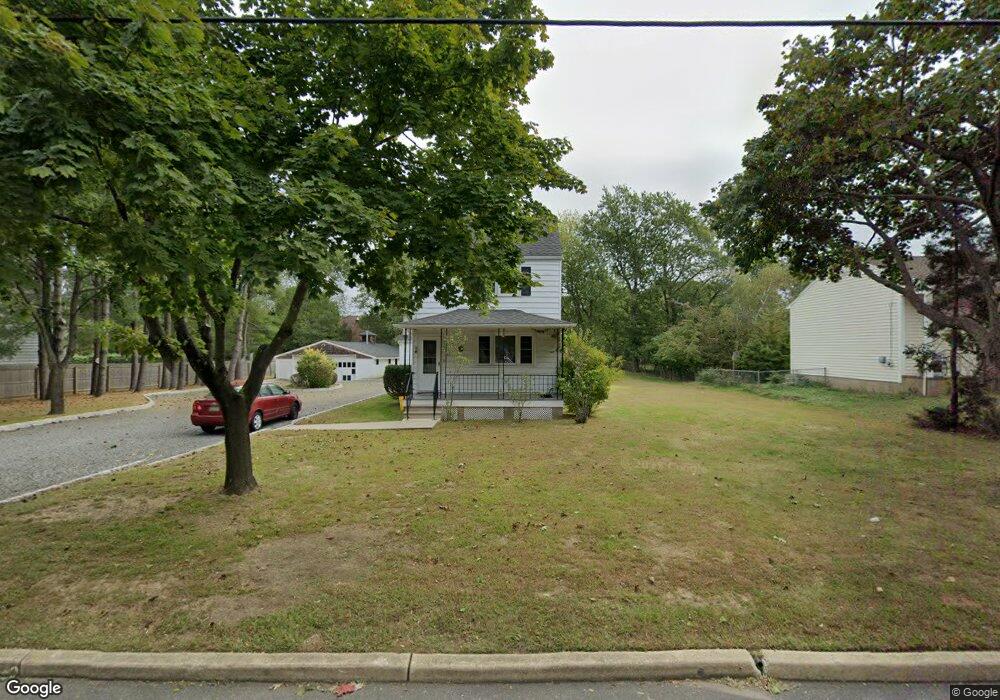
114 Whalepond Rd Unit L West Long Branch, NJ 07764
Estimated Value: $1,153,000 - $1,926,703
2
Beds
2
Baths
1,080
Sq Ft
$1,349/Sq Ft
Est. Value
About This Home
This home is located at 114 Whalepond Rd Unit L, West Long Branch, NJ 07764 and is currently estimated at $1,457,234, approximately $1,349 per square foot. 114 Whalepond Rd Unit L is a home located in Monmouth County with nearby schools including Betty McElmon Elementary School, Frank Antonides School, and Shore Regional High School.
Ownership History
Date
Name
Owned For
Owner Type
Purchase Details
Closed on
Aug 28, 2020
Sold by
Amold James L and Estate Of Jimmie S Arnor
Bought by
Alkada Abie
Current Estimated Value
Home Financials for this Owner
Home Financials are based on the most recent Mortgage that was taken out on this home.
Original Mortgage
$532,000
Outstanding Balance
$471,239
Interest Rate
2.8%
Mortgage Type
New Conventional
Estimated Equity
$985,995
Create a Home Valuation Report for This Property
The Home Valuation Report is an in-depth analysis detailing your home's value as well as a comparison with similar homes in the area
Home Values in the Area
Average Home Value in this Area
Purchase History
| Date | Buyer | Sale Price | Title Company |
|---|---|---|---|
| Alkada Abie | $690,000 | Madison Title Agency Llc |
Source: Public Records
Mortgage History
| Date | Status | Borrower | Loan Amount |
|---|---|---|---|
| Open | Alkada Abie | $532,000 |
Source: Public Records
Tax History Compared to Growth
Tax History
| Year | Tax Paid | Tax Assessment Tax Assessment Total Assessment is a certain percentage of the fair market value that is determined by local assessors to be the total taxable value of land and additions on the property. | Land | Improvement |
|---|---|---|---|---|
| 2025 | $27,136 | $2,211,400 | $1,168,900 | $1,042,500 |
| 2024 | $13,484 | $2,082,600 | $1,059,200 | $1,023,400 |
| 2023 | $13,484 | $965,200 | $744,900 | $220,300 |
| 2022 | $12,333 | $649,800 | $447,400 | $202,400 |
| 2021 | $12,333 | $638,000 | $345,700 | $292,300 |
| 2020 | $10,224 | $497,500 | $311,600 | $185,900 |
| 2019 | $10,009 | $489,700 | $304,900 | $184,800 |
| 2018 | $10,038 | $474,400 | $298,200 | $176,200 |
| 2017 | $9,717 | $438,500 | $267,700 | $170,800 |
| 2016 | $9,433 | $434,300 | $267,700 | $166,600 |
| 2015 | $9,250 | $425,300 | $274,400 | $150,900 |
| 2014 | $8,802 | $377,600 | $233,700 | $143,900 |
Source: Public Records
Map
Nearby Homes
- 114 Whalepond Rd
- 110 Whalepond Rd
- 120 Whalepond Rd
- 13 Windsor Dr
- 122 Whalepond Rd
- 15 Windsor Dr
- 108 Whalepond Rd
- 17 Windsor Dr
- 9 Windsor Dr
- 210 Whalepond Rd
- 206 Whalepond Rd
- 124 Whalepond Rd
- 104 Whalepond Rd
- 19 Windsor Dr
- 7 Windsor Dr
- 202 Whalepond Rd
- 305 Whalepond Rd
- 14 Windsor Dr
- 12 Windsor Dr
- 3 Ash St