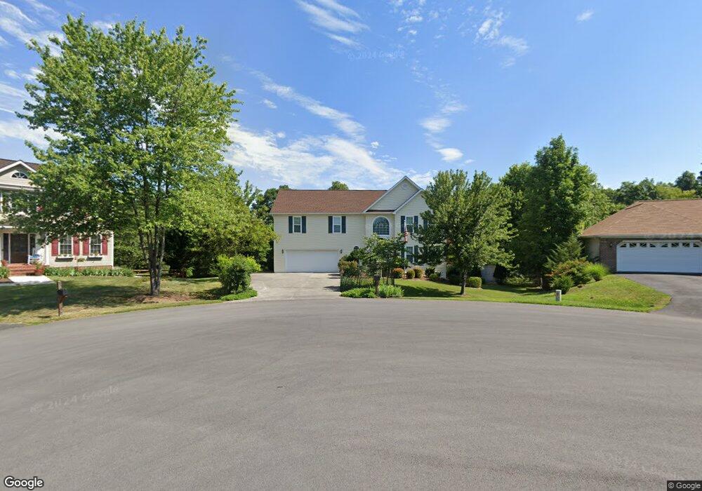
114 Whipp Dr Winchester, VA 22602
Estimated Value: $432,000 - $486,616
4
Beds
3
Baths
2,409
Sq Ft
$190/Sq Ft
Est. Value
About This Home
This home is located at 114 Whipp Dr, Winchester, VA 22602 and is currently estimated at $457,904, approximately $190 per square foot. 114 Whipp Dr is a home located in Frederick County with nearby schools including Admiral Richard E. Byrd Middle School, Millbrook High School, and Sharon's Centre.
Ownership History
Date
Name
Owned For
Owner Type
Purchase Details
Closed on
Jan 24, 2025
Sold by
Zombor Miklos and Zombor Betty T
Bought by
Zombor Living Trust and Zombor
Current Estimated Value
Purchase Details
Closed on
Nov 26, 2008
Sold by
Collins Jonathan E
Bought by
Zombor Miklos
Purchase Details
Closed on
Apr 12, 2005
Sold by
Payton Sanford
Bought by
Marshall Jonathan
Home Financials for this Owner
Home Financials are based on the most recent Mortgage that was taken out on this home.
Original Mortgage
$244,000
Interest Rate
5.78%
Mortgage Type
New Conventional
Create a Home Valuation Report for This Property
The Home Valuation Report is an in-depth analysis detailing your home's value as well as a comparison with similar homes in the area
Home Values in the Area
Average Home Value in this Area
Purchase History
| Date | Buyer | Sale Price | Title Company |
|---|---|---|---|
| Zombor Living Trust | -- | None Listed On Document | |
| Zombor Miklos | $272,900 | -- | |
| Marshall Jonathan | $305,000 | -- |
Source: Public Records
Mortgage History
| Date | Status | Borrower | Loan Amount |
|---|---|---|---|
| Previous Owner | Marshall Jonathan | $244,000 |
Source: Public Records
Tax History
| Year | Tax Paid | Tax Assessment Tax Assessment Total Assessment is a certain percentage of the fair market value that is determined by local assessors to be the total taxable value of land and additions on the property. | Land | Improvement |
|---|---|---|---|---|
| 2025 | $2,189 | $456,100 | $103,000 | $353,100 |
| 2024 | $977 | $383,100 | $87,000 | $296,100 |
| 2023 | $1,954 | $383,100 | $87,000 | $296,100 |
| 2022 | $1,890 | $309,800 | $82,000 | $227,800 |
| 2021 | $1,890 | $309,800 | $82,000 | $227,800 |
| 2020 | $1,706 | $279,600 | $82,000 | $197,600 |
| 2019 | $1,706 | $279,600 | $82,000 | $197,600 |
| 2018 | $1,624 | $266,300 | $82,000 | $184,300 |
| 2017 | $1,598 | $266,300 | $82,000 | $184,300 |
| 2016 | $1,475 | $245,800 | $69,500 | $176,300 |
| 2015 | $663 | $245,800 | $69,500 | $176,300 |
| 2014 | $663 | $225,100 | $64,500 | $160,600 |
Source: Public Records
Map
Nearby Homes
- 117 Whipp Dr
- 108 Norfolk Ct
- 407 Tamarack Cir
- 108 Senseny Glen Dr
- 144 Morning Glory Dr
- 129 Lakota St
- 127 Lakota St
- 123 Lakota St
- 116 Wickham Terrace
- 124 Wappinger Terrace
- 123 Wappinger Terrace
- 142 Sequoia Dr
- 133 Mascouten St
- 216 Lehigh Dr
- 104 Wappinger Terrace
- 137 Mascouten St
- 125 Mascouten St
- 136 Wappinger Terrace
- 105 Seminole Dr
- 219 Lehigh Dr
Your Personal Tour Guide
Ask me questions while you tour the home.