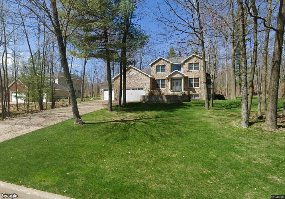
114 Windtree Dr Wausau, WI 54401
Estimated Value: $541,270 - $598,000
3
Beds
4
Baths
--
Sq Ft
0.38
Acres
About This Home
This home is located at 114 Windtree Dr, Wausau, WI 54401 and is currently estimated at $576,818. 114 Windtree Dr is a home located in Marathon County with nearby schools including Stettin Elementary School, John Muir Middle School, and West High School.
Ownership History
Date
Name
Owned For
Owner Type
Purchase Details
Closed on
Feb 21, 2024
Sold by
Conley Michael A and Conley Lynn M
Bought by
Conley Revocable Trust and Conley
Current Estimated Value
Purchase Details
Closed on
Aug 24, 2006
Sold by
Zick David J
Bought by
Conley Michael A and Conley Lynn A
Home Financials for this Owner
Home Financials are based on the most recent Mortgage that was taken out on this home.
Original Mortgage
$370,000
Interest Rate
6.78%
Mortgage Type
Unknown
Create a Home Valuation Report for This Property
The Home Valuation Report is an in-depth analysis detailing your home's value as well as a comparison with similar homes in the area
Home Values in the Area
Average Home Value in this Area
Purchase History
| Date | Buyer | Sale Price | Title Company |
|---|---|---|---|
| Conley Revocable Trust | -- | None Listed On Document | |
| Conley Michael A | $373,000 | None Available |
Source: Public Records
Mortgage History
| Date | Status | Borrower | Loan Amount |
|---|---|---|---|
| Previous Owner | Conley Michael A | $370,000 |
Source: Public Records
Tax History Compared to Growth
Tax History
| Year | Tax Paid | Tax Assessment Tax Assessment Total Assessment is a certain percentage of the fair market value that is determined by local assessors to be the total taxable value of land and additions on the property. | Land | Improvement |
|---|---|---|---|---|
| 2024 | $9,983 | $530,700 | $43,900 | $486,800 |
| 2023 | $10,271 | $415,300 | $48,600 | $366,700 |
| 2022 | $10,303 | $415,300 | $48,600 | $366,700 |
| 2021 | $9,950 | $415,300 | $48,600 | $366,700 |
| 2020 | $10,183 | $415,300 | $48,600 | $366,700 |
| 2019 | $10,253 | $391,200 | $35,600 | $355,600 |
| 2018 | $10,319 | $391,200 | $35,600 | $355,600 |
| 2017 | $9,826 | $391,200 | $35,600 | $355,600 |
| 2016 | $9,547 | $391,200 | $35,600 | $355,600 |
| 2015 | $9,930 | $391,200 | $35,600 | $355,600 |
| 2014 | $9,176 | $379,900 | $49,800 | $330,100 |
Source: Public Records
Map
Nearby Homes
- 212 Windtree Dr
- 6007 Birchwood Dr
- 5713 Birchwood Dr
- 6011 Stettin Dr
- 210 Bluestone Dr
- 303 Rimrock Rd
- 6607 Morgan Creek Dr
- 6603 Conner Davis Dr
- 116 S 68th Ave
- 10.80 Acres N 72nd Ave
- 4615 Rib River Trail
- 210 S 45th Ave
- 206 N 44th Ave
- 145683 Flint Creek Cir
- 231747 Twin Fawn Trail
- 231781 Twin Fawn Trail
- 231752 Twin Fawn Trail
- 231816 Little Brook Ct
- 231876 Little Brook Ct
- 145699 Bristers Hill Rd
- 110 Windtree Dr
- 118 Windtree Dr
- 113 Windtree Dr
- 106 Windtree Dr
- 204 Windtree Dr
- 117 Windtree Dr
- 109 Windtree Dr
- 207 Windtree Dr
- 221 Lavina Dr
- 5814 Old Coach Rd
- 210 Windtree Dr
- 225 Lavina Dr
- 215 Windtree Dr
- 5806 Old Coach Rd
- 229 Lavina Dr
- 5915 Old Coach Rd
- 5907 Old Coach Rd
- 216 Windtree Dr
- 5901 Old Coach Rd
- 225 Windtree Dr