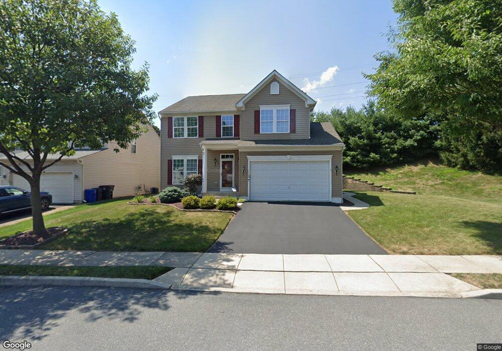
1140 Blair Rd Bethlehem, PA 18017
Estimated Value: $567,000 - $610,000
4
Beds
4
Baths
3,306
Sq Ft
$176/Sq Ft
Est. Value
About This Home
This home is located at 1140 Blair Rd, Bethlehem, PA 18017 and is currently estimated at $581,810, approximately $175 per square foot. 1140 Blair Rd is a home located in Northampton County with nearby schools including Asa Packer Elementary School, Nitschmann Middle School, and Liberty High School.
Ownership History
Date
Name
Owned For
Owner Type
Purchase Details
Closed on
Jun 30, 2008
Sold by
Nvr Inc
Bought by
Maco Lauren E and Maco Marie W
Current Estimated Value
Home Financials for this Owner
Home Financials are based on the most recent Mortgage that was taken out on this home.
Original Mortgage
$257,420
Outstanding Balance
$168,411
Interest Rate
6.35%
Mortgage Type
Purchase Money Mortgage
Estimated Equity
$413,399
Purchase Details
Closed on
Mar 23, 2008
Sold by
Hanover Pointe Associates Lp
Bought by
Nvr Inc and Ryan Homes
Create a Home Valuation Report for This Property
The Home Valuation Report is an in-depth analysis detailing your home's value as well as a comparison with similar homes in the area
Home Values in the Area
Average Home Value in this Area
Purchase History
| Date | Buyer | Sale Price | Title Company |
|---|---|---|---|
| Maco Lauren E | $321,775 | None Available | |
| Nvr Inc | $92,500 | None Available |
Source: Public Records
Mortgage History
| Date | Status | Borrower | Loan Amount |
|---|---|---|---|
| Open | Maco Lauren E | $257,420 |
Source: Public Records
Tax History Compared to Growth
Tax History
| Year | Tax Paid | Tax Assessment Tax Assessment Total Assessment is a certain percentage of the fair market value that is determined by local assessors to be the total taxable value of land and additions on the property. | Land | Improvement |
|---|---|---|---|---|
| 2025 | $1,138 | $105,400 | $20,500 | $84,900 |
| 2024 | $7,684 | $105,400 | $20,500 | $84,900 |
| 2023 | $7,710 | $105,400 | $20,500 | $84,900 |
| 2022 | $7,637 | $105,400 | $20,500 | $84,900 |
| 2021 | $7,575 | $105,400 | $20,500 | $84,900 |
| 2020 | $7,585 | $105,400 | $20,500 | $84,900 |
| 2019 | $7,554 | $105,400 | $20,500 | $84,900 |
| 2018 | $7,404 | $105,400 | $20,500 | $84,900 |
| 2017 | $7,352 | $105,400 | $20,500 | $84,900 |
| 2016 | -- | $105,400 | $20,500 | $84,900 |
| 2015 | -- | $105,400 | $20,500 | $84,900 |
| 2014 | -- | $105,400 | $20,500 | $84,900 |
Source: Public Records
Map
Nearby Homes
- 1215 Ciara Dr
- 1215 W MacAda Rd
- 960 Yorkshire Rd
- 809 Overlook Dr
- 820 Yorkshire Rd
- 1285 Stafore Dr
- 2520 Winston Rd
- 1445 Westgate Dr
- 1305 Statten Ave
- 2392 Jacksonville Rd
- 0 Rosewood Dr Unit 766427
- 2616 Pioneer Rd
- 1970 Rosewood Dr Unit Lot 6
- 460 Bridle Path Rd
- 3760 Jacksonville Rd
- 1344 Greenview Dr
- 1336 Greenview Dr
- 1440 Greenview Dr
- 1309 Greenview Dr
- 2126 Herbert Dr