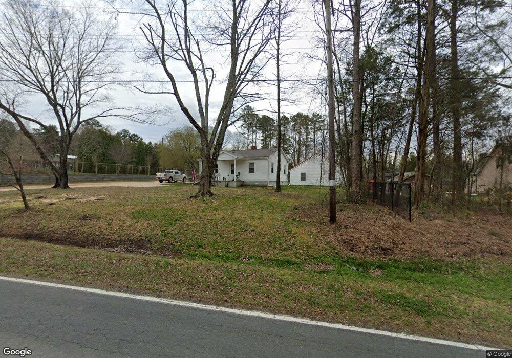
1140 Dial St Kannapolis, NC 28083
Estimated Value: $155,527 - $266,000
--
Bed
1
Bath
966
Sq Ft
$217/Sq Ft
Est. Value
About This Home
This home is located at 1140 Dial St, Kannapolis, NC 28083 and is currently estimated at $209,632, approximately $217 per square foot. 1140 Dial St is a home located in Rowan County with nearby schools including Landis Elementary School, Corriher Lipe Middle School, and South Rowan High School.
Ownership History
Date
Name
Owned For
Owner Type
Purchase Details
Closed on
Oct 21, 2021
Sold by
Coughenour Tammy Lynn
Bought by
Coughenour Steve P
Current Estimated Value
Purchase Details
Closed on
Sep 6, 2017
Sold by
Coughenour Charles P and Hileman Vickie C
Bought by
Coughenour Steve P and Coughenour Tammy Lynn
Purchase Details
Closed on
Feb 16, 2015
Sold by
Coughenour Charles P and Coughenour Mary J
Bought by
Coughenour Charles P and Hileman Vickie C
Purchase Details
Closed on
Jul 14, 2011
Sold by
Coughenour Mary
Bought by
Coughenour Charles P and Hileman Vickie C
Create a Home Valuation Report for This Property
The Home Valuation Report is an in-depth analysis detailing your home's value as well as a comparison with similar homes in the area
Home Values in the Area
Average Home Value in this Area
Purchase History
| Date | Buyer | Sale Price | Title Company |
|---|---|---|---|
| Coughenour Steve P | -- | None Available | |
| Coughenour Steve P | -- | None Available | |
| Coughenour Charles P | -- | None Available | |
| Coughenour Charles P | -- | None Available |
Source: Public Records
Tax History Compared to Growth
Tax History
| Year | Tax Paid | Tax Assessment Tax Assessment Total Assessment is a certain percentage of the fair market value that is determined by local assessors to be the total taxable value of land and additions on the property. | Land | Improvement |
|---|---|---|---|---|
| 2025 | $621 | $99,711 | $34,121 | $65,590 |
| 2024 | $621 | $99,711 | $34,121 | $65,590 |
| 2023 | $621 | $99,711 | $34,121 | $65,590 |
| 2022 | $486 | $69,469 | $25,650 | $43,819 |
| 2021 | $486 | $69,469 | $25,650 | $43,819 |
| 2020 | $486 | $69,469 | $25,650 | $43,819 |
| 2019 | $486 | $69,469 | $25,650 | $43,819 |
| 2018 | $480 | $69,080 | $25,679 | $43,401 |
| 2017 | $240 | $69,080 | $25,679 | $43,401 |
| 2016 | $243 | $69,080 | $25,679 | $43,401 |
| 2015 | $247 | $69,080 | $25,679 | $43,401 |
| 2014 | $240 | $68,359 | $21,684 | $46,675 |
Source: Public Records
Map
Nearby Homes
- 01 Dial St
- 00 Dial St
- 1255 Dial St
- 0 N Cannon Blvd Unit CAR4271457
- 00 Coldwater St
- 203 Hickory Wood Dr
- 805 E Mills Dr
- 2653 Brady Ave
- 400 E 27th St
- 0 S Chapel St
- 204 E 27th St
- 1840 Bostian Rd
- 601 S Chapel St
- 00 E 22nd St
- 309 E 25th St
- 0 N Chapel St
- 208 S Chapel St
- 411 S Central Ave
- 233 E Rice St Unit 9
- 408 E 22nd St
- 1216 Dial St
- 2955 Dial St
- 1145 Dial St
- 1130 Dial St
- 1220 Dial St
- 1120 Dial St
- 1217 Dial St
- 1110 Dial St
- 1125 Dial St
- 1250 Dial St
- 1024 Dial St
- 1225 Dial St
- 1230 Dial St
- 1140 Cold Water Extension
- 1243 Dial St
- 0 Coldwater St Unit 2216537
- 0 Coldwater St Unit L148-151 3340509
- 0 Coldwater St Unit L251-265 3340499
- 0 Coldwater St Unit 176-179 & 184-188
- 0 Coldwater St Unit NULL R48652