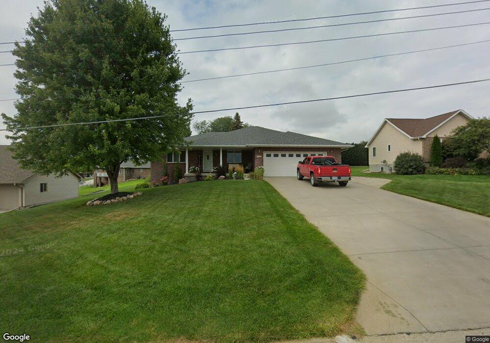
1140 E Grove St West Point, NE 68788
Estimated Value: $305,000 - $407,000
3
Beds
3
Baths
1,659
Sq Ft
$224/Sq Ft
Est. Value
About This Home
This home is located at 1140 E Grove St, West Point, NE 68788 and is currently estimated at $371,169, approximately $223 per square foot. 1140 E Grove St is a home located in Cuming County with nearby schools including West Point-Beemer Junior/Senior High School, Guardian Angels Elementary School, and St. Paul Lutheran School.
Ownership History
Date
Name
Owned For
Owner Type
Purchase Details
Closed on
Mar 13, 2006
Sold by
Hastings Gary J and Hastings Rosalie A
Bought by
Kreikemeier Bruce and Kreikemeier Bonnie
Current Estimated Value
Home Financials for this Owner
Home Financials are based on the most recent Mortgage that was taken out on this home.
Original Mortgage
$160,946
Outstanding Balance
$90,035
Interest Rate
6.19%
Mortgage Type
Future Advance Clause Open End Mortgage
Estimated Equity
$281,134
Create a Home Valuation Report for This Property
The Home Valuation Report is an in-depth analysis detailing your home's value as well as a comparison with similar homes in the area
Home Values in the Area
Average Home Value in this Area
Purchase History
| Date | Buyer | Sale Price | Title Company |
|---|---|---|---|
| Kreikemeier Bruce | $198,000 | -- |
Source: Public Records
Mortgage History
| Date | Status | Borrower | Loan Amount |
|---|---|---|---|
| Open | Kreikemeier Bruce | $160,946 |
Source: Public Records
Tax History Compared to Growth
Tax History
| Year | Tax Paid | Tax Assessment Tax Assessment Total Assessment is a certain percentage of the fair market value that is determined by local assessors to be the total taxable value of land and additions on the property. | Land | Improvement |
|---|---|---|---|---|
| 2025 | $3,011 | $381,050 | $26,395 | $354,655 |
| 2024 | $3,011 | $355,830 | $26,395 | $329,435 |
| 2023 | $3,965 | $343,625 | $23,325 | $320,300 |
| 2022 | $3,934 | $310,955 | $23,325 | $287,630 |
| 2021 | $3,730 | $279,955 | $21,485 | $258,470 |
| 2020 | $3,536 | $264,745 | $21,485 | $243,260 |
| 2019 | $3,447 | $252,270 | $21,485 | $230,785 |
| 2018 | $2,861 | $208,475 | $21,485 | $186,990 |
| 2017 | $2,924 | $208,475 | $21,485 | $186,990 |
| 2016 | $2,855 | $197,615 | $19,030 | $178,585 |
| 2015 | $3,037 | $197,615 | $19,030 | $178,585 |
| 2014 | $3,150 | $178,880 | $19,030 | $159,850 |
| 2013 | $3,150 | $178,880 | $19,030 | $159,850 |
Source: Public Records
Map
Nearby Homes
- 1142 E Grove St
- 1138 E Grove St
- 1113 E Park St
- 1139 E Grove St
- 1119 E Park St
- 1148 E Grove St
- 1131 E Grove St
- 1121 E Park St
- 134 S Kloke St
- 132 S Kloke St
- 1150 E Grove St
- 1112 E Park St
- 1114 E Park St
- 1123 E Park St
- 1140 E Grant St
- 209 S Kloke St
- 1120 E Park St
- 136 Kloke Cir
- 1110 E Park St
- 139 S Kloke St