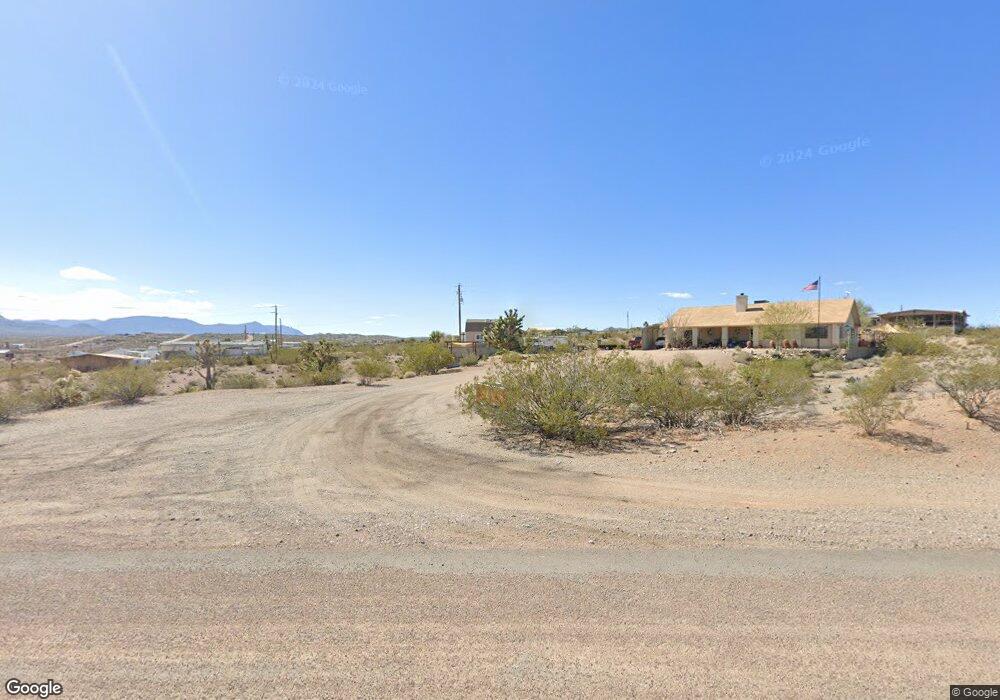
1140 E Mohawk Dr Meadview, AZ 86444
Estimated Value: $236,000 - $293,000
3
Beds
2
Baths
1,614
Sq Ft
$159/Sq Ft
Est. Value
About This Home
This home is located at 1140 E Mohawk Dr, Meadview, AZ 86444 and is currently estimated at $256,518, approximately $158 per square foot. 1140 E Mohawk Dr is a home with nearby schools including Cerbat Elementary School, Kingman Middle School, and Kingman High School.
Ownership History
Date
Name
Owned For
Owner Type
Purchase Details
Closed on
Aug 13, 2018
Sold by
Newkirk Donald R and Newkirk Pamela A
Bought by
Arias John and Arias Jo Anne
Current Estimated Value
Home Financials for this Owner
Home Financials are based on the most recent Mortgage that was taken out on this home.
Original Mortgage
$148,500
Outstanding Balance
$127,885
Interest Rate
4.5%
Mortgage Type
New Conventional
Estimated Equity
$128,633
Purchase Details
Closed on
Jan 24, 2002
Sold by
Doro Gloria A
Bought by
Newkirk Donald R and Newkirk Pamela A
Home Financials for this Owner
Home Financials are based on the most recent Mortgage that was taken out on this home.
Original Mortgage
$95,000
Interest Rate
7.15%
Mortgage Type
Seller Take Back
Create a Home Valuation Report for This Property
The Home Valuation Report is an in-depth analysis detailing your home's value as well as a comparison with similar homes in the area
Home Values in the Area
Average Home Value in this Area
Purchase History
| Date | Buyer | Sale Price | Title Company |
|---|---|---|---|
| Arias John | $165,000 | Pioneer Title Agency Inc | |
| Newkirk Donald R | $145,000 | First American Title |
Source: Public Records
Mortgage History
| Date | Status | Borrower | Loan Amount |
|---|---|---|---|
| Open | Arias John | $148,500 | |
| Previous Owner | Newkirk Donald R | $95,000 |
Source: Public Records
Tax History
| Year | Tax Paid | Tax Assessment Tax Assessment Total Assessment is a certain percentage of the fair market value that is determined by local assessors to be the total taxable value of land and additions on the property. | Land | Improvement |
|---|---|---|---|---|
| 2026 | $581 | -- | -- | -- |
| 2025 | $1,189 | $20,005 | $0 | $0 |
| 2024 | $1,189 | $18,834 | $0 | $0 |
| 2023 | $1,189 | $19,015 | $0 | $0 |
| 2022 | $1,104 | $15,460 | $0 | $0 |
| 2021 | $1,143 | $13,047 | $0 | $0 |
| 2019 | $1,044 | $10,700 | $0 | $0 |
| 2018 | $1,080 | $10,201 | $0 | $0 |
| 2017 | $1,079 | $10,559 | $0 | $0 |
| 2016 | $1,048 | $10,449 | $0 | $0 |
| 2015 | $1,069 | $10,496 | $0 | $0 |
Source: Public Records
Map
Nearby Homes
- 1105 & 1145 E Stanton Dr
- 1210 Hance Dr Unit 158
- 765 Bishop Dr
- 1150 Price Dr
- 715 Sumner Dr
- 670 Sumner Dr Unit 154
- 1205 E Spencer Dr
- 1360 Dellenbaugh Dr
- 590 Sumner Dr
- 790 Yates Dr
- 1305 Dellenbaugh Dr
- 715 Whitmore Dr
- 900 Spencer Dr
- 595 Dellenbaugh Dr
- 470 E Sumner Dr
- 760 Supai Dr
- 30565 Escalante Blvd
- 1260 Moqui Ln
- 30555 Escalante Blvd
- 515 Bishop Dr
- 1120 Mohawk Dr
- 30720 N Bright Angel Dr
- 1105 Stanton Dr
- 1145 Stanton Dr
- 1180 Mohawk Dr
- 1125 Mohawk Dr
- 1165 E Mohawk Dr
- 1125 E Mohawk Dr
- 1165 Stanton Dr
- 1105 Mohawk Dr
- 1185 Stanton Dr
- 1220 E Mohawk Dr
- 1221 Mohawk Dr
- 1100 Stanton Dr
- 1140 Stanton Dr
- 30715 N Bright Angel Dr
- 1120 E Mohawk Dr
- 1265 Stanton Dr
- 1200 E Spencer Way
- 1180 Stanton Dr
Your Personal Tour Guide
Ask me questions while you tour the home.