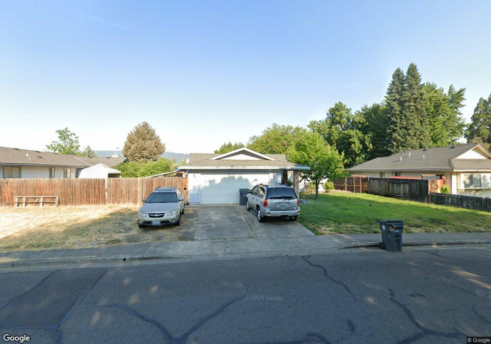
1140 Freeman Rd Central Point, OR 97502
Estimated Value: $352,000 - $376,194
3
Beds
2
Baths
1,380
Sq Ft
$267/Sq Ft
Est. Value
About This Home
This home is located at 1140 Freeman Rd, Central Point, OR 97502 and is currently estimated at $368,049, approximately $266 per square foot. 1140 Freeman Rd is a home located in Jackson County with nearby schools including Central Point Elementary School, Scenic Middle School, and Crater High School.
Ownership History
Date
Name
Owned For
Owner Type
Purchase Details
Closed on
Feb 22, 2002
Sold by
Napier Earl E and Napier Michele L
Bought by
Trowbridge Dan S and Trowbridge Peggy M
Current Estimated Value
Home Financials for this Owner
Home Financials are based on the most recent Mortgage that was taken out on this home.
Original Mortgage
$126,514
Outstanding Balance
$49,739
Interest Rate
6.8%
Mortgage Type
FHA
Estimated Equity
$318,310
Purchase Details
Closed on
Jan 13, 1999
Sold by
Gianni Jacob A and Gianni Lauren M
Bought by
Napier Earl E and Napier Michele L
Home Financials for this Owner
Home Financials are based on the most recent Mortgage that was taken out on this home.
Original Mortgage
$107,834
Interest Rate
6.66%
Mortgage Type
FHA
Create a Home Valuation Report for This Property
The Home Valuation Report is an in-depth analysis detailing your home's value as well as a comparison with similar homes in the area
Purchase History
| Date | Buyer | Sale Price | Title Company |
|---|---|---|---|
| Trowbridge Dan S | $128,500 | Jackson County Title | |
| Napier Earl E | $108,000 | Jackson County Title |
Source: Public Records
Mortgage History
| Date | Status | Borrower | Loan Amount |
|---|---|---|---|
| Open | Trowbridge Dan S | $126,514 | |
| Previous Owner | Napier Earl E | $107,834 |
Source: Public Records
Tax History
| Year | Tax Paid | Tax Assessment Tax Assessment Total Assessment is a certain percentage of the fair market value that is determined by local assessors to be the total taxable value of land and additions on the property. | Land | Improvement |
|---|---|---|---|---|
| 2026 | $3,348 | $202,300 | -- | -- |
| 2025 | $3,265 | $196,410 | $75,430 | $120,980 |
| 2024 | $3,265 | $190,690 | $73,240 | $117,450 |
| 2023 | $3,160 | $185,140 | $71,110 | $114,030 |
| 2022 | $3,087 | $185,140 | $71,110 | $114,030 |
| 2021 | $2,999 | $179,750 | $69,040 | $110,710 |
| 2020 | $2,911 | $174,520 | $67,030 | $107,490 |
| 2019 | $2,839 | $164,510 | $63,180 | $101,330 |
| 2018 | $2,753 | $159,720 | $61,340 | $98,380 |
| 2017 | $2,684 | $159,720 | $61,340 | $98,380 |
| 2016 | $2,605 | $150,560 | $57,820 | $92,740 |
| 2015 | $2,496 | $150,560 | $57,820 | $92,740 |
| 2014 | $2,342 | $141,930 | $54,500 | $87,430 |
Source: Public Records
Map
Nearby Homes
- 887 Silver Fox Dr
- 3358 Bursell Rd
- 3364 Bursell Rd
- 755 S 4th St
- 1204 Heather Ln
- 3600 N Pacific Hwy
- 1189 Lindsey Ct
- 14 Scholarship Way
- 18 Scholarship Way
- 959 Westrop Dr
- 436 Cheney Loop
- 555 Freeman Rd Unit 73
- 555 Freeman Rd Unit 254
- 555 Freeman Rd Unit 105
- 555 Freeman Rd Unit 209
- 114 Cedar St
- 1630 Timothy St
- 1258 Joshua Ct
- 659 Herman Ave
- 918 Brandi Way
- 1145 Rose Valley Dr
- 1130 Freeman Rd
- 1135 Rose Valley Dr
- 1120 Freeman Rd
- 1125 Rose Valley Dr
- 1135 Freeman Rd Unit 2
- 1200 Freeman Rd
- 1115 Rose Valley Dr
- 1130 Rose Valley Dr
- 540 Renee Cir
- 1140 Rose Valley Dr
- 3333 Edwina Ave
- 1110 Freeman Rd
- 1191 Freeman Rd
- 1090 Edwina Ave
- 1120 Rose Valley Dr
- 1150 Rose Valley Dr
- 1115 Freeman Rd
- 1210 Freeman Rd Unit 2
- 520 Renee Cir
Your Personal Tour Guide
Ask me questions while you tour the home.