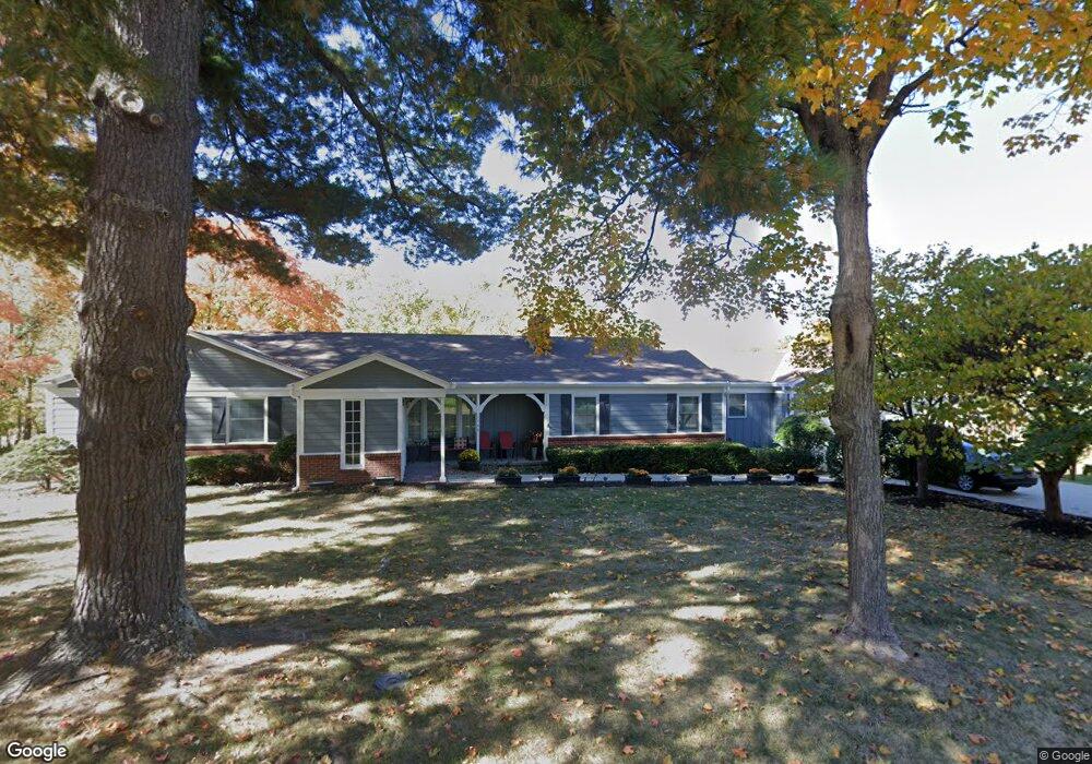
1140 Manchester Rd Liberty, MO 64068
Estimated Value: $379,000 - $551,936
5
Beds
3
Baths
2,433
Sq Ft
$184/Sq Ft
Est. Value
About This Home
This home is located at 1140 Manchester Rd, Liberty, MO 64068 and is currently estimated at $448,484, approximately $184 per square foot. 1140 Manchester Rd is a home located in Clay County with nearby schools including Alexander Doniphan Elementary School, Discovery Middle School, and Liberty High School.
Ownership History
Date
Name
Owned For
Owner Type
Purchase Details
Closed on
Sep 30, 2025
Sold by
Lowe Lisa Brock and Lowe Michael W
Bought by
Lowe Jessica Anne Scassel and Lowe Brock Elliot
Current Estimated Value
Home Financials for this Owner
Home Financials are based on the most recent Mortgage that was taken out on this home.
Original Mortgage
$316,350
Outstanding Balance
$316,350
Interest Rate
6.58%
Mortgage Type
New Conventional
Estimated Equity
$132,134
Purchase Details
Closed on
Feb 27, 2025
Sold by
Linnea K Brock Trust and Todd Ellen Marie
Bought by
Lowe Lisa B
Purchase Details
Closed on
Mar 9, 2023
Sold by
Brock Linnea
Bought by
Linnea K Brock Trust
Purchase Details
Closed on
Feb 26, 2007
Sold by
Star Development Corp
Bought by
Brock Raymond R and Brock Linnea
Create a Home Valuation Report for This Property
The Home Valuation Report is an in-depth analysis detailing your home's value as well as a comparison with similar homes in the area
Home Values in the Area
Average Home Value in this Area
Purchase History
| Date | Buyer | Sale Price | Title Company |
|---|---|---|---|
| Lowe Jessica Anne Scassel | -- | Alliance Title Company | |
| Lowe Lisa B | -- | None Listed On Document | |
| Lowe Lisa B | -- | None Listed On Document | |
| Linnea K Brock Trust | -- | -- | |
| Brock Raymond R | -- | Thomson Title Corporation |
Source: Public Records
Mortgage History
| Date | Status | Borrower | Loan Amount |
|---|---|---|---|
| Open | Lowe Jessica Anne Scassel | $316,350 |
Source: Public Records
Tax History Compared to Growth
Tax History
| Year | Tax Paid | Tax Assessment Tax Assessment Total Assessment is a certain percentage of the fair market value that is determined by local assessors to be the total taxable value of land and additions on the property. | Land | Improvement |
|---|---|---|---|---|
| 2025 | $4,865 | $72,140 | -- | -- |
| 2024 | $4,865 | $63,250 | -- | -- |
| 2023 | $4,947 | $63,250 | $0 | $0 |
| 2022 | $4,734 | $59,760 | $0 | $0 |
| 2021 | $4,697 | $59,755 | $11,400 | $48,355 |
| 2020 | $4,416 | $52,760 | $0 | $0 |
| 2019 | $4,415 | $52,760 | $0 | $0 |
| 2018 | $4,241 | $49,760 | $0 | $0 |
| 2017 | $4,202 | $49,760 | $7,600 | $42,160 |
| 2016 | $4,202 | $49,760 | $7,600 | $42,160 |
| 2015 | $4,202 | $49,760 | $7,600 | $42,160 |
| 2014 | $3,964 | $46,570 | $7,600 | $38,970 |
Source: Public Records
Map
Nearby Homes
- 1124 Amesbury Ave
- 415 Monterey Ave
- 918 Amesbury Ave
- 862 Amesbury Ave
- 509 Belmont St
- 420 Belmont St
- 1323 Amesbury Ave
- 1218 Canterbury Ln
- 716 Bristol Ct
- 1507 Amesbury Ave
- 1733 Welleslay Ln
- 1331 Park Ln
- 1317 Park Ln
- 1537 Canterbury Ln
- 253 S Stewart Rd
- 1304 Wellington Way
- 1209 Liberty Drive Terrace
- 1327 Easton Ct
- 7908 N Ditzler Ave
- 9102 NE 79th Terrace
- 1120 Manchester Rd
- 1934 Barford Rd
- 1933 Barford Rd
- 1106 Manchester Rd
- 1121 Manchester Rd
- 1930 Barford Rd
- 1107 Manchester Rd
- 1929 Barford Rd
- 1036 Manchester Rd
- 1925 Barford Rd
- 1926 Barford Rd
- 1920 High Dr
- 1037 Manchester Rd
- 1924 High Dr
- 409 Wilshire Blvd
- 1912 High Dr
- 405 Wilshire Blvd
- 1928 High Dr
- 1932 High Dr
- 413 Wilshire Blvd