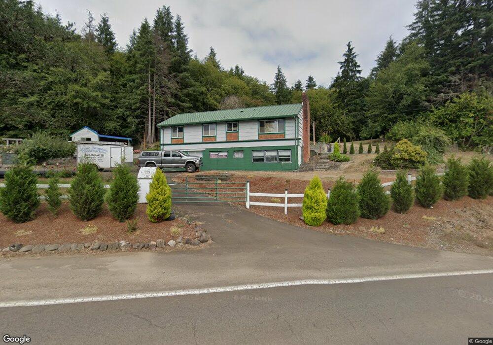
1140 Netarts Hwy W Tillamook, OR 97141
Estimated Value: $426,400 - $638,000
3
Beds
2
Baths
1,100
Sq Ft
$450/Sq Ft
Est. Value
About This Home
This home is located at 1140 Netarts Hwy W, Tillamook, OR 97141 and is currently estimated at $494,600, approximately $449 per square foot. 1140 Netarts Hwy W is a home located in Tillamook County with nearby schools including Tillamook High School, Little Clipper Preschool, and Pacific Christian School.
Ownership History
Date
Name
Owned For
Owner Type
Purchase Details
Closed on
Dec 12, 2008
Sold by
Russell Kevin
Bought by
Bruneau Steven
Current Estimated Value
Home Financials for this Owner
Home Financials are based on the most recent Mortgage that was taken out on this home.
Original Mortgage
$212,642
Outstanding Balance
$142,816
Interest Rate
6.47%
Mortgage Type
FHA
Estimated Equity
$351,784
Purchase Details
Closed on
Aug 7, 2006
Sold by
Russell Allison M
Bought by
Russell Kevin
Home Financials for this Owner
Home Financials are based on the most recent Mortgage that was taken out on this home.
Original Mortgage
$195,000
Interest Rate
9.56%
Mortgage Type
Unknown
Create a Home Valuation Report for This Property
The Home Valuation Report is an in-depth analysis detailing your home's value as well as a comparison with similar homes in the area
Home Values in the Area
Average Home Value in this Area
Purchase History
| Date | Buyer | Sale Price | Title Company |
|---|---|---|---|
| Bruneau Steven | $216,000 | First American | |
| Russell Kevin | -- | Ticor Title Ins Co |
Source: Public Records
Mortgage History
| Date | Status | Borrower | Loan Amount |
|---|---|---|---|
| Open | Bruneau Steven | $212,642 | |
| Previous Owner | Russell Kevin | $195,000 |
Source: Public Records
Tax History Compared to Growth
Tax History
| Year | Tax Paid | Tax Assessment Tax Assessment Total Assessment is a certain percentage of the fair market value that is determined by local assessors to be the total taxable value of land and additions on the property. | Land | Improvement |
|---|---|---|---|---|
| 2024 | $1,824 | $176,130 | $65,210 | $110,920 |
| 2023 | $1,814 | $171,000 | $63,310 | $107,690 |
| 2022 | $1,753 | $166,020 | $61,470 | $104,550 |
| 2021 | $1,703 | $161,190 | $59,680 | $101,510 |
| 2020 | $1,658 | $156,500 | $57,940 | $98,560 |
| 2019 | $1,553 | $151,950 | $56,250 | $95,700 |
| 2018 | $1,514 | $147,530 | $54,610 | $92,920 |
| 2017 | $1,476 | $143,240 | $53,020 | $90,220 |
| 2016 | $1,419 | $139,070 | $51,480 | $87,590 |
| 2015 | $1,392 | $135,020 | $49,980 | $85,040 |
| 2014 | $1,372 | $131,090 | $48,520 | $82,570 |
| 2013 | -- | $127,280 | $47,110 | $80,170 |
Source: Public Records
Map
Nearby Homes
- 605 Cottonwood Ave
- 1209 6th St
- 412 Birch Ave
- 1412 9th St
- 315 Birch Ave
- 1307 3rd St
- 1009/1011 Grove Ave Unit 1009-11
- 1003 Grove Ave
- 0 Sequoia Loop Unit 145 359344119
- 0 Sequoia Loop Unit 116 259912765
- 1010 Ivy Ave
- 0 Ocn Hghlnd-Sequoia Loop Unit 146
- 1806 8th St
- 1706 5th St
- 1703 4th St
- 2375 Bayocean Rd NW
- 1708 4th St
- 02600 12th St
- Lot 2405 12th St
- VL Sequoia Loop
- 1190 Netarts Hwy W
- 1070 Netarts Hwy W
- 1070 Netarts Hwy W Unit Netarts Hwy
- 1220 Netarts Hwy W
- 1310 Netarts Hwy W
- 1250 Netarts Hwy W
- 985 Doe Cir
- 1972 Deer Ridge Rd
- 1945 Deer Ridge Rd
- 1970 Deer Ridge Rd
- 1970 Deer Rd
- 1340 Netarts Hwy W
- 1995 Deer Ridge Rd
- 1985 Deer Ridge Rd
- 1975 Deer Ridge Rd
- 1975 Deer Rd
- 1940 Deer Rd
- 1940 Deer Ridge Rd
- 1965 Deer Ridge Rd
- 1965 Deer Rd