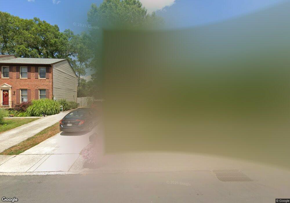
1140 Redwood Dr Carlisle, PA 17013
Estimated Value: $222,000 - $236,000
3
Beds
3
Baths
1,344
Sq Ft
$170/Sq Ft
Est. Value
About This Home
This home is located at 1140 Redwood Dr, Carlisle, PA 17013 and is currently estimated at $229,043, approximately $170 per square foot. 1140 Redwood Dr is a home located in Cumberland County with nearby schools including Bellaire Elementary School, Wilson Middle School, and Carlisle Area High School.
Ownership History
Date
Name
Owned For
Owner Type
Purchase Details
Closed on
Aug 4, 2021
Sold by
Tracy Davis C and Williams Martha L
Bought by
Darr Megan and Hodge Lamar Anthony
Current Estimated Value
Home Financials for this Owner
Home Financials are based on the most recent Mortgage that was taken out on this home.
Original Mortgage
$166,920
Outstanding Balance
$151,782
Interest Rate
2.9%
Mortgage Type
FHA
Estimated Equity
$77,261
Create a Home Valuation Report for This Property
The Home Valuation Report is an in-depth analysis detailing your home's value as well as a comparison with similar homes in the area
Home Values in the Area
Average Home Value in this Area
Purchase History
| Date | Buyer | Sale Price | Title Company |
|---|---|---|---|
| Darr Megan | $170,000 | None Available |
Source: Public Records
Mortgage History
| Date | Status | Borrower | Loan Amount |
|---|---|---|---|
| Open | Darr Megan | $166,920 |
Source: Public Records
Tax History Compared to Growth
Tax History
| Year | Tax Paid | Tax Assessment Tax Assessment Total Assessment is a certain percentage of the fair market value that is determined by local assessors to be the total taxable value of land and additions on the property. | Land | Improvement |
|---|---|---|---|---|
| 2025 | $2,933 | $140,000 | $27,800 | $112,200 |
| 2024 | $2,822 | $140,000 | $27,800 | $112,200 |
| 2023 | $2,720 | $140,000 | $27,800 | $112,200 |
| 2022 | $2,676 | $140,000 | $27,800 | $112,200 |
| 2021 | $2,633 | $140,000 | $27,800 | $112,200 |
| 2020 | $2,570 | $140,000 | $27,800 | $112,200 |
| 2019 | $2,509 | $140,000 | $27,800 | $112,200 |
| 2018 | $2,444 | $140,000 | $27,800 | $112,200 |
| 2017 | $2,389 | $140,000 | $27,800 | $112,200 |
| 2016 | -- | $140,000 | $27,800 | $112,200 |
| 2015 | -- | $140,000 | $27,800 | $112,200 |
| 2014 | -- | $140,000 | $27,800 | $112,200 |
Source: Public Records
Map
Nearby Homes
- 1138 Franklin St
- 60 Courtyard Dr
- 8 Lantern Ct
- 7 Lantern Ct
- 4 Family Dr
- 0 Waggoners Gap Rd Unit PACB2047920
- 6 Family Dr
- 920 N West St
- 906 N West St
- 26 American Ave
- Bryson Plan at Hays Landing
- Monroe Plan at Hays Landing
- Willow Plan at Hays Landing
- Mackenzie Plan at Hays Landing
- Cooper Plan at Hays Landing
- Charlotte Plan at Hays Landing
- Dalton Plan at Hays Landing
- Heron Plan at Hays Landing
- 24 American Ave
- 6 Stream Dr
- 1142 Redwood Dr
- 1138 Redwood Dr
- 1136 Redwood Dr
- 1144 Redwood Dr
- 1146 Redwood Dr
- 1134 Redwood Dr
- 1127 Redwood Dr
- 1129 Redwood Dr
- 1125 Redwood Dr
- 1148 Redwood Dr
- 1131 Redwood Dr
- 1133 Redwood Dr
- 1123 Redwood Dr
- 1132 Redwood Dr
- 1150 Redwood Dr
- 1135 Redwood Dr
- 1130 Redwood Dr
- 1121 Redwood Dr
- 1137 Redwood Dr
- 1128 Redwood Dr