Estimated Value: $294,000 - $327,000
3
Beds
2
Baths
1,573
Sq Ft
$198/Sq Ft
Est. Value
About This Home
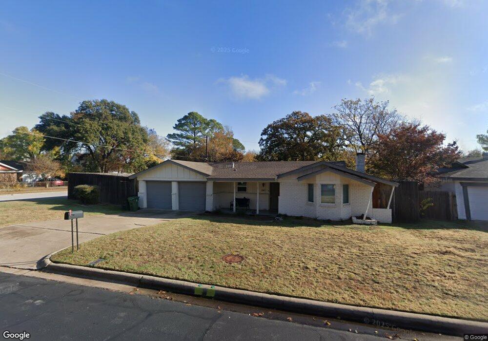
This home is located at 1140 Simpson Dr, Hurst, TX 76053 and is currently estimated at $311,215, approximately $197 per square foot. 1140 Simpson Dr is a home located in Tarrant County with nearby schools including Harrison Lane Elementary School, Hurst J High School, and L.D. Bell High School.
Ownership History
Date
Name
Owned For
Owner Type
Purchase Details
Closed on
May 7, 2018
Sold by
Champery Real Estate 2015 Llc
Bought by
Mella Michael and Wren Mella Hayley
Current Estimated Value
Home Financials for this Owner
Home Financials are based on the most recent Mortgage that was taken out on this home.
Original Mortgage
$178,000
Outstanding Balance
$153,405
Interest Rate
4.44%
Mortgage Type
New Conventional
Estimated Equity
$157,810
Purchase Details
Closed on
Oct 20, 2017
Sold by
Brecknridge Property Fund 2016 Kllc
Bought by
Hampery Rel Estae 2015 Llc
Purchase Details
Closed on
Aug 8, 2017
Sold by
Burk Diana Ann
Bought by
Breckenridg Properties Fund 2016 Llc
Purchase Details
Closed on
Dec 28, 1999
Sold by
Hoffman Eric Michael and Hoffman Susan Lynn
Bought by
Brown Thomas D and Brown Darline N
Home Financials for this Owner
Home Financials are based on the most recent Mortgage that was taken out on this home.
Original Mortgage
$39,600
Interest Rate
7.69%
Create a Home Valuation Report for This Property
The Home Valuation Report is an in-depth analysis detailing your home's value as well as a comparison with similar homes in the area
Home Values in the Area
Average Home Value in this Area
Purchase History
| Date | Buyer | Sale Price | Title Company |
|---|---|---|---|
| Mella Michael | -- | Fidelity National Title | |
| Hampery Rel Estae 2015 Llc | -- | Fidelity National Title | |
| Breckenridg Properties Fund 2016 Llc | -- | First Western Title | |
| Brown Thomas D | -- | Commonwealth Land Title |
Source: Public Records
Mortgage History
| Date | Status | Borrower | Loan Amount |
|---|---|---|---|
| Open | Mella Michael | $178,000 | |
| Previous Owner | Brown Thomas D | $39,600 |
Source: Public Records
Tax History
| Year | Tax Paid | Tax Assessment Tax Assessment Total Assessment is a certain percentage of the fair market value that is determined by local assessors to be the total taxable value of land and additions on the property. | Land | Improvement |
|---|---|---|---|---|
| 2025 | $4,744 | $334,502 | $55,000 | $279,502 |
| 2024 | $4,744 | $334,502 | $55,000 | $279,502 |
| 2023 | $5,677 | $318,850 | $40,000 | $278,850 |
| 2022 | $5,931 | $279,713 | $40,000 | $239,713 |
| 2021 | $5,770 | $267,926 | $40,000 | $227,926 |
| 2020 | $5,233 | $217,500 | $40,000 | $177,500 |
| 2019 | $5,346 | $218,413 | $40,000 | $178,413 |
| 2018 | $4,111 | $167,976 | $19,000 | $148,976 |
| 2017 | $2,918 | $158,433 | $19,000 | $139,433 |
| 2016 | $2,653 | $147,624 | $19,000 | $128,624 |
| 2015 | $701 | $95,300 | $15,000 | $80,300 |
| 2014 | $701 | $95,300 | $15,000 | $80,300 |
Source: Public Records
Map
Nearby Homes
- 1148 Simpson Dr
- 1113 Norwood Dr
- 1160 Harrison Ln
- 1236 Harrison Ln
- 1016 Keith Dr
- 905 Brown Trail
- 153 Sheri Ln
- 1213 Glenda Dr
- 1348 Norwood Dr
- 344 Bedford Ct E
- 341 Hurst Dr
- 802 Brown Trail
- 1352 Simpson Dr
- 1112 Karla Dr
- 209 W Cedar St
- 936 Barbara Ann Dr
- 701 Harrison Ln
- 629 Harrison Ln
- 1236 King Dr
- 609 Norwood Dr
- 1145 Norwood Dr
- 1144 Simpson Dr
- 1141 Norwood Dr
- 1132 Simpson Dr
- 1141 Simpson Dr
- 1147 Norwood Dr
- 1137 Simpson Dr
- 1137 Norwood Dr
- 1145 Simpson Dr
- 1133 Simpson Dr
- 1128 Simpson Dr
- 1149 Norwood Dr
- 1149 Simpson Dr
- 1133 Norwood Dr
- 1129 Simpson Dr
- 1140 Harrison Ln
- 1144 Norwood Dr
- 1136 Harrison Ln
- 1153 Simpson Dr
- 1144 Harrison Ln
Your Personal Tour Guide
Ask me questions while you tour the home.