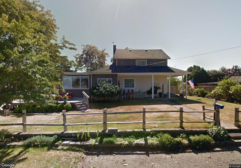
1141 3rd Ave Seaside, OR 97138
Estimated Value: $374,000 - $628,000
3
Beds
1
Bath
1,910
Sq Ft
$244/Sq Ft
Est. Value
About This Home
This home is located at 1141 3rd Ave, Seaside, OR 97138 and is currently estimated at $466,512, approximately $244 per square foot. 1141 3rd Ave is a home located in Clatsop County with nearby schools including Seaside High School.
Ownership History
Date
Name
Owned For
Owner Type
Purchase Details
Closed on
Aug 14, 2021
Sold by
Dugan Judy Ann
Bought by
Parsons Martin C and Parsons Katie
Current Estimated Value
Home Financials for this Owner
Home Financials are based on the most recent Mortgage that was taken out on this home.
Original Mortgage
$294,820
Outstanding Balance
$267,092
Interest Rate
2.8%
Mortgage Type
FHA
Estimated Equity
$199,420
Create a Home Valuation Report for This Property
The Home Valuation Report is an in-depth analysis detailing your home's value as well as a comparison with similar homes in the area
Purchase History
| Date | Buyer | Sale Price | Title Company |
|---|---|---|---|
| Parsons Martin C | $305,000 | Lawyers Title Com Svcs |
Source: Public Records
Mortgage History
| Date | Status | Borrower | Loan Amount |
|---|---|---|---|
| Open | Parsons Martin C | $294,820 |
Source: Public Records
Tax History
| Year | Tax Paid | Tax Assessment Tax Assessment Total Assessment is a certain percentage of the fair market value that is determined by local assessors to be the total taxable value of land and additions on the property. | Land | Improvement |
|---|---|---|---|---|
| 2025 | $3,510 | $244,262 | -- | -- |
| 2024 | $3,407 | $237,149 | -- | -- |
| 2023 | $3,306 | $230,243 | $0 | $0 |
| 2022 | $3,216 | $223,538 | $0 | $0 |
| 2021 | $3,148 | $217,028 | $0 | $0 |
| 2020 | $2,966 | $203,261 | $0 | $0 |
| 2019 | $2,885 | $197,342 | $0 | $0 |
Source: Public Records
Map
Nearby Homes
- 1299 6th Ave
- 1110 6th Ave
- 815 N King St
- 1265 Avenue
- 1000 N Holladay Dr
- 1000 N Holladay Dr Unit 304
- 1805 Broadway St
- 727 12th Ave
- 0 Vl Whispering Pines Dr
- 460 10th Ave
- 423 N Downing St
- 908-910 N Franklin St
- 2270 Skyline Dr
- 720 Avenue G
- 805 S King St
- 0 N Wahanna Rd
- 460 12th Ave
- 360 Hilltop Dr
- 0 Vl Whispering Pines (Tl 13345) Dr
- 720 740 Avenue G
Your Personal Tour Guide
Ask me questions while you tour the home.