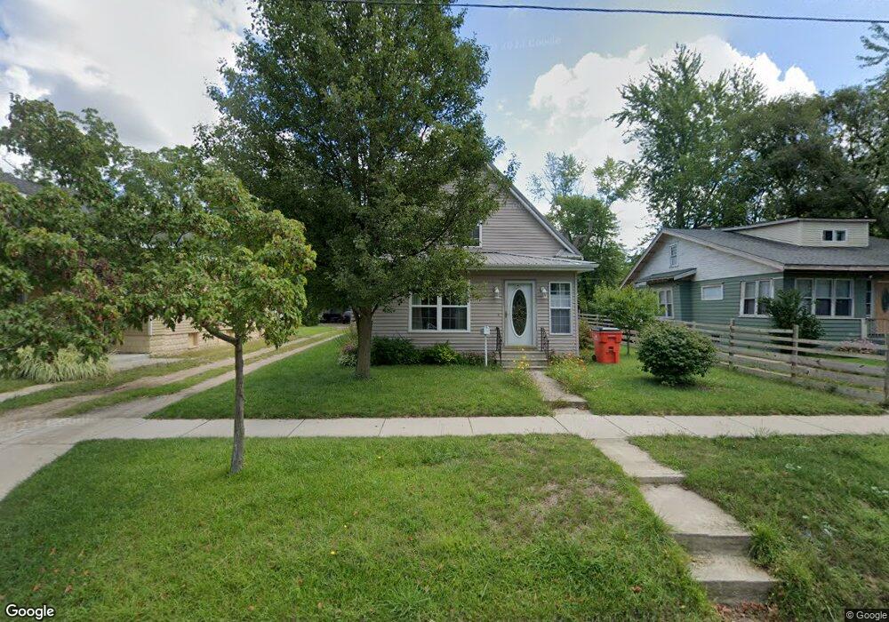
1141 Colfax Ave Benton Harbor, MI 49022
Estimated Value: $101,000 - $183,000
3
Beds
2
Baths
2,044
Sq Ft
$64/Sq Ft
Est. Value
About This Home
This home is located at 1141 Colfax Ave, Benton Harbor, MI 49022 and is currently estimated at $130,751, approximately $63 per square foot. 1141 Colfax Ave is a home located in Berrien County with nearby schools including Fair Plain Middle School, Benton Harbor High School, and Benton Harbor Charter School Academy.
Ownership History
Date
Name
Owned For
Owner Type
Purchase Details
Closed on
Apr 13, 2005
Sold by
King Kate
Bought by
Welsher Randall and Welsher Julia
Current Estimated Value
Home Financials for this Owner
Home Financials are based on the most recent Mortgage that was taken out on this home.
Original Mortgage
$70,200
Outstanding Balance
$40,175
Interest Rate
7.5%
Mortgage Type
Fannie Mae Freddie Mac
Estimated Equity
$90,576
Purchase Details
Closed on
Jun 20, 2001
Purchase Details
Closed on
Jun 5, 2001
Purchase Details
Closed on
Jun 4, 2001
Purchase Details
Closed on
May 2, 2001
Purchase Details
Closed on
Aug 23, 1995
Create a Home Valuation Report for This Property
The Home Valuation Report is an in-depth analysis detailing your home's value as well as a comparison with similar homes in the area
Home Values in the Area
Average Home Value in this Area
Purchase History
| Date | Buyer | Sale Price | Title Company |
|---|---|---|---|
| Welsher Randall | $78,000 | -- | |
| -- | -- | -- | |
| -- | -- | -- | |
| -- | -- | -- | |
| -- | $3,000 | -- | |
| -- | $1,500 | -- |
Source: Public Records
Mortgage History
| Date | Status | Borrower | Loan Amount |
|---|---|---|---|
| Open | Welsher Randall | $70,200 | |
| Closed | Welsher Randall | $1,300 |
Source: Public Records
Tax History Compared to Growth
Tax History
| Year | Tax Paid | Tax Assessment Tax Assessment Total Assessment is a certain percentage of the fair market value that is determined by local assessors to be the total taxable value of land and additions on the property. | Land | Improvement |
|---|---|---|---|---|
| 2025 | $748 | $39,700 | $0 | $0 |
| 2024 | $708 | $36,000 | $0 | $0 |
| 2023 | $520 | $27,300 | $0 | $0 |
| 2022 | $643 | $21,500 | $0 | $0 |
| 2021 | $658 | $21,000 | $600 | $20,400 |
| 2020 | $650 | $21,400 | $0 | $0 |
| 2019 | $641 | $19,700 | $0 | $0 |
| 2018 | $623 | $16,800 | $0 | $0 |
| 2017 | $611 | $13,900 | $0 | $0 |
| 2016 | $599 | $14,000 | $0 | $0 |
| 2015 | $597 | $13,500 | $0 | $0 |
| 2014 | $638 | $16,400 | $0 | $0 |
Source: Public Records
Map
Nearby Homes
- 1235 Colfax Ave
- 202 Searles Ave
- 979 Lavette Ave
- 180 Emery Ave
- 941 Colfax Ave
- 1267 Broadway
- 1097 Pearl St
- 361 E May St
- 171 E Empire Ave
- 872 Mcalister Ave
- 1332 Columbus Ave
- 349 E Empire Ave
- 131 Clay St
- 1301 Superior St
- 1045 Broadway
- 833 Pearl St
- 1219 Ogden Ave
- 377 Western Ave
- 379 Western Ave
- 694 Colfax Ave
- 1131 Colfax Ave
- 1159 Colfax Ave
- 1121 Colfax Ave
- 1163 Colfax Ave
- 1142 Lavette Ave
- 1119 Colfax Ave
- 1134 Lavette Ave
- 1148 Lavette Ave
- 1126 Lavette Ave
- 1156 Lavette Ave
- 124 E May St
- 1109 Colfax Ave
- 1120 Lavette Ave
- 1164 Lavette Ave
- 1120 Colfax Ave
- 4 Colfax Ave
- 1171 Colfax Ave
- 1100 Lavette Ave
- 1124 Colfax Ave
- 1180 Lavette Ave