Estimated Value: $326,000 - $368,000
3
Beds
3
Baths
1,740
Sq Ft
$199/Sq Ft
Est. Value
About This Home
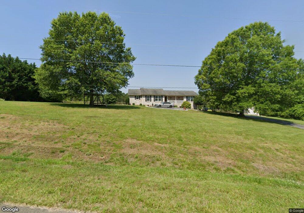
This home is located at 1141 Curt Boyles Rd, King, NC 27021 and is currently estimated at $346,592, approximately $199 per square foot. 1141 Curt Boyles Rd is a home located in Stokes County with nearby schools including Mount Olive Elementary School, Chestnut Grove Middle, and West Stokes High.
Ownership History
Date
Name
Owned For
Owner Type
Purchase Details
Closed on
Jun 20, 2006
Sold by
Burk Susan M
Bought by
Puckett Richard Grant and Puckett Robyn M
Current Estimated Value
Home Financials for this Owner
Home Financials are based on the most recent Mortgage that was taken out on this home.
Original Mortgage
$201,435
Outstanding Balance
$118,427
Interest Rate
6.57%
Mortgage Type
VA
Estimated Equity
$228,165
Create a Home Valuation Report for This Property
The Home Valuation Report is an in-depth analysis detailing your home's value as well as a comparison with similar homes in the area
Home Values in the Area
Average Home Value in this Area
Purchase History
| Date | Buyer | Sale Price | Title Company |
|---|---|---|---|
| Puckett Richard Grant | $195,000 | None Available |
Source: Public Records
Mortgage History
| Date | Status | Borrower | Loan Amount |
|---|---|---|---|
| Open | Puckett Richard Grant | $201,435 |
Source: Public Records
Tax History Compared to Growth
Tax History
| Year | Tax Paid | Tax Assessment Tax Assessment Total Assessment is a certain percentage of the fair market value that is determined by local assessors to be the total taxable value of land and additions on the property. | Land | Improvement |
|---|---|---|---|---|
| 2025 | $2,101 | $293,900 | $53,800 | $240,100 |
| 2024 | $2,101 | $213,000 | $41,500 | $171,500 |
| 2023 | $1,725 | $213,000 | $41,500 | $171,500 |
| 2022 | $1,576 | $213,000 | $41,500 | $171,500 |
| 2021 | $1,576 | $213,000 | $41,500 | $171,500 |
| 2020 | $1,418 | $191,600 | $40,500 | $151,100 |
| 2019 | $1,418 | $191,600 | $40,500 | $151,100 |
| 2018 | $1,418 | $191,600 | $40,500 | $151,100 |
| 2017 | $1,408 | $191,600 | $40,500 | $151,100 |
| 2016 | $1,354 | $184,200 | $40,500 | $143,700 |
| 2015 | $1,345 | $184,200 | $40,500 | $143,700 |
| 2014 | $1,350 | $184,200 | $40,500 | $143,700 |
Source: Public Records
Map
Nearby Homes
- 1105 Flippin Ln
- 1085 Mystic Ln
- 1035 Sueron Dr
- Lot 9 Brown Rd
- 1060 Brown Rd
- 0 Edwards Farm Rd
- 1120 Sterling Pointe Dr
- 1.59ac Deerfield Dr
- 3-3 Thomas Farm Rd
- 310 Cedardale Ln
- 353 Goff Rd
- 1249 Kentland Dr
- Lot 2 Rock Haven Dr
- Lot 4 Rock Haven Dr
- Lot 6 Rock Haven Dr
- Lot 1 Rock Haven Dr
- Lot 3 Rock Haven Dr
- Lot 5 Rock Haven Dr
- 103 Jasper Ct
- 1208 Kentland Dr
- 1127 Curt Boyles Rd
- 1158 Curt Boyles Rd
- 1075 Curt Boyles Rd
- 0 Briarcreek Road & Flippin Ln
- 1065 Curt Boyles Rd
- 1109 Briarcreek Rd
- 1081 Briarcreek Rd
- 1050 Mongoose Ln
- 2050 Chestnut Grove Rd
- 1085 Mongoose Ln
- 1075 Mongoose Ln
- 1040 Curt Boyles Rd
- 1065 Mongoose Ln
- 1030 Mongoose Ln
- 2142 Chestnut Grove Rd
- 1015 Curt Boyles Rd
- 2044 Chestnut Grove Rd
- 2020 Chestnut Grove Rd
- 1176 Briarcreek Rd
- 1035 Mongoose Ln