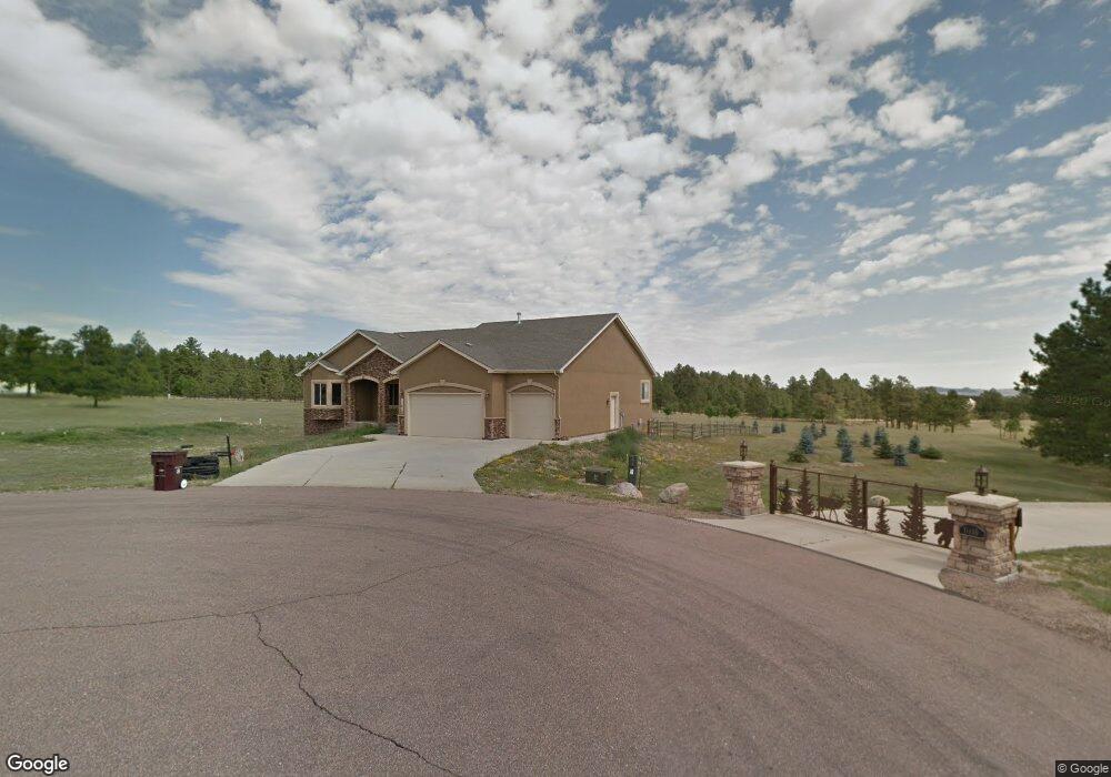
11410 Guinevere Ct Colorado Springs, CO 80908
Estimated Value: $1,013,162 - $1,158,000
5
Beds
3
Baths
2,382
Sq Ft
$451/Sq Ft
Est. Value
About This Home
This home is located at 11410 Guinevere Ct, Colorado Springs, CO 80908 and is currently estimated at $1,075,041, approximately $451 per square foot. 11410 Guinevere Ct is a home located in El Paso County with nearby schools including Bennett Ranch Elementary School, Falcon Middle School, and Falcon High School.
Ownership History
Date
Name
Owned For
Owner Type
Purchase Details
Closed on
Dec 5, 2014
Sold by
Vigil Steven J and Vigil Stephanie J
Bought by
Nelson Jay E and Nelson Rose M
Current Estimated Value
Home Financials for this Owner
Home Financials are based on the most recent Mortgage that was taken out on this home.
Original Mortgage
$417,000
Outstanding Balance
$319,537
Interest Rate
3.93%
Mortgage Type
New Conventional
Estimated Equity
$755,504
Purchase Details
Closed on
Jan 21, 2005
Sold by
Transwestern Development Corp
Bought by
Vigil Steven J and Vigil Stephanie J
Create a Home Valuation Report for This Property
The Home Valuation Report is an in-depth analysis detailing your home's value as well as a comparison with similar homes in the area
Home Values in the Area
Average Home Value in this Area
Purchase History
| Date | Buyer | Sale Price | Title Company |
|---|---|---|---|
| Nelson Jay E | $525,000 | Guardian Title | |
| Vigil Steven J | $117,000 | -- |
Source: Public Records
Mortgage History
| Date | Status | Borrower | Loan Amount |
|---|---|---|---|
| Open | Nelson Jay E | $417,000 |
Source: Public Records
Tax History Compared to Growth
Tax History
| Year | Tax Paid | Tax Assessment Tax Assessment Total Assessment is a certain percentage of the fair market value that is determined by local assessors to be the total taxable value of land and additions on the property. | Land | Improvement |
|---|---|---|---|---|
| 2025 | $4,670 | $75,220 | -- | -- |
| 2024 | $4,550 | $69,040 | $14,630 | $54,410 |
| 2022 | $3,457 | $49,790 | $11,330 | $38,460 |
| 2021 | $3,596 | $51,230 | $11,660 | $39,570 |
| 2020 | $3,157 | $44,770 | $10,190 | $34,580 |
| 2019 | $3,128 | $44,770 | $10,190 | $34,580 |
| 2018 | $2,631 | $37,020 | $8,280 | $28,740 |
| 2017 | $2,410 | $37,020 | $8,280 | $28,740 |
| 2016 | $2,352 | $35,650 | $9,160 | $26,490 |
| 2015 | $2,354 | $35,650 | $9,160 | $26,490 |
| 2014 | $2,399 | $35,650 | $9,320 | $26,330 |
Source: Public Records
Map
Nearby Homes
- 12155 Spine Creek Place
- 12188 Goodson Rd
- 12196 Goodson Rd
- 11824 Black Hills Dr
- 12190 Smoke Bluffs Rd
- 12683 Fulford Ct
- 12150 Fox Brush Dr
- 11504 Blackcomb Trail
- 0 Goodson Rd
- 10973 Torreys Peak Way
- 11134 Lobo Peak Dr
- 10932 Huron Peak Place
- 11960 Conestoga Trail S
- 12340 Oregon Wagon Trail
- 10760 Sandlilly Ln
- 10965 Long Summer Ct
- 10677 Greenbelt Dr
- 12695 Black Hills Dr
- 11935 Conestoga Trail S
- 12692 Clark Peak Ct
- 11490 Guinevere Ct
- 11915 Old England Dr
- 11960 Old England Dr
- 11830 Sir Galahad Dr
- 11920 Old England Dr
- 11875 Old England Dr
- 11870 Sir Galahad Dr
- 11910 Sir Galahad Dr
- 11880 Old England Dr
- 11990 Sir Galahad Dr
- 11125 Ayer Rd
- 11795 Sir Galahad Dr
- 11610 Round Table Ct
- 12010 Spine Creek Place
- 11995 Sir Galahad Dr
- 11840 Old England Dr
- 11650 Ayer Rd
- 11615 Round Table Ct
- 12080 Spine Creek Place
- 11550 Ayer Rd