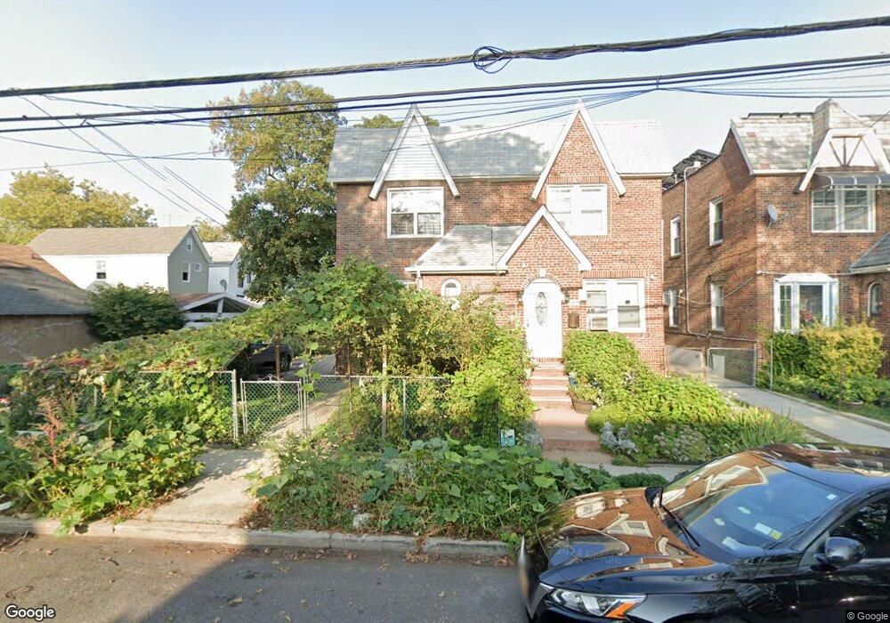
11411 132nd St South Ozone Park, NY 11420
South Ozone Park NeighborhoodEstimated Value: $750,629 - $831,000
--
Bed
--
Bath
1,312
Sq Ft
$601/Sq Ft
Est. Value
About This Home
This home is located at 11411 132nd St, South Ozone Park, NY 11420 and is currently estimated at $788,657, approximately $601 per square foot. 11411 132nd St is a home located in Queens County with nearby schools including P.S. 155, J.H.S. 226 Virgil I. Grisson, and Al-Ihsan Academy.
Ownership History
Date
Name
Owned For
Owner Type
Purchase Details
Closed on
Mar 26, 2018
Sold by
Norwood Mattie J
Bought by
Hossain Kazi
Current Estimated Value
Home Financials for this Owner
Home Financials are based on the most recent Mortgage that was taken out on this home.
Original Mortgage
$416,000
Outstanding Balance
$357,420
Interest Rate
4.4%
Mortgage Type
Purchase Money Mortgage
Estimated Equity
$431,237
Create a Home Valuation Report for This Property
The Home Valuation Report is an in-depth analysis detailing your home's value as well as a comparison with similar homes in the area
Home Values in the Area
Average Home Value in this Area
Purchase History
| Date | Buyer | Sale Price | Title Company |
|---|---|---|---|
| Hossain Kazi | $520,000 | -- |
Source: Public Records
Mortgage History
| Date | Status | Borrower | Loan Amount |
|---|---|---|---|
| Open | Hossain Kazi | $416,000 |
Source: Public Records
Tax History Compared to Growth
Tax History
| Year | Tax Paid | Tax Assessment Tax Assessment Total Assessment is a certain percentage of the fair market value that is determined by local assessors to be the total taxable value of land and additions on the property. | Land | Improvement |
|---|---|---|---|---|
| 2025 | $5,797 | $30,594 | $9,094 | $21,500 |
| 2024 | $5,797 | $28,862 | $6,935 | $21,927 |
| 2023 | $5,797 | $28,862 | $6,935 | $21,927 |
| 2022 | $5,431 | $36,540 | $10,380 | $26,160 |
| 2021 | $5,391 | $34,500 | $10,380 | $24,120 |
| 2020 | $5,101 | $33,840 | $10,380 | $23,460 |
| 2019 | $4,739 | $28,980 | $10,380 | $18,600 |
| 2018 | $4,605 | $24,052 | $7,926 | $16,126 |
| 2017 | $4,566 | $23,869 | $8,804 | $15,065 |
| 2016 | $4,192 | $23,869 | $8,804 | $15,065 |
| 2015 | $2,496 | $21,246 | $8,463 | $12,783 |
| 2014 | $2,496 | $20,044 | $8,018 | $12,026 |
Source: Public Records
Map
Nearby Homes
- 114-33 133rd St
- 13319 Linden Blvd
- 114-39 134th St
- 11455 131st St
- 11406 135th St
- 11408 131st St Unit whole house
- 134-01 Linden Blvd
- 114-29 130th St
- 131-16 115th Ave
- 11409 135th St
- 111-17 133rd St
- 11143 130th St
- 114-50 130th St
- 115-19 134th St
- 111-41 128th St
- 11548 135th St
- 11158 128th St
- 115-28 130th St
- 109-49 132nd St
- 134-07 116th Ave
- 11411 132nd St
- 11413 132nd St
- 114-13 132nd St
- 11413 132nd St
- 11415 132nd St
- 114-17 132nd St Unit house
- 114-17 132nd St
- 11417 132nd St
- 13206 Linden Blvd
- 13210 Linden Blvd
- 13202 Linden Blvd
- 11419 132nd St
- 13212 Linden Blvd
- 11421 132nd St
- 11414 133rd St
- 114-14 133rd St
- 114-14 133rd St Unit 2
- 11412 133rd St
- 13214 Linden Blvd
- 11416 133rd St