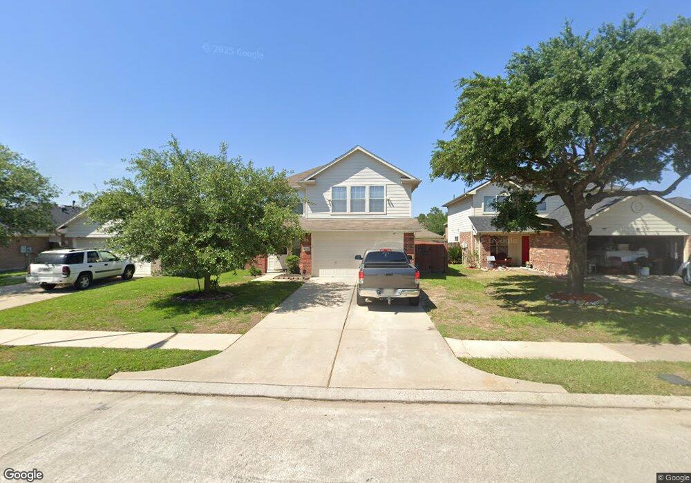
11411 Canyon Shore Dr Humble, TX 77396
Estimated Value: $257,702 - $280,000
4
Beds
3
Baths
2,200
Sq Ft
$122/Sq Ft
Est. Value
About This Home
This home is located at 11411 Canyon Shore Dr, Humble, TX 77396 and is currently estimated at $269,176, approximately $122 per square foot. 11411 Canyon Shore Dr is a home located in Harris County with nearby schools including Ridge Creek Elementary, Middle #10, and Summer Creek High School.
Ownership History
Date
Name
Owned For
Owner Type
Purchase Details
Closed on
Apr 20, 2005
Sold by
Nuhome Of Texas
Bought by
Parker Lawrence E
Current Estimated Value
Home Financials for this Owner
Home Financials are based on the most recent Mortgage that was taken out on this home.
Original Mortgage
$96,792
Interest Rate
5.93%
Mortgage Type
Fannie Mae Freddie Mac
Create a Home Valuation Report for This Property
The Home Valuation Report is an in-depth analysis detailing your home's value as well as a comparison with similar homes in the area
Home Values in the Area
Average Home Value in this Area
Purchase History
| Date | Buyer | Sale Price | Title Company |
|---|---|---|---|
| Parker Lawrence E | -- | North American Title Co | |
| Lennar Homes Of Texas Sales & Mktg Ltd | -- | North American Title Co |
Source: Public Records
Mortgage History
| Date | Status | Borrower | Loan Amount |
|---|---|---|---|
| Previous Owner | Parker Lawrence E | $96,792 | |
| Closed | Parker Lawrence E | $24,198 |
Source: Public Records
Tax History Compared to Growth
Tax History
| Year | Tax Paid | Tax Assessment Tax Assessment Total Assessment is a certain percentage of the fair market value that is determined by local assessors to be the total taxable value of land and additions on the property. | Land | Improvement |
|---|---|---|---|---|
| 2025 | $2,048 | $247,854 | $52,770 | $195,084 |
| 2024 | $2,048 | $253,185 | $23,747 | $229,438 |
| 2023 | $2,048 | $262,549 | $23,747 | $238,802 |
| 2022 | $6,085 | $231,587 | $23,747 | $207,840 |
| 2021 | $5,780 | $188,434 | $23,747 | $164,687 |
| 2020 | $5,679 | $178,411 | $23,747 | $154,664 |
| 2019 | $5,501 | $180,858 | $23,747 | $157,111 |
| 2018 | $1,144 | $161,786 | $18,950 | $142,836 |
| 2017 | $4,601 | $161,786 | $18,950 | $142,836 |
| 2016 | $4,183 | $149,944 | $18,950 | $130,994 |
| 2015 | $2,099 | $149,944 | $18,950 | $130,994 |
| 2014 | $2,099 | $113,746 | $18,950 | $94,796 |
Source: Public Records
Map
Nearby Homes
- 15031 Arizona Sky Ct
- 15026 Sunset Creek Dr
- 15314 Loys Coves Ct
- 15103 Dry Ridge Ct
- 15214 Central Lakes Dr
- 11123 Drakeland Dr
- 15318 Central Lakes Dr
- 15203 Albert Oak Dr
- 15302 Albert Oak Dr
- 11019 Drakeland Dr
- 11111 Clear Fork Dr
- 11122 Hillside Creek Dr
- 12006 Loch Muick Dr
- 11042 Hillside Creek Dr
- 11034 Hillside Creek Dr
- 10826 Thorncliff Dr
- 11002 Hillside Creek Dr
- 10910 Drakeland Dr
- 10915 Clear Fork Dr
- 11919 Alsey Rose Dr
- 11415 Canyon Shore Dr
- 11407 Canyon Shore Dr
- 11419 Canyon Shore Dr
- 11403 Canyon Shore Dr
- 11406 Sandstone Canyon Dr
- 11423 Canyon Shore Dr
- 11414 Sandstone Canyon Dr
- 11402 Sandstone Canyon Dr
- 15023 August Sunset Dr
- 15022 Loys Coves Ct
- 11418 Sandstone Canyon Dr
- 15019 August Sunset Dr
- 15018 Loys Coves Ct
- 11355 Canyon Shore Dr
- 11427 Canyon Shore Dr
- 11422 Sandstone Canyon Dr
- 15030 August Sunset Dr
- 15015 August Sunset Dr
- 15014 Loys Coves Ct
- 11346 Sandstone Canyon Dr