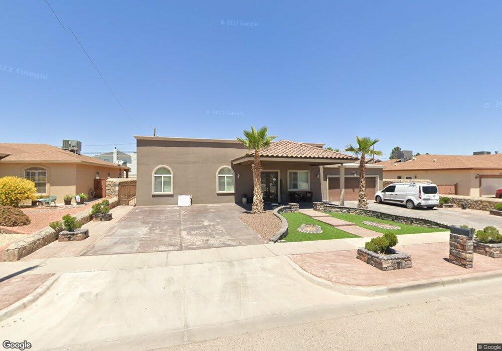
11413 Lindenwood Dr Dr El Paso, TX 79935
Pico Norte NeighborhoodEstimated Value: $233,000 - $246,000
3
Beds
2
Baths
2,215
Sq Ft
$108/Sq Ft
Est. Value
About This Home
This home is located at 11413 Lindenwood Dr Dr, El Paso, TX 79935 and is currently estimated at $240,246, approximately $108 per square foot. 11413 Lindenwood Dr Dr is a home located in El Paso County with nearby schools including East Point Elementary School, Eastwood Middle School, and Eastwood High School.
Ownership History
Date
Name
Owned For
Owner Type
Purchase Details
Closed on
Aug 30, 2014
Sold by
Parral Cynthia Kay and Parral Sy Nichole
Bought by
Mgmj Enterprises Llc
Current Estimated Value
Home Financials for this Owner
Home Financials are based on the most recent Mortgage that was taken out on this home.
Original Mortgage
$126,000
Outstanding Balance
$96,046
Interest Rate
4.18%
Mortgage Type
Purchase Money Mortgage
Estimated Equity
$144,200
Create a Home Valuation Report for This Property
The Home Valuation Report is an in-depth analysis detailing your home's value as well as a comparison with similar homes in the area
Home Values in the Area
Average Home Value in this Area
Purchase History
| Date | Buyer | Sale Price | Title Company |
|---|---|---|---|
| Mgmj Enterprises Llc | -- | None Available |
Source: Public Records
Mortgage History
| Date | Status | Borrower | Loan Amount |
|---|---|---|---|
| Open | Mgmj Enterprises Llc | $126,000 |
Source: Public Records
Tax History Compared to Growth
Tax History
| Year | Tax Paid | Tax Assessment Tax Assessment Total Assessment is a certain percentage of the fair market value that is determined by local assessors to be the total taxable value of land and additions on the property. | Land | Improvement |
|---|---|---|---|---|
| 2025 | $2,835 | $240,643 | -- | -- |
| 2024 | $2,835 | $218,766 | -- | -- |
| 2023 | $2,835 | $198,878 | $0 | $0 |
| 2022 | $5,614 | $180,798 | $0 | $0 |
| 2021 | $5,343 | $164,362 | $25,460 | $138,902 |
| 2020 | $4,849 | $153,520 | $20,198 | $133,322 |
| 2018 | $4,671 | $150,207 | $20,198 | $130,009 |
| 2017 | $4,660 | $152,448 | $20,198 | $132,250 |
| 2016 | $4,660 | $152,448 | $20,198 | $132,250 |
| 2015 | $3,683 | $152,448 | $20,198 | $132,250 |
| 2014 | $3,683 | $152,344 | $20,198 | $132,146 |
Source: Public Records
Map
Nearby Homes
- 10712 Gay Brewer Dr
- 10916 Miller Barber Dr
- 2325 Ken Venturi Ln
- 2820 Beachcomber Dr
- 2313 Frank Beard Dr
- 3200 Voss Dr
- 3112 Eads Place
- 3108 3108 Rock Wall Ln Tx Ln
- 10649 Islerock Dr
- 11008 Johnny Miller Dr
- 3229 E Glen Dr
- 3101 Vogue Dr
- 2801 Brady Place
- 2701 Brady Place
- 3324 Kilgore Place
- 2825 Wong Place Unit A/D
- 2224 Escarpa Dr
- 2109 Febrero Dr
- 10605 Kinross Ave Unit B
- 10512 Album Ave
- 10814 Gay Brewer Dr
- 10820 Gay Brewer Dr
- 10808 Gay Brewer Dr
- 10817 Tony Jacklin Dr
- 10821 Tony Jacklin Dr
- 10804 Gay Brewer Dr
- 10813 Tony Jacklin Dr
- 10824 Gay Brewer Dr
- 10813 Gay Brewer Dr
- 10817 Gay Brewer Dr
- 10825 Tony Jacklin Dr
- 10809 Gay Brewer Dr
- 10821 Gay Brewer Dr
- 10809 Tony Jacklin Dr
- 10809 Tony Jacklin Dr Unit 1
- 10800 Gay Brewer Dr
- 10805 Gay Brewer Dr
- 10825 Gay Brewer Dr
- 10820 Tony Jacklin Dr
- 2956 Doug Ford Dr