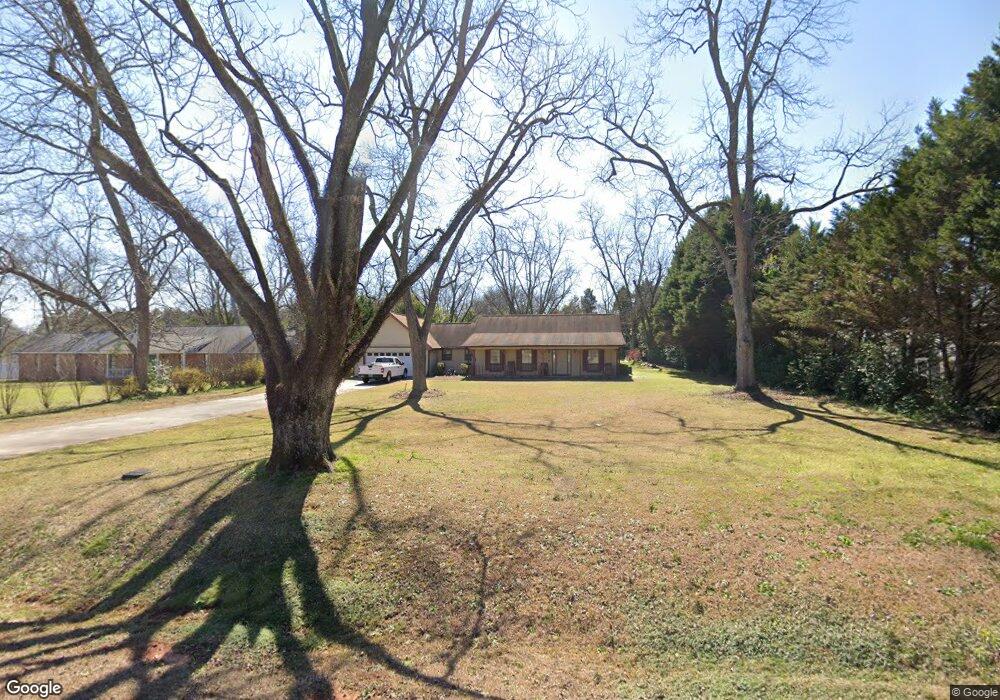
1142 Dunbar Rd Warner Robins, GA 31093
Estimated Value: $249,553 - $343,000
3
Beds
2
Baths
1,998
Sq Ft
$141/Sq Ft
Est. Value
About This Home
This home is located at 1142 Dunbar Rd, Warner Robins, GA 31093 and is currently estimated at $281,888, approximately $141 per square foot. 1142 Dunbar Rd is a home located in Houston County with nearby schools including Centerville Elementary School, Thomson Middle School, and Northside High School.
Ownership History
Date
Name
Owned For
Owner Type
Purchase Details
Closed on
Aug 6, 2025
Sold by
Smith Clara M
Bought by
Smith John B
Current Estimated Value
Purchase Details
Closed on
Sep 21, 1987
Sold by
Sussex Construction Company In
Bought by
Smith John B and Smith Clara M
Purchase Details
Closed on
Jul 1, 1987
Bought by
Sussex Construction Company Inc
Create a Home Valuation Report for This Property
The Home Valuation Report is an in-depth analysis detailing your home's value as well as a comparison with similar homes in the area
Home Values in the Area
Average Home Value in this Area
Purchase History
| Date | Buyer | Sale Price | Title Company |
|---|---|---|---|
| Smith John B | -- | None Listed On Document | |
| Smith John B | -- | None Listed On Document | |
| Smith John B | -- | -- | |
| Sussex Construction Company Inc | -- | -- |
Source: Public Records
Tax History Compared to Growth
Tax History
| Year | Tax Paid | Tax Assessment Tax Assessment Total Assessment is a certain percentage of the fair market value that is determined by local assessors to be the total taxable value of land and additions on the property. | Land | Improvement |
|---|---|---|---|---|
| 2024 | $1,493 | $64,400 | $7,360 | $57,040 |
| 2023 | $1,444 | $61,760 | $7,360 | $54,400 |
| 2022 | $1,130 | $48,760 | $7,360 | $41,400 |
| 2021 | $1,065 | $45,840 | $7,360 | $38,480 |
| 2020 | $1,026 | $44,040 | $7,360 | $36,680 |
| 2019 | $1,026 | $44,040 | $7,360 | $36,680 |
| 2018 | $1,024 | $43,960 | $7,280 | $36,680 |
| 2017 | $1,025 | $43,960 | $7,280 | $36,680 |
| 2016 | $1,027 | $43,960 | $7,280 | $36,680 |
| 2015 | $1,029 | $43,960 | $7,280 | $36,680 |
| 2014 | -- | $43,960 | $7,280 | $36,680 |
| 2013 | -- | $43,960 | $7,280 | $36,680 |
Source: Public Records
Map
Nearby Homes
- 306 Antebellum Cir
- 1089 Dunbar Rd
- 116 Red Birch Ln
- 113 Sourwood Ln
- 113 Sourwood Ln
- 104 Sourwood Ln
- 141 Back Cedar Ln
- 106 Arbor Creek
- 411 High View Way
- 175 Arbor Creek
- 4001 U S 41 Unit LOT 65
- 315 Silver Cir
- 110 Pilgrim Mill Trail
- 211 River Birch Way
- 207 Longleaf Dr
- 102 Winged Elm Grove
- 205 Longleaf Dr
- 214 River Birch Way
- 204 River Birch Way
- 205 Cambridge Dr
- 1140 Dunbar Rd
- 1138 Dunbar Rd
- 1143 Dunbar Rd
- 1145 Dunbar Rd
- 1141 Dunbar Rd
- 1125 N Houston Lake Blvd
- 1110 N Houston Lake Blvd
- 1134 Dunbar Rd
- 1139 Dunbar Rd
- 1127 N Houston Lake Blvd
- 1125 Houston Lake Rd
- 1137 Dunbar Rd
- 1108 N Houston Lake Blvd
- 1123 1/2 N Houston Lake Blvd
- 100 Gemstone Ct
- 1204 N Houston Lake Blvd
- 0 Gemstone Ct Unit LOT 7 02914572
- 105 Gemstone Ct
- N/A Gemstone Ct
- 103 Gemstone Ct