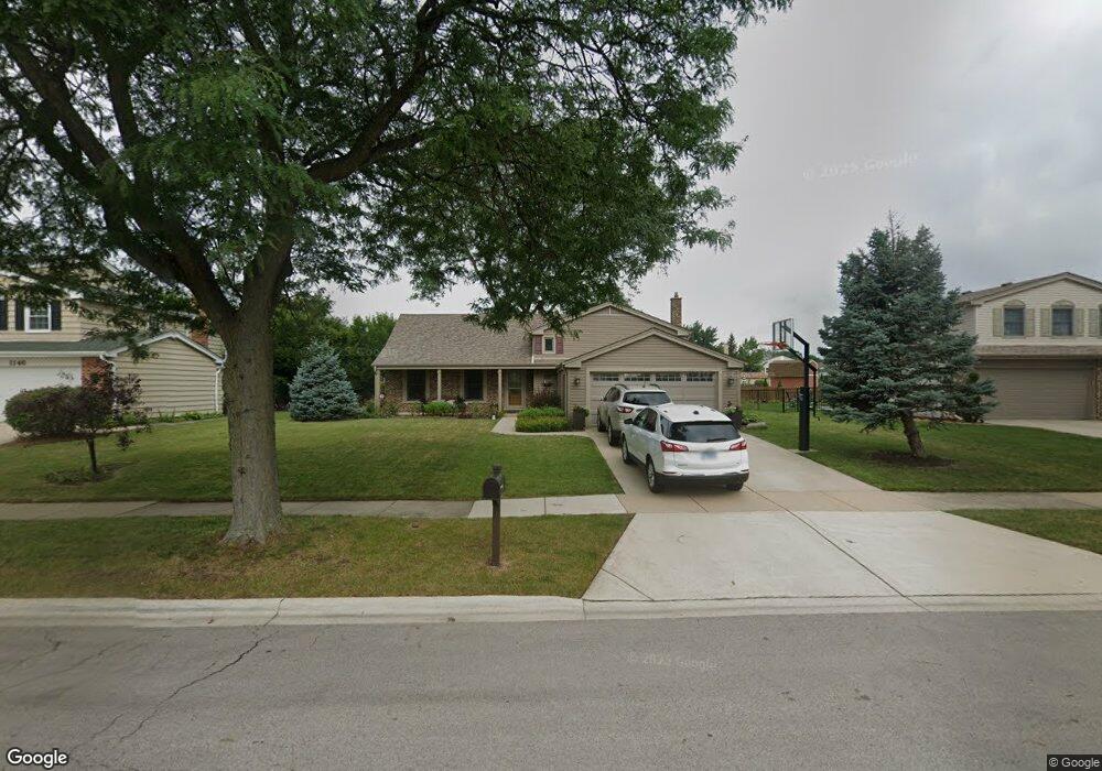
1142 Jamestown Ct Schaumburg, IL 60193
South Schaumburg NeighborhoodEstimated Value: $519,342 - $635,000
4
Beds
3
Baths
1,824
Sq Ft
$314/Sq Ft
Est. Value
About This Home
This home is located at 1142 Jamestown Ct, Schaumburg, IL 60193 and is currently estimated at $572,336, approximately $313 per square foot. 1142 Jamestown Ct is a home located in Cook County with nearby schools including Michael Collins Elementary School, Robert Frost Junior High School, and J B Conant High School.
Ownership History
Date
Name
Owned For
Owner Type
Purchase Details
Closed on
Mar 31, 2000
Sold by
Geraci Domenick and Geraci Marla
Bought by
Bradley Mark E and Bradley Donna M
Current Estimated Value
Home Financials for this Owner
Home Financials are based on the most recent Mortgage that was taken out on this home.
Original Mortgage
$216,000
Outstanding Balance
$72,083
Interest Rate
7.87%
Estimated Equity
$500,253
Purchase Details
Closed on
Nov 28, 1994
Sold by
Johnsen Dee A
Bought by
Geraci Domenick and Geraci Marla
Home Financials for this Owner
Home Financials are based on the most recent Mortgage that was taken out on this home.
Original Mortgage
$135,000
Interest Rate
8.91%
Create a Home Valuation Report for This Property
The Home Valuation Report is an in-depth analysis detailing your home's value as well as a comparison with similar homes in the area
Home Values in the Area
Average Home Value in this Area
Purchase History
| Date | Buyer | Sale Price | Title Company |
|---|---|---|---|
| Bradley Mark E | $270,000 | -- | |
| Geraci Domenick | $185,000 | Lawyers Title Insurance Corp |
Source: Public Records
Mortgage History
| Date | Status | Borrower | Loan Amount |
|---|---|---|---|
| Open | Bradley Mark E | $216,000 | |
| Previous Owner | Geraci Domenick | $135,000 | |
| Closed | Bradley Mark E | $27,000 |
Source: Public Records
Tax History Compared to Growth
Tax History
| Year | Tax Paid | Tax Assessment Tax Assessment Total Assessment is a certain percentage of the fair market value that is determined by local assessors to be the total taxable value of land and additions on the property. | Land | Improvement |
|---|---|---|---|---|
| 2024 | $9,779 | $38,226 | $11,176 | $27,050 |
| 2023 | $9,455 | $38,226 | $11,176 | $27,050 |
| 2022 | $9,455 | $38,226 | $11,176 | $27,050 |
| 2021 | $7,928 | $29,487 | $6,096 | $23,391 |
| 2020 | $7,859 | $29,487 | $6,096 | $23,391 |
| 2019 | $7,863 | $32,764 | $6,096 | $26,668 |
| 2018 | $8,428 | $31,517 | $5,334 | $26,183 |
| 2017 | $8,312 | $31,517 | $5,334 | $26,183 |
| 2016 | $8,016 | $31,517 | $5,334 | $26,183 |
| 2015 | $7,765 | $28,580 | $4,572 | $24,008 |
| 2014 | $7,696 | $28,580 | $4,572 | $24,008 |
| 2013 | $7,482 | $28,580 | $4,572 | $24,008 |
Source: Public Records
Map
Nearby Homes
- 1078 Newport Harbor Unit 6101
- 421 E Wise Rd
- 1100 Boston Harbor Unit 7004
- 286 Nantucket Harbor Unit 601
- 1205 Laurel Ln
- 620 S Point Dr
- 1323 S Roselle Rd
- 731 Highpoint Ct
- 1420 Indian Hill Dr
- 13 W Monterey Ave
- 826 Thornton Ct Unit 2AL
- 717 Tipperary Ct Unit 1C
- 924 Surrey Dr Unit 1A
- 733 Limerick Ln Unit 7333D
- 409 New York Ln
- 211 Steeple Bush Ln Unit 10343
- 205 Steeple Bush Ln Unit 10444
- 134 Lunt Ave
- 712 Tipperary Ct Unit 1C
- 711 Tipperary Ct Unit 2D
- 1146 Jamestown Ct
- 1138 Jamestown Ct
- 1143 Crest Ct
- 1147 Crest Ct
- 1150 Jamestown Ct
- 1134 Jamestown Ct
- 1139 Crest Ct
- 1139 Jamestown Ct
- 1143 Jamestown Ct
- 1135 Jamestown Ct
- 1151 Crest Ct
- 1128 Jamestown Ct
- 1147 Jamestown Ct
- 1111 Brunswick Harbor Unit 45
- 1111 Brunswick Harbor Unit 1111
- 1138 Crest Ct
- 1127 Jamestown Ct
- 1131 Jamestown Ct
- 1107 Brunswick Harbor Unit 45
- 1107 Brunswick Harbor Unit 1107