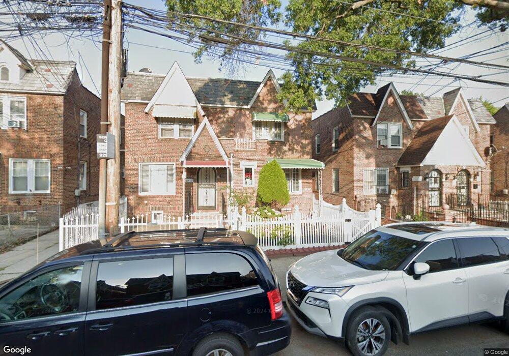
11429 132nd St South Ozone Park, NY 11420
South Ozone Park NeighborhoodEstimated Value: $640,000 - $745,000
--
Bed
--
Bath
1,312
Sq Ft
$525/Sq Ft
Est. Value
About This Home
This home is located at 11429 132nd St, South Ozone Park, NY 11420 and is currently estimated at $688,941, approximately $525 per square foot. 11429 132nd St is a home located in Queens County with nearby schools including P.S. 155, J.H.S. 226 Virgil I. Grisson, and Al-Ihsan Academy.
Ownership History
Date
Name
Owned For
Owner Type
Purchase Details
Closed on
Sep 5, 2006
Sold by
Wong Ansel L and Wong Yvonne E
Bought by
Singh Bickram
Current Estimated Value
Home Financials for this Owner
Home Financials are based on the most recent Mortgage that was taken out on this home.
Original Mortgage
$312,800
Outstanding Balance
$188,257
Interest Rate
6.71%
Mortgage Type
Purchase Money Mortgage
Estimated Equity
$500,684
Create a Home Valuation Report for This Property
The Home Valuation Report is an in-depth analysis detailing your home's value as well as a comparison with similar homes in the area
Home Values in the Area
Average Home Value in this Area
Purchase History
| Date | Buyer | Sale Price | Title Company |
|---|---|---|---|
| Singh Bickram | $391,000 | -- | |
| Singh Bickram | $391,000 | -- |
Source: Public Records
Mortgage History
| Date | Status | Borrower | Loan Amount |
|---|---|---|---|
| Open | Singh Bickram | $312,800 | |
| Closed | Singh Bickram | $312,800 | |
| Closed | Singh Bickram | $58,600 |
Source: Public Records
Tax History Compared to Growth
Tax History
| Year | Tax Paid | Tax Assessment Tax Assessment Total Assessment is a certain percentage of the fair market value that is determined by local assessors to be the total taxable value of land and additions on the property. | Land | Improvement |
|---|---|---|---|---|
| 2025 | $6,304 | $31,816 | $5,951 | $25,865 |
| 2024 | $6,304 | $31,385 | $5,638 | $25,747 |
| 2023 | $5,957 | $29,658 | $5,681 | $23,977 |
| 2022 | $5,744 | $34,620 | $7,620 | $27,000 |
| 2021 | $5,739 | $37,020 | $7,620 | $29,400 |
| 2020 | $5,612 | $34,380 | $7,620 | $26,760 |
| 2019 | $5,471 | $30,180 | $7,620 | $22,560 |
| 2018 | $5,038 | $24,715 | $6,736 | $17,979 |
| 2017 | $4,888 | $23,976 | $6,936 | $17,040 |
| 2016 | $4,543 | $23,976 | $6,936 | $17,040 |
| 2015 | $2,728 | $22,094 | $6,969 | $15,125 |
| 2014 | $2,728 | $21,795 | $7,780 | $14,015 |
Source: Public Records
Map
Nearby Homes
- 114-33 133rd St
- 114-39 134th St
- 11455 131st St
- 131-16 115th Ave
- 13319 Linden Blvd
- 11408 131st St Unit whole house
- 11406 135th St
- 114-29 130th St
- 11409 135th St
- 134-01 Linden Blvd
- 114-50 130th St
- 115-19 134th St
- 111-17 133rd St
- 11143 130th St
- 11548 135th St
- 115-28 130th St
- 134-07 116th Ave
- 111-41 128th St
- 11546 Van Wyck Expy
- 11158 128th St
- 11433 132nd St
- 11435 132nd St
- 11429 132nd St
- 11437 132nd St
- 11427 132nd St
- 114-35 132nd St
- 11439 132nd St
- 11425 132nd St
- 11441 132nd St
- 11423 132nd St
- 11441 132nd St
- 11432 133rd St
- 11436 133rd St
- 11443 132nd St
- 11443 132nd St
- 11430 133rd St
- 11421 132nd St
- 11443 132nd St
- 11438 133rd St
- 11428 133rd St