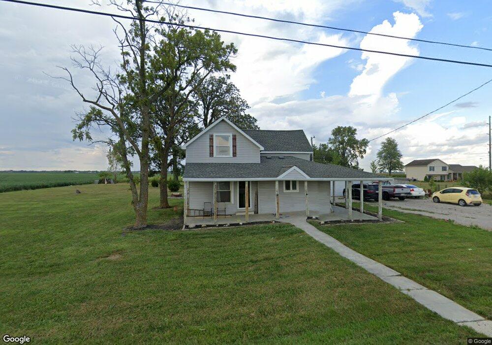
11433 State Route 613 Paulding, OH 45879
Estimated Value: $132,000 - $197,000
3
Beds
1
Bath
1,492
Sq Ft
$107/Sq Ft
Est. Value
About This Home
This home is located at 11433 State Route 613, Paulding, OH 45879 and is currently estimated at $158,958, approximately $106 per square foot. 11433 State Route 613 is a home located in Paulding County with nearby schools including Wayne Trace High School.
Ownership History
Date
Name
Owned For
Owner Type
Purchase Details
Closed on
Dec 29, 2017
Sold by
Trausch Matthew J
Bought by
Trausch Nathaniel
Current Estimated Value
Home Financials for this Owner
Home Financials are based on the most recent Mortgage that was taken out on this home.
Original Mortgage
$56,145
Outstanding Balance
$47,392
Interest Rate
3.95%
Mortgage Type
New Conventional
Estimated Equity
$111,566
Purchase Details
Closed on
Oct 17, 2012
Sold by
Trausch Jessica E and Mccreery Jessica E
Bought by
Trausch Matthew J
Purchase Details
Closed on
Nov 21, 2011
Sold by
Teaches Cu
Bought by
Trausch Matthew J and Trausch Jessica E
Purchase Details
Closed on
May 16, 2011
Sold by
Haines Cynthia A
Bought by
Teachers Cu
Purchase Details
Closed on
Apr 24, 1998
Sold by
Speice Michael R
Bought by
Trausch Matthew J
Purchase Details
Closed on
Jul 25, 1994
Bought by
Trausch Matthew J
Create a Home Valuation Report for This Property
The Home Valuation Report is an in-depth analysis detailing your home's value as well as a comparison with similar homes in the area
Home Values in the Area
Average Home Value in this Area
Purchase History
| Date | Buyer | Sale Price | Title Company |
|---|---|---|---|
| Trausch Nathaniel | $78,000 | None Available | |
| Trausch Matthew J | -- | None Available | |
| Trausch Matthew J | $17,000 | None Available | |
| Teachers Cu | $34,000 | None Available | |
| Trausch Matthew J | -- | -- | |
| Trausch Matthew J | $39,000 | -- |
Source: Public Records
Mortgage History
| Date | Status | Borrower | Loan Amount |
|---|---|---|---|
| Open | Trausch Nathaniel | $56,145 |
Source: Public Records
Tax History Compared to Growth
Tax History
| Year | Tax Paid | Tax Assessment Tax Assessment Total Assessment is a certain percentage of the fair market value that is determined by local assessors to be the total taxable value of land and additions on the property. | Land | Improvement |
|---|---|---|---|---|
| 2024 | $1,023 | $31,190 | $7,840 | $23,350 |
| 2023 | $1,023 | $31,190 | $7,840 | $23,350 |
| 2022 | $1,019 | $31,190 | $7,840 | $23,350 |
| 2021 | $1,021 | $28,420 | $7,700 | $20,720 |
| 2020 | $1,056 | $28,420 | $7,700 | $20,720 |
| 2019 | $1,062 | $26,530 | $7,700 | $18,830 |
| 2018 | $908 | $26,530 | $7,700 | $18,830 |
| 2017 | $909 | $26,530 | $7,700 | $18,830 |
| 2016 | $909 | $26,530 | $7,700 | $18,830 |
| 2015 | $897 | $26,710 | $7,560 | $19,150 |
| 2014 | $909 | $26,710 | $7,560 | $19,150 |
| 2013 | $1,031 | $26,710 | $7,560 | $19,150 |
Source: Public Records
Map
Nearby Homes
- 225 2nd St
- 12783 Road 82
- 720 W Wayne St
- 717 W Harrison St
- 300 S Williams St
- 720 W Perry St
- 614 W Jackson St
- 215 N Dewitt St
- 14255 Road 126
- 752 N Dix St
- 606 Lincoln Ave
- 418 E Baldwin St
- Tract 2 - 0000 Ohio 111
- 0000 Ohio 111
- 0 Road 111
- 907 Country View Dr
- 0 Road 72
- 1045 Emerald Rd
- 1051 Emerald Rd
- 1065 Emerald Rd
- 11489 State Route 613
- 11260 State Route 613
- 11100 State Route 613
- 11817 Ohio 613
- 11388 State Route 613
- 8511 Road 95
- 8264 Road 107
- 8576 Road 95
- 10664 State Route 613
- 10611 State Route 613
- 8643 Road 107
- 880 Sr 613
- 311 Lewis St
- 7397 Road 107
- 12291 State Route 613
- 411 Lewis St
- 210 Lewis St
- 451 Lewis St
- 12315 State Route 613
- 611 Lewis St