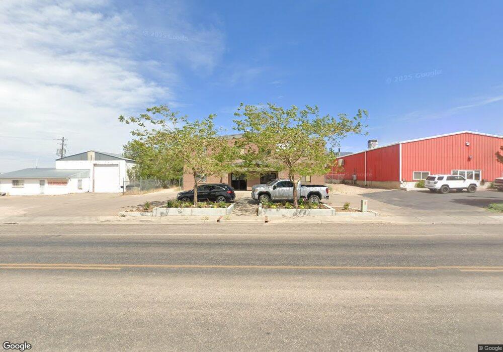
1144 N Airport Rd Cedar City, UT 84721
Estimated Value: $808,947
--
Bed
--
Bath
6,156
Sq Ft
$131/Sq Ft
Est. Value
About This Home
This home is located at 1144 N Airport Rd, Cedar City, UT 84721 and is currently estimated at $808,947, approximately $131 per square foot. 1144 N Airport Rd is a home located in Iron County with nearby schools including Three Peaks School, Canyon View Middle School, and Canyon View High School.
Ownership History
Date
Name
Owned For
Owner Type
Purchase Details
Closed on
May 15, 2020
Sold by
Kb Family Llc
Bought by
Tony Biz Llc
Current Estimated Value
Home Financials for this Owner
Home Financials are based on the most recent Mortgage that was taken out on this home.
Original Mortgage
$437,000
Outstanding Balance
$387,243
Interest Rate
3.3%
Mortgage Type
Commercial
Estimated Equity
$421,704
Purchase Details
Closed on
Jan 24, 2017
Sold by
K B Family Lp
Bought by
Kb Family Llc Series 1
Create a Home Valuation Report for This Property
The Home Valuation Report is an in-depth analysis detailing your home's value as well as a comparison with similar homes in the area
Home Values in the Area
Average Home Value in this Area
Purchase History
| Date | Buyer | Sale Price | Title Company |
|---|---|---|---|
| Tony Biz Llc | -- | American Secure Title | |
| Kb Family Llc Series 1 | -- | None Available |
Source: Public Records
Mortgage History
| Date | Status | Borrower | Loan Amount |
|---|---|---|---|
| Open | Tony Biz Llc | $437,000 |
Source: Public Records
Tax History Compared to Growth
Tax History
| Year | Tax Paid | Tax Assessment Tax Assessment Total Assessment is a certain percentage of the fair market value that is determined by local assessors to be the total taxable value of land and additions on the property. | Land | Improvement |
|---|---|---|---|---|
| 2025 | $5,899 | $758,484 | $203,861 | $554,623 |
| 2023 | $5,205 | $682,015 | $99,665 | $582,350 |
| 2022 | $5,932 | $645,225 | $90,605 | $554,620 |
| 2021 | $4,998 | $543,725 | $81,540 | $462,185 |
| 2020 | $5,012 | $483,440 | $81,540 | $401,900 |
| 2019 | $4,967 | $458,310 | $62,290 | $396,020 |
| 2018 | $5,072 | $452,645 | $56,625 | $396,020 |
| 2017 | $5,152 | $452,645 | $56,625 | $396,020 |
| 2016 | $5,092 | $416,640 | $56,625 | $360,015 |
| 2015 | $5,370 | $416,640 | $0 | $0 |
| 2014 | $4,482 | $325,230 | $0 | $0 |
Source: Public Records
Map
Nearby Homes
- 960 N 1400 W
- 4482 W 250 N
- 4591 W 250 N
- 300 N Airport Rd
- 305 N Airport Rd
- 799 N 2325 W
- 2502 W 850 N
- 1222 N Cedar Blvd
- 827 W 1175 N Unit 56
- 780 W 1125 N Unit 128
- 780 W 1125 N Unit 114
- 698 W 1050 N
- 147.9141 Acre Ft Water Right 73-1201
- 495 N 2150 W
- 576 W 1045 N Unit A17
- 1392 N 650 W
- 1398 N 650 W
- 1177 N Northfield Rd Unit 26
- 1177 N Northfield Rd Unit 66
- 1137 Brook St
- 1212 N Airport Rd
- 1835 Kittyhawk Dr
- 1835 Kitty Hawk Dr
- Lot 9 Iron Mountain Subdivision
- 1215 N Airport (Lease Only) Rd
- 1215 N Airport - Industrial Pk II Rd
- 1215 N Airport Rd Unit Cedar City Industria
- 1215 N Airport Rd
- 2183 Park Ave
- Lot 102 Iron Mountain Subdivision
- 15.98 Ac. Off Airport Rd
- Lot 106 Iron Mountain Subdivision
- Lot 18 Iron Mountain Subdivision
- 1450 W Industry Way
- 15.98 Ac. N Airport Rd
- 2300 N Airport Rd
- 3.94 Acres N Airport Rd
- 3.30 Acres N Airport Rd
- 21 Acres N Airport Rd