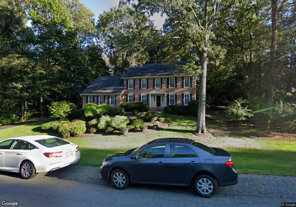
11441 Bronzedale Dr Oakton, VA 22124
Foxvale NeighborhoodEstimated Value: $1,202,000 - $1,364,000
4
Beds
4
Baths
2,762
Sq Ft
$462/Sq Ft
Est. Value
About This Home
This home is located at 11441 Bronzedale Dr, Oakton, VA 22124 and is currently estimated at $1,275,872, approximately $461 per square foot. 11441 Bronzedale Dr is a home located in Fairfax County with nearby schools including Waples Mill Elementary School, Franklin Middle, and Oakton High.
Ownership History
Date
Name
Owned For
Owner Type
Purchase Details
Closed on
Mar 18, 2022
Sold by
Embroski Paul Anthony and Embroski Karen Koundkjian
Bought by
Emroski Family Trust and Embroski
Current Estimated Value
Purchase Details
Closed on
Aug 31, 1999
Sold by
Murphy Larry J
Bought by
Embrosky Paula
Home Financials for this Owner
Home Financials are based on the most recent Mortgage that was taken out on this home.
Original Mortgage
$333,600
Interest Rate
7.5%
Create a Home Valuation Report for This Property
The Home Valuation Report is an in-depth analysis detailing your home's value as well as a comparison with similar homes in the area
Home Values in the Area
Average Home Value in this Area
Purchase History
| Date | Buyer | Sale Price | Title Company |
|---|---|---|---|
| Emroski Family Trust | -- | None Listed On Document | |
| Emroski Family Trust | -- | None Listed On Document | |
| Embrosky Paula | $417,000 | -- |
Source: Public Records
Mortgage History
| Date | Status | Borrower | Loan Amount |
|---|---|---|---|
| Previous Owner | Embrosky Paula | $333,600 |
Source: Public Records
Tax History
| Year | Tax Paid | Tax Assessment Tax Assessment Total Assessment is a certain percentage of the fair market value that is determined by local assessors to be the total taxable value of land and additions on the property. | Land | Improvement |
|---|---|---|---|---|
| 2025 | $11,987 | $1,186,460 | $429,000 | $757,460 |
| 2024 | $11,987 | $1,034,690 | $409,000 | $625,690 |
| 2023 | $11,511 | $1,020,020 | $409,000 | $611,020 |
| 2022 | $10,576 | $924,900 | $409,000 | $515,900 |
| 2021 | $9,951 | $848,000 | $379,000 | $469,000 |
| 2020 | $9,485 | $801,450 | $359,000 | $442,450 |
| 2019 | $9,426 | $796,450 | $354,000 | $442,450 |
| 2018 | $8,848 | $769,430 | $344,000 | $425,430 |
| 2017 | $9,482 | $816,700 | $344,000 | $472,700 |
| 2016 | $9,461 | $816,700 | $344,000 | $472,700 |
Source: Public Records
Map
Nearby Homes
- 3214 Dominy Ct
- 3268 Fox Mill Rd
- 3281 Dutch Mill Ct
- 11410 Waples Mill Rd
- 11698 Fox Glen Dr
- 3106 Hunt Rd
- 11704 Foxvale Ct
- 3684 Waples Crest Ct
- 3406 Lyrac St
- 11317 Walnut Creek Ct
- 11813 Vale Rd
- 11202 Cranbrook Ln
- 3022 Fox Den Ln
- 3105 Miller Heights Rd
- 11046 Heathland Dr
- 3903 Golf Tee Ct Unit 301
- 11328 Vale Rd
- 3923 Fairfax Farms Rd
- 3902 Golf Tee Ct Unit 101
- 3557 Orchid Pond Way
- 11439 Bronzedale Dr
- 11444 Stone Mill Ct
- 3257 History Dr
- 11437 Bronzedale Dr
- 11442 Stone Mill Ct
- 11442 Bronzedale Dr
- 11447 Bronzedale Dr
- 11446 Bronzedale Dr
- 11446 Bronzedale Dr
- 11436 Bronzedale Dr
- 3266 History Dr
- 11440 Bronzedale Dr
- 3255 History Dr
- 11440 Stone Mill Ct
- 11438 Bronzedale Dr
- 11435 Bronzedale Dr
- 11443 Stone Mill Ct
- 11448 Bronzedale Dr
- 11448 Bronzedale Dr
- 3256 History Dr
Your Personal Tour Guide
Ask me questions while you tour the home.