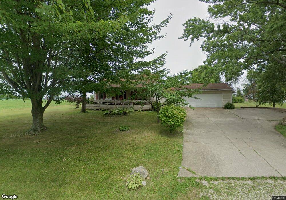
11441 Easton St NE Alliance, OH 44601
Estimated Value: $108,000 - $196,000
1
Bed
1
Bath
1,111
Sq Ft
$135/Sq Ft
Est. Value
About This Home
This home is located at 11441 Easton St NE, Alliance, OH 44601 and is currently estimated at $149,677, approximately $134 per square foot. 11441 Easton St NE is a home located in Stark County with nearby schools including Marlington High School.
Ownership History
Date
Name
Owned For
Owner Type
Purchase Details
Closed on
Mar 6, 2018
Sold by
Estate Of Phyllis Dawson
Bought by
Sanderbeck Julie and Kibler Daniel
Current Estimated Value
Purchase Details
Closed on
Feb 28, 2018
Sold by
Kibler Daniel and Kibler Mark
Bought by
Sanderbeck Julie
Purchase Details
Closed on
Jan 12, 2001
Sold by
Dawson George E
Bought by
Dawson Phyllis
Purchase Details
Closed on
May 30, 1995
Sold by
Morrison Eileen R
Bought by
Dawson George E and Dawson Phyllis V
Home Financials for this Owner
Home Financials are based on the most recent Mortgage that was taken out on this home.
Original Mortgage
$24,600
Interest Rate
5.95%
Mortgage Type
New Conventional
Create a Home Valuation Report for This Property
The Home Valuation Report is an in-depth analysis detailing your home's value as well as a comparison with similar homes in the area
Home Values in the Area
Average Home Value in this Area
Purchase History
| Date | Buyer | Sale Price | Title Company |
|---|---|---|---|
| Sanderbeck Julie | -- | None Available | |
| Sanderbeck Julie | $49,100 | None Available | |
| Dawson Phyllis | -- | -- | |
| Dawson George E | $29,000 | -- |
Source: Public Records
Mortgage History
| Date | Status | Borrower | Loan Amount |
|---|---|---|---|
| Previous Owner | Dawson George E | $24,600 |
Source: Public Records
Tax History Compared to Growth
Tax History
| Year | Tax Paid | Tax Assessment Tax Assessment Total Assessment is a certain percentage of the fair market value that is determined by local assessors to be the total taxable value of land and additions on the property. | Land | Improvement |
|---|---|---|---|---|
| 2025 | -- | $31,860 | $11,450 | $20,410 |
| 2024 | -- | $31,860 | $11,450 | $20,410 |
| 2023 | $1,009 | $31,580 | $9,980 | $21,600 |
| 2022 | $1,012 | $31,580 | $9,980 | $21,600 |
| 2021 | $1,015 | $31,580 | $9,980 | $21,600 |
| 2020 | $980 | $27,300 | $8,610 | $18,690 |
| 2019 | $973 | $27,310 | $8,610 | $18,700 |
| 2018 | $975 | $27,310 | $8,610 | $18,700 |
| 2017 | $880 | $22,900 | $5,740 | $17,160 |
| 2016 | $864 | $22,900 | $5,740 | $17,160 |
| 2015 | $867 | $22,940 | $5,740 | $17,200 |
| 2014 | $799 | $19,330 | $4,830 | $14,500 |
| 2013 | $402 | $19,430 | $4,830 | $14,600 |
Source: Public Records
Map
Nearby Homes
- 6109 Oakhill Ave NE
- 12222 Cenfield St NE
- 5990 Meese Rd NE
- 0 Valewood Cir Unit 5006281
- 5765 Maplegrove St
- 2435 Queensbury Rd
- 2851 Patriots Path Unit 3D
- 0 Easton St NE
- 2377 Ansley St Unit 2377
- 5495 Meese Rd NE
- 6052 N Nickelplate St
- 0 Moulin Ave NE
- 5869 Beechwood Ave
- 13881 Salem Church St NE
- 0 Winchester St
- 0 Winchester St Unit 5162877
- 0 Reeder Ave NE
- 2081 Marwood Cir
- 1430 Westwood Ave
- 1325 W Beech St
- 11477 Easton St NE
- 11485 Easton St NE
- 11400 Easton St NE
- 11526 Easton St NE
- 11371 Easton St NE
- 11537 Easton St NE
- 11546 Easton St NE
- 11547 Easton St NE
- 11338 Easton St NE
- 11562 Easton St NE
- 11321 Easton St NE
- 11322 Easton St NE
- 11580 Easton St NE
- 11310 Easton St NE
- 11638 Easton St NE
- 11670 Easton St NE
- 11684 Easton St NE
- 11183 Easton St NE
- 11693 Easton St NE
- 11696 Easton St NE