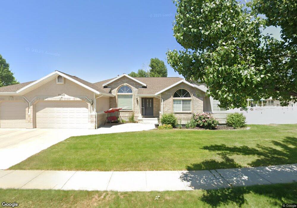
11442 S Charter Pointe Rd South Jordan, UT 84095
Estimated Value: $837,000 - $913,000
5
Beds
4
Baths
3,772
Sq Ft
$231/Sq Ft
Est. Value
About This Home
This home is located at 11442 S Charter Pointe Rd, South Jordan, UT 84095 and is currently estimated at $871,610, approximately $231 per square foot. 11442 S Charter Pointe Rd is a home located in Salt Lake County with nearby schools including Monte Vista Elementary School, South Jordan Middle School, and Hawthorn Academy South Jordan.
Ownership History
Date
Name
Owned For
Owner Type
Purchase Details
Closed on
Jul 5, 2019
Sold by
Gray Michael S and Gray Beth A
Bought by
Zumwalt Michael D and Zumwalt Jeanette
Current Estimated Value
Home Financials for this Owner
Home Financials are based on the most recent Mortgage that was taken out on this home.
Original Mortgage
$497,035
Outstanding Balance
$435,447
Interest Rate
3.82%
Mortgage Type
Commercial
Estimated Equity
$436,163
Purchase Details
Closed on
Jun 25, 1998
Sold by
Garn G Christensen Construction Inc
Bought by
Gray Michael S and Gray Beth A
Home Financials for this Owner
Home Financials are based on the most recent Mortgage that was taken out on this home.
Original Mortgage
$200,600
Interest Rate
7.17%
Create a Home Valuation Report for This Property
The Home Valuation Report is an in-depth analysis detailing your home's value as well as a comparison with similar homes in the area
Home Values in the Area
Average Home Value in this Area
Purchase History
| Date | Buyer | Sale Price | Title Company |
|---|---|---|---|
| Zumwalt Michael D | -- | Cottonwood Title | |
| Gray Michael S | -- | -- |
Source: Public Records
Mortgage History
| Date | Status | Borrower | Loan Amount |
|---|---|---|---|
| Open | Zumwalt Michael D | $497,035 | |
| Previous Owner | Gray Michael S | $200,600 |
Source: Public Records
Tax History Compared to Growth
Tax History
| Year | Tax Paid | Tax Assessment Tax Assessment Total Assessment is a certain percentage of the fair market value that is determined by local assessors to be the total taxable value of land and additions on the property. | Land | Improvement |
|---|---|---|---|---|
| 2025 | $4,045 | $789,700 | $259,600 | $530,100 |
| 2024 | $4,045 | $768,000 | $247,300 | $520,700 |
| 2023 | $4,027 | $721,400 | $240,000 | $481,400 |
| 2022 | $4,155 | $729,500 | $235,300 | $494,200 |
| 2021 | $3,318 | $534,600 | $194,500 | $340,100 |
| 2020 | $3,252 | $491,100 | $194,500 | $296,600 |
| 2019 | $2,947 | $437,500 | $184,100 | $253,400 |
| 2018 | $2,584 | $381,700 | $183,000 | $198,700 |
| 2017 | $2,515 | $364,100 | $179,900 | $184,200 |
| 2016 | $2,604 | $357,200 | $166,300 | $190,900 |
| 2015 | $2,622 | $349,600 | $167,900 | $181,700 |
| 2014 | $2,925 | $383,400 | $160,000 | $223,400 |
Source: Public Records
Map
Nearby Homes
- 2410 W 11400 S
- 11513 S Jackson Downs Way
- 11707 S Myers Park Ln Unit 111
- 2602 W 11625 S
- 11666 S Gold Dust Dr
- 2626 W Midas Side Way
- 11788 S Myers Park Ln Unit 101
- 2511 W 11730 S
- 2295 W Myers Ln
- 11423 S Polo Club Ct
- 11716 S 2610 W
- 2732 W Lizzi Cove
- 2817 W 11460 St S Unit 203
- 1767 W Lunford Ln
- 1592 W Andover Rd
- 3028 W Wilkins Peak Ct
- 1721 W Hollow Cedar Ln Unit 1
- 2834 Proudest Ln Unit 247
- 12034 S 1900 W
- 1611 W Laurel Chase Dr
- 11442 Charter Pointe Rd
- 2302 Sand Pointe Ln
- 11422 Charter Pointe Rd
- 2303 W 11400 S
- 11447 Charter Pointe Rd
- 11468 Charter Pointe Rd
- 11431 Charter Pointe Rd
- 11468 S Charter Pointe Rd
- 11463 Charter Pointe Rd
- 2322 Sand Pointe Ln
- 2323 W 11400 S
- 11413 Charter Pointe Rd
- 11413 S Charter Pointe Rd
- 2321 Sand Pointe Ln
- 2321 W Sand Pointe Ln
- 11479 S Charter Pointe Rd
- 11479 Charter Pointe Rd
- 11486 Charter Pointe Rd
- 11486 S Charter Pointe Rd
- 2303 Roanoke Ln